Registrations are now open for the Australian Institute of Mine Surveyors (AIMS) Kalgoorlie Regional Seminar, which will be held at the Kalgoorlie Bowling Club on Friday, 29 October.
The day will start at 2:30pm with an optional lawn bowls and beers social occasion, followed at 4:00pm by AIMS sessions and a sponsor interaction session. Drinks and nibbles will be supplied. Sponsors include AAM, Arvista, Caroni, Deswik, GeoCue Australia, HL Geospatial and Maptek.
There are various levels of registration fees depending upon member category. Full details can be found at the link above.

Global Space and Technology Convention (GSTC) is Asia’s Premier Space & Technology event, bringing you the latest technology news, what’s hot in the satellite scene and space technology updates. Over 10 years in the making, GSTC has taken up a crucial role in highlighting how space technology and satellite communications will shape our lives here in Asia. From learning how satellite communication and data can transform urban cities, to its applications in maritime surveillance, security and IoT, GSTC is the go-to platform for your space and satellite business, to connect with the rapidly evolving space industry in Asia.

The presenters for this topical webinar will be Dr Craig Roberts, Senior Lecturer in Surveying/GPS/Geodesy at UNSW and Wayne Patterson Director, Spatial Operations at the NSW Department of Customer Service.
Roberts will give a short update on the revision of the Australian Standard, AS_5488 Classification of subsurface utility information in the context of datum modernisation, low-cost multi-GNSS and recent advances in positioning infrastructure in Australia.
Data storage, data distribution and security are identified as challenges suggesting a reimagined data governance will be needed. Could a spatial digital twin assist? What is a spatial digital twin? Is it a BIM? Where does it come from? What is an open data policy? Who can use it? Can I use it? Which datum? How accurate is the data?
Rather than just another PowerPoint webinar, Roberts will interview Patterson in a free-flowing format. Attendees will be invited to ask their own questions live in the chat as the conversation evolves.
This webinar is targeted at surveyors, geospatial users, students and the wider spatial community.

The WA geospatial community will come together on 16 February 2022 to learn, network, share experiences and catch up with colleagues old and new.
The WA Asia-Pacific Spatial Excellence Awards dinner will also be held in conjunction with the conference, celebrating the outstanding work being undertaken across the region during 2022.
Image credit: ©stock.adobe.com/au/anekoho

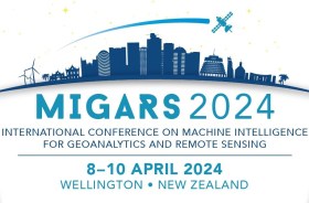
The International Association of the IEEE-Geoscience and Remote Sensing Society (GRSS), the IEEE-Computational Intelligence Society (CIS) and the local organising committee invite geospatial and computing professionals to attend the International Conference on Machine Intelligence for GeoAnalytics and Remote Sensing (MIGARS) to be held in Wellington, Aotearoa New Zealand in April 2024.
MIGARS aims to explore the interface of machine intelligence approaches with geosciences, spatial analytics, and remote sensing. With the tremendous developments in remote sensing technology, data acquisitions and sensing platforms, digital data have grown leaps and bounds to stream and are too big by volume, variety, and veracity. The challenge is handling, processing, and automating geo-data from various sources, such as multi-platform remote sensors and IoT devices, informing decision-making and monitoring our planet.
The conference will focus on connecting researchers from various disciplines, including computation/artificial intelligence, engineering, remote sensing, hydrology, agriculture and geosciences, and look for the potential use of intelligent computational approaches for geo-data-based applications and for serving society at large.

The ROTORTECH Helicopter and Uncrewed Flight Exposition is the premier industry event for the Helicopter/Rotary Wing and RPAS/UAV/eVTOL community in Australia, New Zealand and the Indo-Asia-Pacific region.
Held by AMDA Foundation with input from major industry supporter the Australian Helicopter Industry Association, ROTORTECH 2024 will provide a vital interface between industry, regulators and government, including:
- Operations and safety presentations
- Industry conferences
- Manufacturers technical workshops
- Industry exposition showcasing the products and services of helicopter and uncrewed flight related companies
ROTORTECH 2024 will host conferences by the AHIA and Australian Association for Uncrewed Systems (AAUS) and feature presentations by key rotary and uncrewed flight industry experts from Australia and the Indo-Asia-Pacific region.


