Learn how to plan and deliver products and services to any location in Australia – no matter how ambiguous the address with what3words.
what3words has divided the world into a grid of 3m x 3m squares and assigned each one a unique 3 word address, providing a precise and incredibly simple way to talk about location. It means everyone and everywhere now has an address.
Join Peter Landis, 360HR’s geospatial recruitment specialist, as he interviews Tom Blaksley from what3words, to uncover the potential and real world applications benefiting from this revolutionary solution to an age old problem.
Webinar details:
Date: Thursday, 21 February
Time: 4.00PM AEDT

Presented by Bentley Institute, the Year in Infrastructure Conference is a global gathering of leading executives in the world of infrastructure design, construction, and operations focused on best practices and technologies for going digital.
The conference is globally recognized as the leading forum for addressing the current priorities and opportunities that impact the infrastructure industry. Attendees hear from industry thought leaders, engage in forums and discussions, and learn about technologies and best practices that will shape the future of infrastructure delivery and operations.
Keynotes
The Year in Infrastructure Conference mainstage is where industry leaders gain insight into how advancements in infrastructure, supported by Bentley technologies, are changing the world and accelerating possibilities. Mainstage presentations given by Greg Bentley and Keith Bentley share Bentley’s strategic vision and provide guidance for embracing going digital. Other presenters include Strategic Partner executives as well as respected global infrastructure leaders.
NEW for 2019! ACCELERATE
Join us at the brand-new ACCELERATE, and experience first-hand all the latest enhancements and key capabilities of CONNECT Edition. Meet Bentley’s product experts. Learn how to drive efficiency through multidiscipline workflows. Find out about infrastructure digital twins.

Organised by OSGeo, this international annual gathering of location enthusiasts is the largest global gathering for geospatial software. Now in its 15th year, FOSS4G (ie. Free and Open Source Software for Geospatial) brings together developers, users, decision-makers and observers from a broad spectrum of organisations and fields of operation.
Through six days of workshops, presentations, discussions, and cooperation, FOSS4G participants create effective and relevant geospatial products, standards, and protocols. The 2021 event will be focused for the first time on South America and will be held with the close collaboration of the GeoLibres Association in Buenos Aires, Argentina.

The 16th annual congress of the Open Source Geospatial Foundation, the non-profit organisation that supports and promotes the collaborative development of free and open source geographic technologies and open geospatial data, will be held in Florence, Italy, at the Palazzo dei Congressi, Palazzo degli Affari and the University of Florence.
FOSS4G (ie. Free and Open Source Software for Geospatial) brings together developers, users, decision-makers and observers from a broad spectrum of organisations and fields of operation.

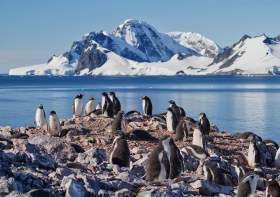
Since the establishment of Scott Base on Ross Island by the late Sir Edmund Hillary in 1957, surveyors have been appointed to assist scientists with survey related tasks on the ice.
This presentation by a panel of Antarctic surveyors promises to be educational, entertaining and informative, as they talk about their experiences on projects on the frozen continent over the last 35-plus years.
Image credit: ©stock.adobe.com/au/hrathke


