Learn how to ‘geo-enlighten your organisation’ at Directions LIVE 2016.
This year’s roadshow will highlight how you can extend the benefits of geospatial technology throughout your entire business – to streamline workflows and maximise your return on investment.
Discover how to further leverage the ArcGIS platform’s spatial analysis capabilities and see how this technology gives your organisation the competitive edge.
At Directions LIVE 2016, you will learn the benefits of working with 3D and 4D data, how to select the perfect app to tackle any challenge, and how ArcGIS Pro complements ArcMap functionality.
We will also be showcasing the innovative ways local organisations are improving operational efficiency with GIS technology.
Directions LIVE is free for Esri users – with light lunch provided.
Register today to join our team of ArcGIS experts and your local GIS user community, and learn how to unlock the full potential of the platform – the market’s only complete GIS solution.

As the investment centre of gravity related to space shifts towards leading economies in the Indo-Pacific, we must think together about shared opportunities, challenges and risks around the ‘Zone Above’.
In collaboration with The University of Western Australia (UWA), the Perth USAsia Centre is convening the 2018 In The Zone Conference, the latest in a series founded to provide a strategic forum for Indo-Pacific policymakers, advocates, business and academic leaders to grapple with issues of shared regional concern. This year’s In the Zone will focus on capability, security and expansion into space and is titled The Zone Above: The Indo-Pacific Era in Space.
Please note a tax invoice will be emailed to attendees in the month prior.
Visit the conference website for a full list of speakers and more information.

Organised by OSGeo, this international annual gathering of location enthusiasts is the largest global gathering for geospatial software. Now in its 15th year, FOSS4G (ie. Free and Open Source Software for Geospatial) brings together developers, users, decision-makers and observers from a broad spectrum of organisations and fields of operation.
Through six days of workshops, presentations, discussions, and cooperation, FOSS4G participants create effective and relevant geospatial products, standards, and protocols. The 2021 event will be focused for the first time on South America and will be held with the close collaboration of the GeoLibres Association in Buenos Aires, Argentina.

During GEO Week 2021, the Group on Earth Observations will present the multidisciplinary activities of the GEO Work Programme that address policy agendas involved in the UN Framework Convention on Climate Change (UNFCCC) COP26, the Convention on Biological Diversity (CBD) COP15, the UN Decade of Ocean Science for Sustainable Development and the UN Decade of Ecosystem Restoration.
The online event will include the GEO-17 plenary, plus anchor and side events. Time will be scheduled each day for virtual networking. On Monday, November 22, the 56th Executive Committee will be held as a closed meeting.
Of particular importance will be the anchor events: These are the main events designed by GEO week 2021 organisers to explain the multidisciplinary nature of GEO through the concept of nexus thinking. Working on multiple topics simultaneously is essential in today’s rapidly changing environmental and social conditions. For example, work in one area will have a knock-on effect or impact in another area, such as the water, energy and food nexus. These events are linked to the global policy agendas that underpin most of GEO’s work.
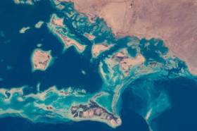
Image credit: NASA

Unable to hold its scheduled 2021 NSW Regional Conference earlier in 2022, SSSI is now inviting the spatial community to join it for a special online seminar featuring some of the speakers from the original program, along with the announcement of the NSW winners of the 2021 Asia-Pacific Spatial Excellence Awards.
This seminar will focus on the importance, efficiency and innovation spatial data can provide in crisis management situations and will feature presentations on:
- Finding your Friendship Island amongst a sea of COVID restrictions — presented by Stella Blake-Kelly, Founder/Director, Cartisan
- Geospatial Intelligence: Providing real-time insights supporting NSW State Emergency Service’s emergency management response — presented by Melissa Daley, Manager, Geospatial Intelligence Systems, NSW State Emergency Service
- COVID-19 Near Me: Trials and tribulations — presented by Kenneth Tsang, Director, jxeeno

The 16th annual congress of the Open Source Geospatial Foundation, the non-profit organisation that supports and promotes the collaborative development of free and open source geographic technologies and open geospatial data, will be held in Florence, Italy, at the Palazzo dei Congressi, Palazzo degli Affari and the University of Florence.
FOSS4G (ie. Free and Open Source Software for Geospatial) brings together developers, users, decision-makers and observers from a broad spectrum of organisations and fields of operation.


