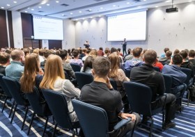
Discover what’s new and what’s next in HDS technology with immersive sessions and a day dedicated to learning, led by Leica Geosystems experts.
The HDS User Conference is designed to deliver a new experience for all attendees from Australia and New Zealand.
Together with our partners C.R. Kennedy and Global Survey the HDS User Conference will bring together Leica Geosystem HDS users in a community environment where they’ll access training sessions, learn about our latest innovations, listen to best practices from industry and experience live demos of the latest HDS technology and solutions.
The HDS User Conference features insightful keynote addresses, customer success stories and HDS dedicated group training sessions. Discover and test-drive new, innovative hardware and software solutions that will improve the performance, speed, workflows and efficiency across your organisation.
SEE AGENDA
Reasons to attend:
- Experience the latest solutions that will help you compete and win in today’s dynamic environment
- Learn about reality capture hardware and software solutions and how to be more efficient and productive
- Leica Geosystems will unveil several new innovations and attendees will get a first-hand look at the latest technology advancements
- Experience hands-on demonstrations and training to improve your workflows
- Learn from and network with peers across industries
What’s included in your registration:
- Two days filled with informative sessions and networking opportunities plus a dedicated day to learning
- Evening welcome cocktail reception
- Post-conference access to training material and presentations
- Morning tea, lunch and afternoon tea catering
- Delegate bags
NOTE: We ask that you select your preferred training session time when registering. Simply choose from the four session times available, per workshop.
This helps us manage classroom numbers to ensure we provide you with quality training sessions and you will have the opportunity to attend each topic throughout day two of the conference.
Day two- August 15
Workshop sessions and timings
Maximising 3DReshaper
9am – 10:30am I 11am- 12:30pm I 1:30pm-3:00pm I 3:30pm-5:00pm
Advanced data management and registration workflow
9am – 10:30am I 11am- 12:30pm I 1:30pm-3:00pm I 3:30pm-5:00pm
Creating diverse deliverables: optimising the latest Leica HDS software updates to transform point cloud data into value- added deliverables
9am – 10:30am I 11am- 12:30pm I 1:30pm-3:00pm I 3:30pm-5:00pm
BIM workflow
9am – 10:30am I 11am- 12:30pm I 1:30pm-3:00pm I 3:30pm-5:00pm
Visit the event page for more information
If you have any questions about the HDS User Conference, training sessions, or assistance regarding registration, please contact:
Tamara Stakic
Marketing Manager
info.anz.geo@leica-geosystems.com
T: +61 3 9914 2262

Organised by OSGeo, this international annual gathering of location enthusiasts is the largest global gathering for geospatial software. Now in its 15th year, FOSS4G (ie. Free and Open Source Software for Geospatial) brings together developers, users, decision-makers and observers from a broad spectrum of organisations and fields of operation.
Through six days of workshops, presentations, discussions, and cooperation, FOSS4G participants create effective and relevant geospatial products, standards, and protocols. The 2021 event will be focused for the first time on South America and will be held with the close collaboration of the GeoLibres Association in Buenos Aires, Argentina.

During GEO Week 2021, the Group on Earth Observations will present the multidisciplinary activities of the GEO Work Programme that address policy agendas involved in the UN Framework Convention on Climate Change (UNFCCC) COP26, the Convention on Biological Diversity (CBD) COP15, the UN Decade of Ocean Science for Sustainable Development and the UN Decade of Ecosystem Restoration.
The online event will include the GEO-17 plenary, plus anchor and side events. Time will be scheduled each day for virtual networking. On Monday, November 22, the 56th Executive Committee will be held as a closed meeting.
Of particular importance will be the anchor events: These are the main events designed by GEO week 2021 organisers to explain the multidisciplinary nature of GEO through the concept of nexus thinking. Working on multiple topics simultaneously is essential in today’s rapidly changing environmental and social conditions. For example, work in one area will have a knock-on effect or impact in another area, such as the water, energy and food nexus. These events are linked to the global policy agendas that underpin most of GEO’s work.
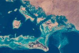
Image credit: NASA

The 16th annual congress of the Open Source Geospatial Foundation, the non-profit organisation that supports and promotes the collaborative development of free and open source geographic technologies and open geospatial data, will be held in Florence, Italy, at the Palazzo dei Congressi, Palazzo degli Affari and the University of Florence.
FOSS4G (ie. Free and Open Source Software for Geospatial) brings together developers, users, decision-makers and observers from a broad spectrum of organisations and fields of operation.

The Committee of Experts on Global Geospatial Information Management (UN-GGIM) will convene the second United Nations World Geospatial Information Congress (UNWGIC) in Hyderabad, India from 10-14 October 2022.
Hosted by the Government of India through its Ministry of Science and Technology, the convening of the UNWGIC arises out of the mandate from the United Nations Economic and Social Council (ECOSOC) to the Committee of Experts to convene global forums to promote comprehensive dialogue on global geospatial information management with all relevant governments, international organisations and stakeholders.
With an overarching theme ‘Geo-Enabling the Global Village: No one should be left behind,’ the second UNWGIC will reflect the importance of integrated geospatial information to support sustainable development and the wellbeing of society, address environmental and climate challenges, embrace digital transformation and technological development, and catalyse vibrant economies.
The congress addresses the development and strengthening of integrated geospatial information management, its capacities and capabilities, and demonstrates the importance of international cooperation and coordination for building a human data and geography community, against the three pillars of sustainable development, for a shared future and a better world, leaving no one behind within an inclusive and equitable global society.
The UNWGIC will feature a high-level, plenary, special and parallel sessions. While the actual second UNWGIC program covers three days (11 – 13 October), the overall event will be a weeklong (10 – 14 October), and will include global and regional meetings, workshops and learning events, expert meetings and side events, including the eleventh plenary meeting of the Regional Committee of United Nations Global Geospatial Information Management for Asia and the Pacific (UN-GGIM-AP), as well as the annual meeting of the UN-GGIM Expanded Bureau.

The Tasmanian Spatial Information Council (TASSIC) will hold a Geospatial Workforce Development Forum on 9 November 2023, to help shape the future of the geospatial sector in Tasmania.
The Forum will bring together key stakeholders from education, employers, government and suppliers to address critical challenges and opportunities facing the sector.
The Forum will include presentations from representatives of industry, government and the education sector, as follows:
- Paul Digney (Jacobs)
- Rob Rowell (Insight GIS)
- Ben Morris (Local Government Association of Tasmania)
- Michael Krome (Australian Spatial Analytics)
- Arco Lucieer (University of Tasmania)
- Sam Ebert (TAFE NSW)
- Troy Robbins (TasTAFE)
The event will conclude with a moderated discussion session led by Danika Bakalich (Geospatial Council of Australia).
The Forum will be a hybrid event with both in-person and online attendance options available, and it will employ the Menti-Meter program to facilitate discussions, ensuring that each delegate’s voice is heard and their input valued.
Image credit: ©stock.adobe.com/au/borisblik


