Organised by OSGeo, this international annual gathering of location enthusiasts is the largest global gathering for geospatial software. Now in its 15th year, FOSS4G (ie. Free and Open Source Software for Geospatial) brings together developers, users, decision-makers and observers from a broad spectrum of organisations and fields of operation.
Through six days of workshops, presentations, discussions, and cooperation, FOSS4G participants create effective and relevant geospatial products, standards, and protocols. The 2021 event will be focused for the first time on South America and will be held with the close collaboration of the GeoLibres Association in Buenos Aires, Argentina.

During GEO Week 2021, the Group on Earth Observations will present the multidisciplinary activities of the GEO Work Programme that address policy agendas involved in the UN Framework Convention on Climate Change (UNFCCC) COP26, the Convention on Biological Diversity (CBD) COP15, the UN Decade of Ocean Science for Sustainable Development and the UN Decade of Ecosystem Restoration.
The online event will include the GEO-17 plenary, plus anchor and side events. Time will be scheduled each day for virtual networking. On Monday, November 22, the 56th Executive Committee will be held as a closed meeting.
Of particular importance will be the anchor events: These are the main events designed by GEO week 2021 organisers to explain the multidisciplinary nature of GEO through the concept of nexus thinking. Working on multiple topics simultaneously is essential in today’s rapidly changing environmental and social conditions. For example, work in one area will have a knock-on effect or impact in another area, such as the water, energy and food nexus. These events are linked to the global policy agendas that underpin most of GEO’s work.
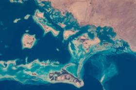
Image credit: NASA

The ITS Australia Summit 2022 in Brisbane will feature a strong industry program over three days driven by abstract submissions & invited keynote presentations, and will include technical tours & demonstrations, cutting edge industry exhibition, workshops, panel discussions, and an exciting social program.
As Australia’s leading transport technology event, Summit will demonstrate new insights and initiatives that will determine our path toward an accessible and automated future transport network.

The 16th annual congress of the Open Source Geospatial Foundation, the non-profit organisation that supports and promotes the collaborative development of free and open source geographic technologies and open geospatial data, will be held in Florence, Italy, at the Palazzo dei Congressi, Palazzo degli Affari and the University of Florence.
FOSS4G (ie. Free and Open Source Software for Geospatial) brings together developers, users, decision-makers and observers from a broad spectrum of organisations and fields of operation.

The Committee of Experts on Global Geospatial Information Management (UN-GGIM) will convene the second United Nations World Geospatial Information Congress (UNWGIC) in Hyderabad, India from 10-14 October 2022.
Hosted by the Government of India through its Ministry of Science and Technology, the convening of the UNWGIC arises out of the mandate from the United Nations Economic and Social Council (ECOSOC) to the Committee of Experts to convene global forums to promote comprehensive dialogue on global geospatial information management with all relevant governments, international organisations and stakeholders.
With an overarching theme ‘Geo-Enabling the Global Village: No one should be left behind,’ the second UNWGIC will reflect the importance of integrated geospatial information to support sustainable development and the wellbeing of society, address environmental and climate challenges, embrace digital transformation and technological development, and catalyse vibrant economies.
The congress addresses the development and strengthening of integrated geospatial information management, its capacities and capabilities, and demonstrates the importance of international cooperation and coordination for building a human data and geography community, against the three pillars of sustainable development, for a shared future and a better world, leaving no one behind within an inclusive and equitable global society.
The UNWGIC will feature a high-level, plenary, special and parallel sessions. While the actual second UNWGIC program covers three days (11 – 13 October), the overall event will be a weeklong (10 – 14 October), and will include global and regional meetings, workshops and learning events, expert meetings and side events, including the eleventh plenary meeting of the Regional Committee of United Nations Global Geospatial Information Management for Asia and the Pacific (UN-GGIM-AP), as well as the annual meeting of the UN-GGIM Expanded Bureau.

Geo Week is an event for increased integration between the built environment, advanced airborne/terrestrial technologies, and commercial 3D technologies. It was created as a response to the changing needs of built world and geospatial professionals, and to acknowledge the convergence of technology taking place currently.
New technological innovations, the need for remote workflows, and hardware breakthroughs are redefining expectations across teams, organisations, and entire industries will canvassed at the event.
Attendees will hear about the latest updates, case studies, ideas and predictions from a variety of experts: innovators, end-users, regulators, and more. What trends and technologies do they see coming? What new challenges and opportunities lie ahead? How can you and your organisation prepare, anticipate, and benefit in a rapidly evolving environment?


