We are pleased to announce our Qld Conference Highlights Webinar Series, showcasing some of the most popular presentations from our 2019 Qld Surveying & Spatial Day, Central Group and Northern Group Conferences.
First up is Dale Atkinson, presenting Native Title and the role of Cadastral Surveyor.
There have been over 120 Native Title Determinations registered in Queensland alone. Complicated legal concepts, lengthy federal court judgements and cultural sensitivities have made this a very avoidable issue for the cadastral surveyor. This talk attempts to provide a basic understanding and argues that there is a vital role for cadastral surveyors to play in this process.
Dale is a cadastral surveyor that runs a small rural based practice in North Queensland. He has a keen interest in rural surveying and maintains a good relationship with many retired rural surveyors. Dale is currently the Chair of the Qld Land Surveying Commission Committee.
Don’t forget to check out our other webinars here.
Registration
By registering below, you receive access to the watch the webinar live OR if you can’t watch it live, you receive the link to the recording 24 hours after the event date. You can then watch the recording at your leisure.
BOSSI CPD
BOSSI CPD points have been assessed as below. The event code for BOSSI is: tbc
- 1.00 BOSSI Cadastral points for live viewing
- 1.00 BOSSI Cadastral points for viewing the recorded webinar if accompanied by a questionnaire with 80% pass mark (contact Katie for a copy)
- 0.5 BOSSI Cadastral CPD points for viewing of the recorded webinar with no questionnaire
Contact
Katie Le Miere
rom.qld@sssi.org.au

SSSI in conjunction with the Hunter Environmental Institute will present this webinar with three pre-eminent speakers:
Amy Steiger (Cardno)
Title: RPAS and thermal cameras for wildlife detection post-bushfire and coastal monitoring
Details: Amy has promoted the use of Remotely Piloted Aircraft Systems (RPAS) gaining experience with remote data capture to cover a range of coastal, environmental and land development applications.
RPAS thermal inspection capability was deployed this summer in wildlife detection post-bushfires.
Amy has also done volumetric surveys of beaches and flown isolated coastal cliff faces in NSW to capture high-resolution photography and derived photogrammetric models to identify geotechnical hazards and contribute to coastal monitoring.
Charity Mundava (WaterNSW)
Title: Remote Sensing in Water Management
Details: Charity will discuss the use of GIS and remote sensing to support water catchment management, feasibility and environmental studies for critical water infrastructure across the state and to support ongoing research into and management of river catchments. Charity will touch on the significance and spatial support for this in the recent NSW bushfires coordinating reservoir availability (in drought) and access for helicopter water drops and supporting bushfire fighting efforts.
Associate Professor In-Young Yeo (University of Newcastle)
Title: Remote sensing and GIS applications for water resources management
Details: Dr Yeo will explain how remote sensing can be used as a technique for assessing soil moisture using multi-source data fusion approaches, vegetation monitoring and water requirement with remote sensing and water balance approach.
She will explain the impacts of conservation management practices in agricultural catchments assessed using catchment model and remote sensing/GIS drawing on examples from Australian and American case studies
CPD Points
BOSSI CPD is 1 SP for this webinar.
Cost
As per details as follows
Contact
rom.nsw@sssi.org.au

Organised by OSGeo, this international annual gathering of location enthusiasts is the largest global gathering for geospatial software. Now in its 15th year, FOSS4G (ie. Free and Open Source Software for Geospatial) brings together developers, users, decision-makers and observers from a broad spectrum of organisations and fields of operation.
Through six days of workshops, presentations, discussions, and cooperation, FOSS4G participants create effective and relevant geospatial products, standards, and protocols. The 2021 event will be focused for the first time on South America and will be held with the close collaboration of the GeoLibres Association in Buenos Aires, Argentina.

The 16th annual congress of the Open Source Geospatial Foundation, the non-profit organisation that supports and promotes the collaborative development of free and open source geographic technologies and open geospatial data, will be held in Florence, Italy, at the Palazzo dei Congressi, Palazzo degli Affari and the University of Florence.
FOSS4G (ie. Free and Open Source Software for Geospatial) brings together developers, users, decision-makers and observers from a broad spectrum of organisations and fields of operation.

The 2022 SSSI Queensland Regional Conference will be held on Friday, 14 October at the Brisbane Convention & Exhibition Centre. It promises to once again be a fantastic opportunity to learn and connect with SSSI members and the broader surveying and spatial community.
The Queensland Asia-Pacific Spatial Excellence Awards dinner will also be held in conjunction with the conference, celebrating the outstanding work being undertaken across the region.
Image credit: ©stock.adobe.com/au/rudi1976

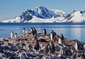
Since the establishment of Scott Base on Ross Island by the late Sir Edmund Hillary in 1957, surveyors have been appointed to assist scientists with survey related tasks on the ice.
This presentation by a panel of Antarctic surveyors promises to be educational, entertaining and informative, as they talk about their experiences on projects on the frozen continent over the last 35-plus years.
Image credit: ©stock.adobe.com/au/hrathke

The Geospatial Council of Australia’s 2023 North Queensland Conference will be held at the Cairns Colonial Club on 28 August 2023.
This annual conference is an opportunity for local surveying professionals at all levels to get together to hear about local projects, connect with colleagues old and new and see the latest equipment from suppliers.
The full conference program is now available.
Image credit: ©stock.adobe.com/au/Gorodenkoff

The 2023 Queensland Geospatial Conference & Awards Dinner will be held in Brisbane on Friday, 20 October 2023.
The conference will be a chance for the Queensland geospatial community to learn about the latest projects and research, connect with colleagues and see the latest technology from local suppliers. The conference will be followed by the awards dinner.
Presentation abstract proposals are being accepted until Monday, 28 August.
Image credit: ©stock.adobe.com/au/rudi1976


