The 42nd Canadian Symposium on Remote Sensing will be a virtual event that will bring together academics, practitioners, vendors and policymakers from the remote sensing community in an informative and productive four-day event under the theme of Understanding Our World: Remote Sensing For A Sustainable Future. It fill have special sessions, general sessions, keynotes, panel discussions and workshops featuring speakers from around the world. Attendees will enjoy both technical sessions and networking opportunities online.

Organised by OSGeo, this international annual gathering of location enthusiasts is the largest global gathering for geospatial software. Now in its 15th year, FOSS4G (ie. Free and Open Source Software for Geospatial) brings together developers, users, decision-makers and observers from a broad spectrum of organisations and fields of operation.
Through six days of workshops, presentations, discussions, and cooperation, FOSS4G participants create effective and relevant geospatial products, standards, and protocols. The 2021 event will be focused for the first time on South America and will be held with the close collaboration of the GeoLibres Association in Buenos Aires, Argentina.

Hosted by 12d – the companies behind 12d Model and 12d Synergy – the highly anticipated 12d Tech Forum returns on 19 – 21 October 2021. The three-day online industry summit will connect over 2,000 surveying, engineering, and construction professionals to learn, innovate, and be inspired.
The 12d Tech Forum provides surveying and geospatial professionals with an excellent training opportunity to keep up to date with the latest innovations and advancements in the industry.
50+ Hours of Inspiring Industry Talks
The 12d Tech Forum will host over 50 hours of industry insights, case studies from cutting-edge Australian and New Zealand surveying projects, and actionable training content. Delivered by some of the greatest minds and speakers in the industry. Talks are tailored for surveyors, engineers, and directors, not just 12d operators.
Free Access to All Keynote Presentations
We’ve secured a huge line-up of 40+ industry speakers, including talks from Land Surveys, Fulton Hogan, GHD, SMEC, Piritahi, and many more.
A few keynote titles include:
- Pilbara Desert Collaboration: Land Surveys’ data management strategy collaborating across the Pilbara desert
- GDA2020 at Mackay City Council: Practical insights into successfully implementing GDA2020 through 12d Model
- Piritahi Case Study: 10,000 lot land development project to crush the Auckland housing crisis
- TfNSW Steering Group & Uniform Coding: Aligning managed utilities through a consistent framework for delivery
Best yet, all sessions will be recorded and available to watch on-demand for 12 months after the event.
Surveying and Geospatial Topics Include…
- BIM & Digital Engineering
- Land & Construction Surveying
- GDA2020, ADAC, A-SPEC
- Point Clouds
- Drone Surveying & Photogrammetry
- Mobile Mapping & GIS
- Digital Twins & Asset Management
- Data Management & Collaboration
Check Out the Preliminary Event Agenda
To see a comprehensive list of keynotes and topics that will be covered at the 12d Tech Forum 2021, check out our Preliminary Event Agenda here.
12d Training Breakout Streams
For more tailored training content focused on upskilling your use of 12d software, purchase a Training Pass (A$149 +GST). Here you will have access to an additional five technical streams covering topics on Design, Survey, Water, Data Management, and Training.
Accrue CPD Points
Every hour you watch of the 12d Tech Forum can earn you 1 CPD point for many industry institutions, such as SSI, Australian Consulting Surveyors, Engineers Australia, and many more.
Virtual Networking Sessions
Meet like-minded individuals and build lasting relationships with our virtual networking sessions. The online forum will be attended by thousands of surveying, mapping, and geospatial professionals from across Australia, New Zealand, and abroad.
Register for FREE Today
Join over 2,000 professionals and gain access to 50+ hours with 150+ in-depth talks, delivered by over 60 speakers. Register for your free Industry Pass today!
To learn more and register, visit 12dtechforum.com/

The International Society for Photogrammetry and Remote Sensing (ISPRS) will hold its 2022 congress in Nice, France, in June 2022. The event will be hosted by the French Society for Photogrammetry and Remote Sensing.
A wide-ranging program has been put together, and it includes a host of leading speakers, such as Australia’s Professor Sisi Zlatanova from the University of South Wales. More than 1500 papers will be presented in the various scientific tracks and sessions over the week. In addition to these presentations, participants will also have the chance to interact and network face-to-face with the authors in poster sessions.
In order to help the registered participants to choose the sessions and the presentations to build their own program during the week, pre-recorded video presentations of the papers will made accessible before the beginning of the event through the digital platform of this event.
The Congress will have a strong technology track, with a large exhibition space that will gather the major players of the geospatial business. A geospatial prospective forum will also address hot topics of our community in order to draw recommendations.
The deadline for both full papers and abstracts is January 10, 2022.

The 16th annual congress of the Open Source Geospatial Foundation, the non-profit organisation that supports and promotes the collaborative development of free and open source geographic technologies and open geospatial data, will be held in Florence, Italy, at the Palazzo dei Congressi, Palazzo degli Affari and the University of Florence.
FOSS4G (ie. Free and Open Source Software for Geospatial) brings together developers, users, decision-makers and observers from a broad spectrum of organisations and fields of operation.

The Ocean Optics Conference attracts a diverse audience of active practitioners in the field, including oceanographers, marine ecologists, limnologists, optical engineers, marine resource managers and policy professionals from around the world.
Conference presentations will include the science of optics across all aquatic environments, research, and applications, including (but not limited to) biogeochemistry, environmental management and applications, instruments, techniques and observational systems, remote sensing, phytoplankton ecology, radiative transfer and optical theory, global change, and benthic processes.
Attendees will attend plenary presentations during the day and interact with colleagues during scientific poster session receptions held in the exhibit/poster hall in the early evening. In addition to invited and contributed oral and poster presentations, the conference will provide the opportunity for community-wide discussions.
NASA Earth Observatory image by Joshua Stevens, using Landsat data from the U.S. Geological Survey.

Featuring a spotlight on crowd-sourced bathymetry, the Map the Gaps Symposium 2023 will bring people together to learn, share and contribute to ocean discovery.
Held on behalf of GEBCO, this event draws global experts in ocean technology, science and policy to discuss deep and coastal ocean exploration, offshore surveying technology, policy, diversity, equity and inclusion, the Nippon Foundation-GEBCO Seabed 2030 project and GEBCO alumni activities.
Participation is open to all, including industry professionals, explorers, authors, students, researchers, government representatives and emerging technologists. Participants can attend in person or online.

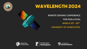
The Wavelength meeting was launched in 2013 for PhD students and early career researchers, addressing the demand for representation of new professionals as well as students from RSPSoc — the UK society for remote sensing and photogrammetry science.
Every year, Wavelength gathers participants from student and early career levels, as well as senior members and individuals within academia and business. The conference offers a setting to present student and EC work and meet new, like-minded contacts.
The 2024 conference will be run in a hybrid format, to accommodate those who can and those who cannot travel to Worcester.

The 4th International Symposium on Applied Geoinformatics (ISAG2024), which will take place at the Wroclaw University of Science and Technology, Wroclaw, Poland, on 9 and 10 May 2024. ISAG2024 is jointly organised by the Department of Geomatics Engineering, Yildiz Technical University, Istanbul, Türkiye, Wroclaw University of Science and Technology, Wroclaw, Poland and Technical University of Crete, Chania, Crete, Greece.
The aim of the 4th ISAG is to bring scientists, engineers and industry researchers together to exchange and share their experiences and research results and discuss the practical challenges encountered and the solutions adopted in geoinformatics.
Topics to be covered include recent advances in AI, satellite imagery, advanced remote sensing, photogrammetry, image processing, global navigation satellite systems, height systems, terrestrial laser scanning, GIS, smart cities and land management.

The ISPRS Technical Commission II ‘Photogrammetry’ focuses, at various scales, on geometric, radiometric and multi-temporal aspects of the image- and range-based 3D surveying, mapping and modelling in the age of AI and mixed reality.
The organisers of the June 2024 Symposium welcome researchers, practitioners and companies involved in photogrammetry and computer vision to present and discuss their results with a broader audience. The Symposium will feature four days of plenary and keynote talks, along with parallel sessions of oral and poster presentations from academia and industry.
The symposium’s theme is ‘The Role of Photogrammetry for a Sustainable World,’ emphasising machine learning and mixed reality. The event is being organised in collaboration with ASPRS (American Society of Photogrammetry and Remote Sensing) and SGPF (Swiss Society of Photogrammetry and Remote Sensing).
Image credit: ©stock.adobe.com/au/Lifes_Sunday


