Organised by OSGeo, this international annual gathering of location enthusiasts is the largest global gathering for geospatial software. Now in its 15th year, FOSS4G (ie. Free and Open Source Software for Geospatial) brings together developers, users, decision-makers and observers from a broad spectrum of organisations and fields of operation.
Through six days of workshops, presentations, discussions, and cooperation, FOSS4G participants create effective and relevant geospatial products, standards, and protocols. The 2021 event will be focused for the first time on South America and will be held with the close collaboration of the GeoLibres Association in Buenos Aires, Argentina.

The presenters for this topical webinar will be Dr Craig Roberts, Senior Lecturer in Surveying/GPS/Geodesy at UNSW and Wayne Patterson Director, Spatial Operations at the NSW Department of Customer Service.
Roberts will give a short update on the revision of the Australian Standard, AS_5488 Classification of subsurface utility information in the context of datum modernisation, low-cost multi-GNSS and recent advances in positioning infrastructure in Australia.
Data storage, data distribution and security are identified as challenges suggesting a reimagined data governance will be needed. Could a spatial digital twin assist? What is a spatial digital twin? Is it a BIM? Where does it come from? What is an open data policy? Who can use it? Can I use it? Which datum? How accurate is the data?
Rather than just another PowerPoint webinar, Roberts will interview Patterson in a free-flowing format. Attendees will be invited to ask their own questions live in the chat as the conversation evolves.
This webinar is targeted at surveyors, geospatial users, students and the wider spatial community.

As Australasia’s premier annual industry event, the Disaster & Emergency Management Conference attracts a passionate crowd of leaders and change-makers from government, private, and volunteer agencies working in disaster and emergency management.
Over two days, you will connect with emergency management professionals and subject matter experts offering insight, reflection, understanding and motivation across a wide range of topics and emergency management incidents.
Enjoy an impressive line-up of keynote speakers, presenters, and panel discussions, and leave with practical tools and techniques to ensure your team is best supported to better plan, prepare, and respond to emergencies, disasters, and rescue operations.
- Connect with emergency management personnel from state and local government, NGOs, and other recovery agencies.
- Explore and engage with exhibitor displays featuring the latest equipment, technologies, and agency services.
- Discover what is happening across multi-sectors via a program of renowned keynote speakers, sector representatives and lived-experience presenters.
- Gain practical tips, techniques, and strategies to incorporate into your organisation to improve the way you approach disaster and emergency planning, response & prevention.

The 16th annual congress of the Open Source Geospatial Foundation, the non-profit organisation that supports and promotes the collaborative development of free and open source geographic technologies and open geospatial data, will be held in Florence, Italy, at the Palazzo dei Congressi, Palazzo degli Affari and the University of Florence.
FOSS4G (ie. Free and Open Source Software for Geospatial) brings together developers, users, decision-makers and observers from a broad spectrum of organisations and fields of operation.

The Geospatial Council of Australia’s Western Australia Digital Twin Summit will be held on 15 November 2023.
The event will focus on Spatial Digital Twins, and attendees will hear the latest developments in this rapidly developing space from government, academia and private industry presenters.
The WA Asia-Pacific Spatial Excellence Awards dinner will also be held in conjunction with the conference, celebrating the outstanding work being undertaken across the region.
Image credit: ©stock.adobe.com/au/anekoho

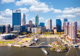
The not-to-be-missed Geospatial Council of Australia (GCA) WA Digital Twin Symposium will be held on 14 March in Perth, giving geospatial professionals a chance to learn about the latest developments in this important field.
- Members: $220 (incl. GST)
- Non-members: $330 (incl. GST)
- Student members: $95 (incl. GST)
Registrations will close on Wednesday 6 March.


