Learn how to plan and deliver products and services to any location in Australia – no matter how ambiguous the address with what3words.
what3words has divided the world into a grid of 3m x 3m squares and assigned each one a unique 3 word address, providing a precise and incredibly simple way to talk about location. It means everyone and everywhere now has an address.
Join Peter Landis, 360HR’s geospatial recruitment specialist, as he interviews Tom Blaksley from what3words, to uncover the potential and real world applications benefiting from this revolutionary solution to an age old problem.
Webinar details:
Date: Thursday, 21 February
Time: 4.00PM AEDT

FIRA is a leading global event series, which this year is focused on the new era of robotics in agriculture and the huge impact it will have on the whole value chain. For the sixth year running, FIRA will be a hybrid in-person/online event, and is expected to attract 3000-plus attendees from around the world, including robot manufacturers, agricultural businesses, producers, investors, suppliers and entrepreneurs.

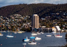
The 2022 Tasmania Surveying & Spatial Conference will be held on Friday, 2 September at Wrest Point in Hobart, and promises to be a fantastic opportunity to learn and network with SSSI members and the broader surveying and spatial community.
This year’s event will include a gala dinner, held in partnership with the University of Tasmania, to celebrate that institution’s 50 years in the field of surveying and spatial teaching.
In addition, the event will include the presentation of the 2022 Tasmanian Asia-Pacific Spatial Excellence Awards.
Image credit: ©stock.adobe.com/au/Norman

The 2023 Tasmanian Geospatial Conference & Awards Reception will be held at the Crowne Plaza in Hobart on 1 September 2023, where delegates will hear the latest news from across the local geospatial industry, including presentations on cadastral surveying, GIS, education and more.
Immediately following the conference will be the Geospatial Excellence Awards Reception, where all attendees will have the chance to enjoy drinks and canapes whilst networking and celebrating the local winners.
The full conference program is now available.
Image credit: ©stock.adobe.com/au/Norman

GeoBuiz Summit is an annual international conference focused on the geospatial industry, which encompasses a range of technologies and applications related to mapping, location-based services, and spatial data analysis.
The summit brings together industry leaders, government representatives, experts, and innovators to discuss the latest trends and innovations in geospatial technology and applications.
The conference covers a range of topics, including geospatial infrastructure, mapping and surveying, satellite imagery and remote sensing, location-based services, smart cities and urban planning, and much more. The GeoBuiz Summit aims to promote collaboration and knowledge-sharing within the geospatial industry and to showcase the latest developments in this exciting and rapidly evolving field.


