
What do you need to know?
During this webinar, we will explore everything you need to know when it comes to migration to the cloud!
Agenda:
- What is the cloud
- Recognising your data and the tools you need to have
- What are the different types of Cloud
- Setting up your application as a service
1Spatial is a Premier-level Managed Service Providers (MSP) globally. This Premier FME Cloud MSP status is awarded by Safe Software, the company behind FME.
This webinar is part of our free and education programme where we focus on one specific topic and dive deep under the covers to highlight a particular data challenge or solution. All of our historic webinars are published on our on-demand webinar page, just in case you missed a session, you can review it there… but if you join us on the live session you’ll have the opportunity to ask our expert presenter some questions around the topic.
In the meantime, if you have any technical questions, or you’d just like a quotation for one of our products, some training or a dedicated consultancy session from one of our FME Certified Professionals, just send us some details to Sales.australia@1spatial.com and we’ll be sure to get back to you.
Throughout our special coverage of Smarter Data Smarter World (SDSW), you will see how organisations are sharing and using trusted geospatial data to achieve sustainability and Net Zero goals. Hear from industry experts around the world about the latest innovations and how we are all collaborating, to make the world safer, smarter and more sustainable.
- Sustainability: We are all striving to sustainably meet the changing data needs and expectations of our users, stakeholders, and regulators, whilst reducing our ecological footprint. See how the adoption of smarter technology can help achieve sustainability goals.
- Innovation: Data is at the centre of businesses and that data increasingly must be accurate, first time and every time it’s required. Hear how organisations are using innovative solutions to create and make available accurate and timely data, for data-led decision making.
- Collaboration: Multiple data sources and multiple data users and stakeholders emphasise the need for up-to-date data at the touch of a button. Discover how through collaboration and engagement businesses are saving time, money, and effort, while increasing productivity.
For those attendees who are members of the Surveying & Spatial Sciences Institute, this webinar is worth 1 SSSI CPD point.

FIRA is a leading global event series, which this year is focused on the new era of robotics in agriculture and the huge impact it will have on the whole value chain. For the sixth year running, FIRA will be a hybrid in-person/online event, and is expected to attract 3000-plus attendees from around the world, including robot manufacturers, agricultural businesses, producers, investors, suppliers and entrepreneurs.
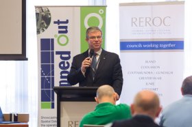
The latest in spatial data applications will be showcased at this year’s Mapped Out Conference to be held at the Rules Club in Wagga Wagga on Wednesday 2 & Thursday 3 March 2022.
Mapped Out will highlight the diversity of applications for spatial data, geographic information systems and their supporting technologies. Guest speakers with local and national experience will be showcasing the use of spatial data to enhance the operation and delivery of government services.
The Conference is a great opportunity for people working in regional NSW in both local government and the private sector to keep abreast of the latest technology and geographical information systems that can be utilised in their day to day work.
Put your pedal to the FMEdal and join us for the FME World Tour 2022!

Is your data driving you crazy? Overtake the competition with FME 2022! Register now to join us in a city near you. Whether you’re a newbie, just discovering the power of FME or an expert and hungry for new functionality, these fun events should be in your calendar!
Take a look at some of the most popular reasons to attend a World Tour event near you:
- Hear customer success stories and gain valuable insight on data integration strategies
- Get up to speed with FME 2022 new capabilities
- Our FME Pit Crew “Certified professionals” will be on the ground to answer any questions you may have.
- Plus lots of great prizes to be won!

The US National States Geographic Information Council (NSGIC) Annual Conference is the place to enhance geospatial excellence and collaboration for state, local, tribal and federal GIS policymakers and coordinators, private sector partners and other leaders in the geospatial ecosystem.
Providing critical and timely networking opportunities, the conference also offers the chance to connect, collaborate, and share with colleagues and partners.
The agenda will comprise:
Roll Call of States — Where state representatives will share a snapshot of achievements, challenges and upcoming activities.
Plenary Sessions — Presentations by and for the NSGIC community exploring challenges, successes and new approaches for collaboration in the geospatial ecosystem.
State Caucus — A roundtable discussion with state and local government representatives to talk frankly about current pressing issues.
GIO Academy — Leadership sessions and networking for state government GIOs and equivalents only (separate registration is required).
Speed Networking — A fun and fast-paced activity where sponsors, who have allocated points, will rotate to complete the circuit of visiting with state reps.
Annual Business Meeting — Including the election of new board members and leadership transition.
Awards Reception — Recognising exceptional work through the Geospatial Excellence Awards & NSGIC Service Awards.

Registrations for 1Spatial’s Annual Breakfast Seminar 2022 are open!
We would love to invite you to join our 3rd Annual Breakfast Seminar 2022 this October, which has limited number of seats available.
We are delighted to say that this event will be back in-person, around Australia!
Throughout the event, you will hear both customer and industry presentations that will focus on the challenges and opportunities for using and sharing geospatial data. There will be panel discussions and opportunities to network with your peers, our team, and other industry experts.
Building and Sustaining your Data Foundations
Strong data foundations are an essential requirement for the effective management of asset information and decision-making. Data needs to be accessible to organisations and their supply chain, to enable them to understand what information they have and need, what data can be upcycled sustainably, where data is located and who has access to it. To create good foundations that allow organisations to have confidence in their data, the quality, management and maintenance of that data is critical. Join us to find out more!
We look forward to welcoming you,
The 1Spatial Team
Join 1Spatial on our World Tour featuring FME!
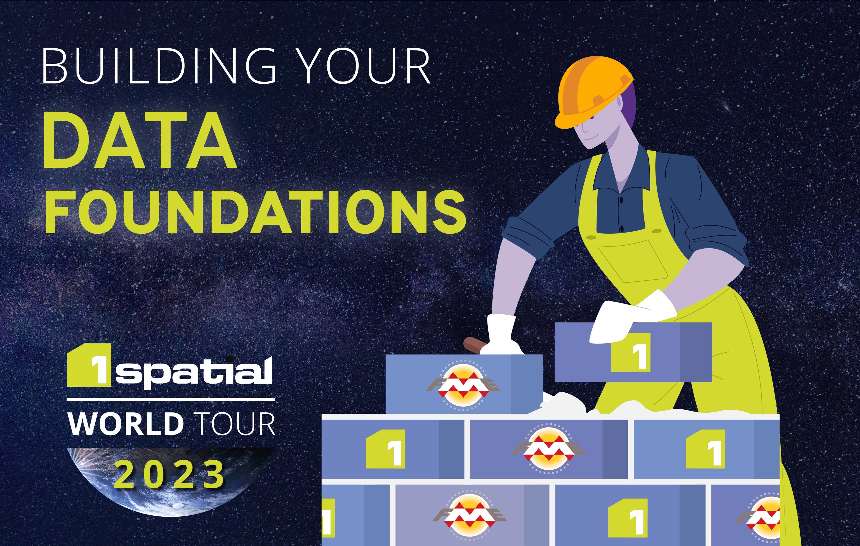
BUILDING YOUR DATA FOUNDATIONS
The power is all yours; building stronger foundations, constructing the perfect data integration platform, and empowering the end-user all at a touch of a button. Register now!
1Spatial is hosting our very own World Tour, featuring FME. And it’s with great pleasure to be kick-starting this epic event in Australia, followed by Singapore, US and the UK!
During this Tour event, you’ll hear about the importance of foundation data and how customers trust 1Spatial’s wide range of products and solutions. You will learn how they are being used by clients all around the world and how they are saving time and money.
We are delighted to have Bob Chell, 1Spatial’s Chief Product Officer (CPO) from the UK joining the event to talk about the 1Spatial Products and how they are being used around the world.
Australian Tour dates – Register now!
- Perth – 08th May | DoubleTree by Hilton Perth Waterfront
- Adelaide – 9th May | Adelaide Convention Centre
- Hobart – 15th May | RACV Hobart Hotel
- Melbourne – 16th May Melbourne Marriott Hotel
- Canberra – 17th May | QT Canberra
- Brisbane – 18th May | Sofitel Brisbane Central
- Sydney – 19th May | Sheraton Grand Sydney Hyde Park
- Singapore – 30th May |Sheraton Towers Singapore

Hosted by the Riverina Eastern Regional Organisation of Councils and the Riverina Spatial Information Group, Mapped Out 2023 will bring together public- and private-sector professionals to learn about the latest geospatial developments.
Mapped Out will highlight the diversity of applications for spatial data, geographic information systems and their supporting technologies. Guest speakers with local and national experience will be showcasing the use of spatial data to enhance the operation and delivery of government services.
The Conference is a great opportunity for people working in regional NSW in both local government and the private sector to keep abreast of the latest technology and geographical information systems that can be utilised in their day-to-day work.

The 2024 edition of the International Conference on Geographical Information Systems Theory, Applications and Management (GISTAM 2024) aims to create a meeting point of researchers and practitioners that address new challenges in geo-spatial data sensing, observation, representation, processing, visualization, sharing and managing, in all aspects concerning both ICT as well as management information systems and knowledge-based systems.
The conference welcomes original papers of either practical or theoretical nature, presenting research or applications, of specialised or interdisciplinary nature, addressing any aspect of geographic information systems and technologies, such as:
- Data acquisition and processing
- Remote sensing
- Interaction with spatial-temporal information
- Spatial data mining
- Managing spatial data
- Modelling, representation and visualisation
- GIS and climate change
- Domain applications


