SDB Day 2019
The International Forum on Satellite-Derived Bathymetry 2019
Esteemed speakers and guests from hydrographic offices, marine industry, service providers and research institutes around the world will gather for Australia’s first SDB Day in May 2019.
Satellite Derived Bathymetry (SDB) is a method for providing high-resolution water depth data in shallow water environments. These waters are notoriously difficult and expensive to access. The method combines satellite imagery with advanced algorithms to provide affordable and accurate data, and all within a relatively quick turnaround time.
The forum addresses the urgent need for both users and producers of SDB to jointly discuss capabilities, standards, data integration and handling uncertainties in its application.

The Future of Place Summit aims to be a day filled with critical discussion, knowledge sharing and networking around the intersection of people, place technology and data.
The event will focus on four themes:
- Designing for digital lifestyles — A new human-centred planning approach
- From precinct plans to development reality — The evolving digital and data DNA of urban growth
- Data-inspired discussions — Tapping into the real voice of the community
- Streets reimagined — The digital backbone for better experiences
Delegates can take part in person or via Zoom.

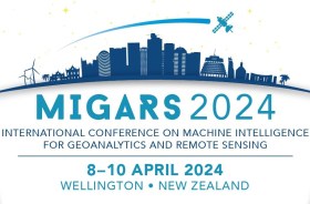
The International Association of the IEEE-Geoscience and Remote Sensing Society (GRSS), the IEEE-Computational Intelligence Society (CIS) and the local organising committee invite geospatial and computing professionals to attend the International Conference on Machine Intelligence for GeoAnalytics and Remote Sensing (MIGARS) to be held in Wellington, Aotearoa New Zealand in April 2024.
MIGARS aims to explore the interface of machine intelligence approaches with geosciences, spatial analytics, and remote sensing. With the tremendous developments in remote sensing technology, data acquisitions and sensing platforms, digital data have grown leaps and bounds to stream and are too big by volume, variety, and veracity. The challenge is handling, processing, and automating geo-data from various sources, such as multi-platform remote sensors and IoT devices, informing decision-making and monitoring our planet.
The conference will focus on connecting researchers from various disciplines, including computation/artificial intelligence, engineering, remote sensing, hydrology, agriculture and geosciences, and look for the potential use of intelligent computational approaches for geo-data-based applications and for serving society at large.

The 4th International Symposium on Applied Geoinformatics (ISAG2024), which will take place at the Wroclaw University of Science and Technology, Wroclaw, Poland, on 9 and 10 May 2024. ISAG2024 is jointly organised by the Department of Geomatics Engineering, Yildiz Technical University, Istanbul, Türkiye, Wroclaw University of Science and Technology, Wroclaw, Poland and Technical University of Crete, Chania, Crete, Greece.
The aim of the 4th ISAG is to bring scientists, engineers and industry researchers together to exchange and share their experiences and research results and discuss the practical challenges encountered and the solutions adopted in geoinformatics.
Topics to be covered include recent advances in AI, satellite imagery, advanced remote sensing, photogrammetry, image processing, global navigation satellite systems, height systems, terrestrial laser scanning, GIS, smart cities and land management.


