About this Event
Everybody talks about UAV LiDAR – the engineer in planning, the forester involved in wood mass calculation, the construction companies taking part in large projects to model it before, during and after its implementation or the utility companies for their corridor mapping and infrastructures management.
Reasons enough for us to continue the Yellowscan Demo tour in Australia, under the motto « Measuring the world with UAV LiDAR ». The scope is to show this high tech tool in a real working environment and how easy it is to generate topographic data with UAV LiDAR.
During our tour you will learn about the latest solutions and use cases from YellowScan and its partners with lectures, workshops and open discussions.
We look forward to meeting you !
YellowScan will be demonstrating two systems:
– YellowScan Surveyor Ultra, the high density & long-range LiDAR solution for UAV. Thanks to its high density (600 000 shots per second), this turn-key fully autonomous system is ideally suited for high speed & long-range projects. Its light weight (1.7 kg battery included) makes it also easy to mount on any drone.
Ideal Use cases: Mining, Archeology, Powerlines.
Applanix APX-15 & Velodyne VLP-32 inside.
– YellowScan Vx-20, the high precision & long-range LiDAR solution for UAV. This system is ideally suited for long range survey needs advanced accuracy (2,5 cm) and precision (1 cm).
Ideal Use Cases: Civil engineering, Forestry
Applanix APX-20 & Riegl miniVUX inside.
LiDAR systems are renowned for under vegetation 3D modeling, and fast data processing.
Contact :
Contact us for any question at laure.fournier@yellowscan-lidar.com

Featuring Don Murray, Co-Founder and President at Safe Software. With over 30 years experience and a Masters Degree in Computer Science from Simon Fraser University, Don leads the direction of Safe and focuses his specialty on server and cloud-based solutions. He regularly travels around the world sharing his passion for making data integration accessible to everyone who needs it.
With only a limited number of seats available, don’t miss this opportunity to find out where it’s come from and what the future holds!
“Supported by SSSI and SIBA/GITA”

At 1Spatial we use validation, integration, automation and our rules-based approach to build strong data infrastructures, leading to better outcomes and making your data smarter.
Have you thought about how you will transform your data to GDA2020?
During this session, we will help you understand the requirements needed for GDA2020 and the best way to migrate your data to this new datum!
Join our team for a free webinar on Friday 27th November and hear how we can help you migrate your data to GDA2020.
Agenda
- Recognising your data and understanding the effect this will have on your data
- Authoritative data sets that already exist
- GA & ICSM slides defining the height datum + case studies of support issues
- Transformations with FME
- Ensuring your organisation has a plan for the transformation
- How we can help you implement the move
In the meantime, if you have any technical questions, or you’d just like a quotation on one of our products, some training or a dedicated consultancy session from one of our specialised consultants, just send us some details to sales.australia@1spatial.com and we’ll be sure to get back to you.
Whether you’re new to FME or an experienced user, our free webinars are packed with tips, tricks and knowledge to take your FME expertise to the next level!

FME 2021 has landed and there’s a lot to take in, so much so, that what might seem like an insignificant new feature at first can have some serious benefits to your data integration routines.
In this session, we’ll hear from our 5 highly qualified consultants on what their 5 hot features are in FME and why you might want to take a closer look.
Agenda
- Enterprise Integration – Using the connectors Safe continues to introduce each year to better integrate FME Server with other systems.
- The FME Parameter Manager – How to improve the user experience of FME parameters in 2021 with the FME Parameter Manager.
- Self Service –Are you tired of doing repetitive tasks? We’ll cover off how you can use FME technology to provide self-service functions to people within your organisation. Self-service data access, data submissions and requests can be streamlined using FME.
- Creating PDF Reports – Do you need to create PDF reports as part of your ETL process? These tips can help you create pretty PDF reports via FME.
- Getting Started Quickly with FME Cloud – Access the power of FME Server instantly without the burden of managing hardware and security.
This webinar is part of our free FME education programme where we focus on one specific topic and dive deep under the covers to highlight a particular data challenge or solution. All of our historic webinars are published on our on-demand webinar page, just in case you missed a session, you can review it there… but if you join us on the live session you’ll have the opportunity to ask our expert presenter some questions around the topic.
In the meantime, if you have any technical questions, or you’d just like a quotation for FME, some training or a dedicated consultancy session from one of our FME Certified Professionals, just send us some details to Sales.australia@1spatial.com and we’ll be sure to get back to you.
The Australasian Hydrographic Society’s HydroSpatial2021 Conference will focus on how hydrography will develop in the future, noting the development of ‘digital twinning’ and the emerging name variants for hydrography such as ‘hydrospatial’ or ‘hydrogeomatics’.
The conference theme, Hydrography of the Future, morphs two modern yet wide-ranging aspects of the hydrographic surveying profession, and should draw papers from relevant scientific, technological, operational and environmental communities. The aim is to provide delegates with valuable insights, creative ideas and inspiration on how to harness current and future technologies, systems and processes so that they can deal with present challenges and prepare for a more sustainable future.
Put your pedal to the FMEdal and join us for the FME World Tour 2022!

Is your data driving you crazy? Overtake the competition with FME 2022! Register now to join us in a city near you. Whether you’re a newbie, just discovering the power of FME or an expert and hungry for new functionality, these fun events should be in your calendar!
Take a look at some of the most popular reasons to attend a World Tour event near you:
- Hear customer success stories and gain valuable insight on data integration strategies
- Get up to speed with FME 2022 new capabilities
- Our FME Pit Crew “Certified professionals” will be on the ground to answer any questions you may have.
- Plus lots of great prizes to be won!
The Australasian Hydrographic Society NZ Region, in conjunction with the Space & Spatial New Zealand Hydrography Stream, are holding a 1-day seminar on Friday, 8 July 2022 at the Miramar Golf Club, Wellington.
The seminar will align closely with the IHO’s World Hydrography Day theme “Hydrography – contributing to the United Nations Ocean Decade”.
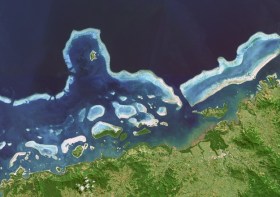
Hydrographers and all those with an interest in hydrography and related disciplines, are invited to attend a World Hydrography Day 2023 Seminar in Suva, Fiji, on 22 and 23 June.
The seminar will be held jointly by the Australasian Hydrographic Society and the Fiji Hydrographic Service. The venue will be the Moana Anglican Services and Teaching Centre at St John the Baptist Theological College.
The organisers are calling for potential sponsors and presenters to get in touch.
The theme for World Hydrography Day 2023 is ‘Hydrography: Contributing to the United Nations Ocean Decade’.
The seminar comes after a two-year pause due to the COVID pandemic and associated travel restrictions. It will provide an opportunity for professionals to network and share hydrospatial knowledge through presentations and discussion.
It is also intended that the presentations will highlight the empowerment of women within the hydrography field.
Registration is free but places are limited. Registrations must be secured by close of business, Tuesday, 20 June 2023.
The Remote Hydrography conference and exhibition brings together manufacturers, operators, regulators, and research and development leaders from both industry and academia, within the field of remote surveying and uncrewed survey operations.
Remote Hydrography 2024 provides an opportunity to share experience gained in the development and application of autonomous and uncrewed platforms (surface, underwater, aerial and space-based) and the associated command and support services.
These and enabling technologies like machine learning and artificial intelligence will revolutionise workflows for hydrographic data collection, processing, analysis and presentation.
The Geospatial Council of Australia’s World Hydrography Day Seminar will dive deep into the latest advancements in hydrographic surveying, mapping technologies and data analysis techniques.
The event will give delegates the opportunity to connect with fellow professionals, share experiences and learn from industry leaders at the forefront of marine charting and exploration.
For both seasoned experts and those just starting out in the field, the event promises invaluable insights and networking opportunities to enhance skills and advance careers.
Image credit: ©stock.adobe.com/au/HENADZ


