
About this Event
Everybody talks about UAV LiDAR – the engineer in planning, the forester involved in wood mass calculation, the construction companies taking part in large projects to model it before, during and after its implementation or the utility companies for their corridor mapping and infrastructures management.
Reasons enough for us to continue the Yellowscan Demo tour in Australia, under the motto « Measuring the world with UAV LiDAR ». The scope is to show this high tech tool in a real working environment and how easy it is to generate topographic data with UAV LiDAR.
During our tour you will learn about the latest solutions and use cases from YellowScan and its partners with lectures, workshops and open discussions.
We look forward to meeting you !
YellowScan will be demonstrating two systems:
– YellowScan Surveyor Ultra, the high density & long-range LiDAR solution for UAV. Thanks to its high density (600 000 shots per second), this turn-key fully autonomous system is ideally suited for high speed & long-range projects. Its light weight (1.7 kg battery included) makes it also easy to mount on any drone.
Ideal Use cases: Mining, Archeology, Powerlines.
Applanix APX-15 & Velodyne VLP-32 inside.
– YellowScan Vx-20, the high precision & long-range LiDAR solution for UAV. This system is ideally suited for long range survey needs advanced accuracy (2,5 cm) and precision (1 cm).
Ideal Use Cases: Civil engineering, Forestry
Applanix APX-20 & Riegl miniVUX inside.
LiDAR systems are renowned for under vegetation 3D modeling, and fast data processing.
Contact :
Contact us for any question at laure.fournier@yellowscan-lidar.com
The Australasian Hydrographic Society’s HydroSpatial2021 Conference will focus on how hydrography will develop in the future, noting the development of ‘digital twinning’ and the emerging name variants for hydrography such as ‘hydrospatial’ or ‘hydrogeomatics’.
The conference theme, Hydrography of the Future, morphs two modern yet wide-ranging aspects of the hydrographic surveying profession, and should draw papers from relevant scientific, technological, operational and environmental communities. The aim is to provide delegates with valuable insights, creative ideas and inspiration on how to harness current and future technologies, systems and processes so that they can deal with present challenges and prepare for a more sustainable future.
The Australasian Hydrographic Society NZ Region, in conjunction with the Space & Spatial New Zealand Hydrography Stream, are holding a 1-day seminar on Friday, 8 July 2022 at the Miramar Golf Club, Wellington.
The seminar will align closely with the IHO’s World Hydrography Day theme “Hydrography – contributing to the United Nations Ocean Decade”.

As Australasia’s premier annual industry event, the Disaster & Emergency Management Conference attracts a passionate crowd of leaders and change-makers from government, private, and volunteer agencies working in disaster and emergency management.
Over two days, you will connect with emergency management professionals and subject matter experts offering insight, reflection, understanding and motivation across a wide range of topics and emergency management incidents.
Enjoy an impressive line-up of keynote speakers, presenters, and panel discussions, and leave with practical tools and techniques to ensure your team is best supported to better plan, prepare, and respond to emergencies, disasters, and rescue operations.
- Connect with emergency management personnel from state and local government, NGOs, and other recovery agencies.
- Explore and engage with exhibitor displays featuring the latest equipment, technologies, and agency services.
- Discover what is happening across multi-sectors via a program of renowned keynote speakers, sector representatives and lived-experience presenters.
- Gain practical tips, techniques, and strategies to incorporate into your organisation to improve the way you approach disaster and emergency planning, response & prevention.
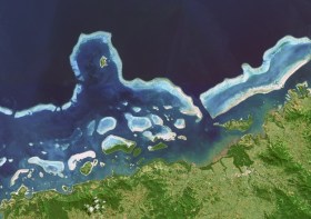
Hydrographers and all those with an interest in hydrography and related disciplines, are invited to attend a World Hydrography Day 2023 Seminar in Suva, Fiji, on 22 and 23 June.
The seminar will be held jointly by the Australasian Hydrographic Society and the Fiji Hydrographic Service. The venue will be the Moana Anglican Services and Teaching Centre at St John the Baptist Theological College.
The organisers are calling for potential sponsors and presenters to get in touch.
The theme for World Hydrography Day 2023 is ‘Hydrography: Contributing to the United Nations Ocean Decade’.
The seminar comes after a two-year pause due to the COVID pandemic and associated travel restrictions. It will provide an opportunity for professionals to network and share hydrospatial knowledge through presentations and discussion.
It is also intended that the presentations will highlight the empowerment of women within the hydrography field.
Registration is free but places are limited. Registrations must be secured by close of business, Tuesday, 20 June 2023.
The International Cartographic Association (ICA) invites you to share your research, practice and experiences in cartography and GIScience at the 31st International Cartographic Conference (ICC 2023), to be held from 13 to 18 August 2023 in Cape Town, South Africa.
The conference theme will be ‘Smart Cartography for Sustainable Development’.
Important dates:
- 5 December 2022 – Submission of full papers closes
- 12 December 2022 – Submission of abstracts closes
- February 2023 – Conference registration opens
- 28 February 2023 – Notification of acceptance
- 8 May 2023 – Submission of revised abstracts and papers
- 15 May 2023 – Early Bird registration closes
- 15 May 2023 – Registration deadline for presenters of abstracts, papers and posters
The Remote Hydrography conference and exhibition brings together manufacturers, operators, regulators, and research and development leaders from both industry and academia, within the field of remote surveying and uncrewed survey operations.
Remote Hydrography 2024 provides an opportunity to share experience gained in the development and application of autonomous and uncrewed platforms (surface, underwater, aerial and space-based) and the associated command and support services.
These and enabling technologies like machine learning and artificial intelligence will revolutionise workflows for hydrographic data collection, processing, analysis and presentation.

The 9th International Conference on Cartography and GIS will take place in Nessebar, Bulgaria from 16 to 21 June 2024. The ICCGIS is a biannual conference that began in 2006 and has been held every two years since (except for 2020). In total, the Conference has attracted attendees from more than 60 countries and has published more than 700 scientific papers in its proceedings.
The aim of the conference is to collect knowledge and share experiences about the latest achievements in the field of cartography and GIS. Multiple parallel events will take place during the conference, including annual meetings of ICA commissions and a special ISDE plenary session. There will also be a Seminar on Disaster Risk Reduction – Solutions and Innovations.


