Learn how to ‘geo-enlighten your organisation’ at Directions LIVE 2016.
This year’s roadshow will highlight how you can extend the benefits of geospatial technology throughout your entire business – to streamline workflows and maximise your return on investment.
Discover how to further leverage the ArcGIS platform’s spatial analysis capabilities and see how this technology gives your organisation the competitive edge.
At Directions LIVE 2016, you will learn the benefits of working with 3D and 4D data, how to select the perfect app to tackle any challenge, and how ArcGIS Pro complements ArcMap functionality.
We will also be showcasing the innovative ways local organisations are improving operational efficiency with GIS technology.
Directions LIVE is free for Esri users – with light lunch provided.
Register today to join our team of ArcGIS experts and your local GIS user community, and learn how to unlock the full potential of the platform – the market’s only complete GIS solution.

The 42nd Canadian Symposium on Remote Sensing will be a virtual event that will bring together academics, practitioners, vendors and policymakers from the remote sensing community in an informative and productive four-day event under the theme of Understanding Our World: Remote Sensing For A Sustainable Future. It fill have special sessions, general sessions, keynotes, panel discussions and workshops featuring speakers from around the world. Attendees will enjoy both technical sessions and networking opportunities online.

Registrations are now open for the Geospatial Council of Australia’s 2024 International Women’s Day breakfast in Brisbane on 8 March. The breakfast will bring together women from across the geospatial sector to share experiences and foster connections among the remarkable individuals shaping the future of geospatial technology.
The event will also serve as a platform to amplify the voices of women in this field, highlighting their contributions, innovation and leadership.
Whether you’re a seasoned professional, an aspiring newcomer or a passionate advocate, these events promise to be filled with inspiring discussions, networking opportunities and empowering insights.
The details are:
- GCA members: $75 (incl. GST)
- Non-GCA members: $100 (incl. GST)
- Student members: $50 (incl. GST)
- Tables can seat up to 8.
- Time: 7:30am to 9:30am
- Venue: Rydges South Bank (Rooftop South), 9 Glenelg St, South Brisbane
- Register
Registrations close Thursday, 29 February.
The breakfast is sponsored by 1Spatial, with other sponsorship opportunities still available. Contact events@geospatialcouncil.org.au for further information.

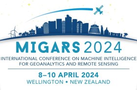
The International Association of the IEEE-Geoscience and Remote Sensing Society (GRSS), the IEEE-Computational Intelligence Society (CIS) and the local organising committee invite geospatial and computing professionals to attend the International Conference on Machine Intelligence for GeoAnalytics and Remote Sensing (MIGARS) to be held in Wellington, Aotearoa New Zealand in April 2024.
MIGARS aims to explore the interface of machine intelligence approaches with geosciences, spatial analytics, and remote sensing. With the tremendous developments in remote sensing technology, data acquisitions and sensing platforms, digital data have grown leaps and bounds to stream and are too big by volume, variety, and veracity. The challenge is handling, processing, and automating geo-data from various sources, such as multi-platform remote sensors and IoT devices, informing decision-making and monitoring our planet.
The conference will focus on connecting researchers from various disciplines, including computation/artificial intelligence, engineering, remote sensing, hydrology, agriculture and geosciences, and look for the potential use of intelligent computational approaches for geo-data-based applications and for serving society at large.


