MaaS offers the potential to drastically improve customer choices, reduce travel costs, increase network capacity and transport sustainability while improving social and environmental outcomes.
From a concept that excited the industry to consider how we might rethink transport to a real world offering that is providing a new way to plan, book and pay for transport.
Mobility 2020 will be a VIRTUAL CONFERENCE.
Australia’s leaders in ITS Mobility and MaaS will bring together experts from industry, government and academia to learn and share ideas about the impact of COVID-19 on our industry and communities. Transportation, freight and logistics, and the transport and technology sector widely have been both massively impacted and deliver essential services. How are organisations and individuals adapting and learning through this crisis?
We will also look at behavioural change, how people are likely to work and study post the covid pandemic, what will be the impact on fare revenue and fare sharing, what are the new sets of challenges MaaS is trying to solve. Join online as key organisations will share covid success stories and how they are pivoting from the pandemic experience.
Now more than ever it is important to stay connected with industry, government and academia to maintain vital connections during a time where our industry is both working at the front lines and continuing to deliver on their existing important roles. Sharing information about what industry is doing and how we are preparing for the future has never been more important.
Key Dates
Wednesday 2 – Thursday 3 September 2020: Virtual sessions, keynote speaker interviews, presentations and panel discussions, live interactive Q&A sessions, polls and surveys.
Program
Full program and speaker line-up to be announced.
Sessions will be broken down and spread over 2 days – allowing you time to connect interact with attendees and presenters via the event platform.
Speakers
We are working with a group of industry experts to design a program that is both substantive and exciting, if you are interested to be a speaker or contribute to an interactive panel discussion, you are encouraged to email your expression of interest to ITS Australia and include:
- Proposed Speaker: Name, Job Title, Organisation
- Proposed presentation title
- Brief paragraph of presentation focus (max 200 words)
Email to: admin@its-australia.com.au

The 42nd Canadian Symposium on Remote Sensing will be a virtual event that will bring together academics, practitioners, vendors and policymakers from the remote sensing community in an informative and productive four-day event under the theme of Understanding Our World: Remote Sensing For A Sustainable Future. It fill have special sessions, general sessions, keynotes, panel discussions and workshops featuring speakers from around the world. Attendees will enjoy both technical sessions and networking opportunities online.

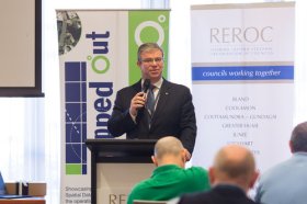
The latest in spatial data applications will be showcased at this year’s Mapped Out Conference to be held at the Rules Club in Wagga Wagga on Wednesday 2 & Thursday 3 March 2022.
Mapped Out will highlight the diversity of applications for spatial data, geographic information systems and their supporting technologies. Guest speakers with local and national experience will be showcasing the use of spatial data to enhance the operation and delivery of government services.
The Conference is a great opportunity for people working in regional NSW in both local government and the private sector to keep abreast of the latest technology and geographical information systems that can be utilised in their day to day work.

The International Cartographic Association (ICA) invites you to share your research, practice and experiences in cartography and GIScience at the 31st International Cartographic Conference (ICC 2023), to be held from 13 to 18 August 2023 in Cape Town, South Africa.
The conference theme will be ‘Smart Cartography for Sustainable Development’.
Important dates:
- 5 December 2022 – Submission of full papers closes
- 12 December 2022 – Submission of abstracts closes
- February 2023 – Conference registration opens
- 28 February 2023 – Notification of acceptance
- 8 May 2023 – Submission of revised abstracts and papers
- 15 May 2023 – Early Bird registration closes
- 15 May 2023 – Registration deadline for presenters of abstracts, papers and posters

The Local Government Spatial Reference Group (LGSRG) will be holding a webinar on Monday, 4 September, to introduce a series of hands-on workshops it will be holding across Victoria during September 2023.
The webinar will cover the topic of Best Practice Geospatial Intelligence for Climate Impact, and will address important topics on climate impact, community safety and how geospatial intelligence can contribute to better outcomes for local governments.
The LGSRG was formed in 2003 to address the need for a sector wide group representing the strategic interests of the Victorian Local Government sector with respect to spatial information. The LGSRG has been active throughout the COVID pandemic to keep the local government geospatial community connected and engaged via the annual Spatial Capability Workshop series which have grown year on year, and is now diversifying with a quarterly Spatial Hour webinar to share stories of success within the local government geospatial sector.
Image credit: ©stock.adobe.com/au/yutthana

Hosted by Eric Andelin CP, Senior Workflow Specialist with guest speaker Michael O’Sullivan, VP Sales, SimActive Inc.
It is often challenging for new entrants into the aerial imagery and mapping service profession to determine cost savings when it comes to their processing software solution. Smaller sensors, altitude restrictions, line of sight requirements and overall flight duration create unique challenges for drone operators. Medium and large format sensors acquire much larger areas, but require a much larger investment, or the ability to subcontract out the acquisition. Mapping expenses tend to increase as projects become larger. And using the wrong image processing software can exacerbate this, leading to narrowing project profits. This webinar will show how a higher-end software such as SimActive’s Correlator3D™ can reduce overall project costs. REGISTER HERE.
Specifically, attendees will learn about the following:
- Common challenges and impact on costs
- Cost variations as projects increase in size
- Workflows in Correlator3D to minimize man-hours
- Accelerating timelines with distributed processing

The 2024 edition of the International Conference on Geographical Information Systems Theory, Applications and Management (GISTAM 2024) aims to create a meeting point of researchers and practitioners that address new challenges in geo-spatial data sensing, observation, representation, processing, visualization, sharing and managing, in all aspects concerning both ICT as well as management information systems and knowledge-based systems.
The conference welcomes original papers of either practical or theoretical nature, presenting research or applications, of specialised or interdisciplinary nature, addressing any aspect of geographic information systems and technologies, such as:
- Data acquisition and processing
- Remote sensing
- Interaction with spatial-temporal information
- Spatial data mining
- Managing spatial data
- Modelling, representation and visualisation
- GIS and climate change
- Domain applications

The 4th International Symposium on Applied Geoinformatics (ISAG2024), which will take place at the Wroclaw University of Science and Technology, Wroclaw, Poland, on 9 and 10 May 2024. ISAG2024 is jointly organised by the Department of Geomatics Engineering, Yildiz Technical University, Istanbul, Türkiye, Wroclaw University of Science and Technology, Wroclaw, Poland and Technical University of Crete, Chania, Crete, Greece.
The aim of the 4th ISAG is to bring scientists, engineers and industry researchers together to exchange and share their experiences and research results and discuss the practical challenges encountered and the solutions adopted in geoinformatics.
Topics to be covered include recent advances in AI, satellite imagery, advanced remote sensing, photogrammetry, image processing, global navigation satellite systems, height systems, terrestrial laser scanning, GIS, smart cities and land management.


