We are pleased to announce our Qld Conference Highlights Webinar Series, showcasing some of the most popular presentations from our 2019 Qld Surveying & Spatial Day, Central Group and Northern Group Conferences.
First up is Dale Atkinson, presenting Native Title and the role of Cadastral Surveyor.
There have been over 120 Native Title Determinations registered in Queensland alone. Complicated legal concepts, lengthy federal court judgements and cultural sensitivities have made this a very avoidable issue for the cadastral surveyor. This talk attempts to provide a basic understanding and argues that there is a vital role for cadastral surveyors to play in this process.
Dale is a cadastral surveyor that runs a small rural based practice in North Queensland. He has a keen interest in rural surveying and maintains a good relationship with many retired rural surveyors. Dale is currently the Chair of the Qld Land Surveying Commission Committee.
Don’t forget to check out our other webinars here.
Registration
By registering below, you receive access to the watch the webinar live OR if you can’t watch it live, you receive the link to the recording 24 hours after the event date. You can then watch the recording at your leisure.
BOSSI CPD
BOSSI CPD points have been assessed as below. The event code for BOSSI is: tbc
- 1.00 BOSSI Cadastral points for live viewing
- 1.00 BOSSI Cadastral points for viewing the recorded webinar if accompanied by a questionnaire with 80% pass mark (contact Katie for a copy)
- 0.5 BOSSI Cadastral CPD points for viewing of the recorded webinar with no questionnaire
Contact
Katie Le Miere
rom.qld@sssi.org.au

Although it has been almost 50 years since there have been a requirement for field information to be lodged, Sec 71 (e) of the Cadastral Rules for Survey 2021 requires the submission of “all relevant field information, in a form that ensures permanent usability”.
While surveyors have been retaining field information electronically, LINZ has found that in many cases the data has been inadequate or needs specific software, or there can be difficulty identifying raw measurements after processing or to relate them to the dataset.
This seminar will share insights from knowledgeable suppliers and practitioners to assist surveyors develop systems and processes to comply with the Rules and to present electronic field data in a clearly readable way.
Participants can attend in person or online.

During 2020 an expert group drafted the SPACE+SPATIAL Industry Growth Roadmap 2030 – a national snapshot for Australian professionals to better understand the bold new future that’s rapidly approaching and what it means for them, their careers, their organisations and all of Australia.
The National Steering Committee is seeking feedback on the Roadmap from spatial professionals of all levels across the country. There are a number of ways to get involved, one of which is to participate in this SSSI and SIBA|GITA SPACE+SPATIAL Roadmap Online Session.
You will hear about the key plans, activities and issues and have the opportunity to have a meaningful discussion with colleagues about your thoughts on the Roadmap Consultation Paper and the topic in general.

A panel of data and industry experts will examine changes to IP and copyright and the disruption of current business models that current and future technologies are creating, with an open discussion about governance considerations that may affect surveying businesses now and in the coming years. This will be an insightful, interesting and challenging discussion around how technology and big data are redefining business opportunities.
The speakers will be:
- Professor Kevin McDougall, Head of School, Civil Engineering and Surveying University of Queensland
- Rachel Sciascia, Partner, Gadens
- Nicole Stephensen, Principal Consultant, Ground Up Consulting Pty Ltd
- Adam Beck , Executive Director, Smart Cities Council Australia New Zealand Secretariat, Centre for Data Leadership
Image credit: ©stock.adobe.com/au/boreala

The Survey and Spatial New Zealand 2021 Annual Conference will draw on the ability of individuals and teams to adapt to change, adversity and setbacks in the current environment.
The conference program will include presentations on rebuilding and improving the economy, with a focus on resilient mindsets to support our members while they navigate the challenges and changes ahead. By sharing concepts, ideas and knowledge, industry members have opportunities to help build back the survey and spatial sector.

The National Surveying Congress will be an opportunity for leaders in the surveying profession to discuss the opportunities and challenges facing the profession. The 2022 Congress theme is ‘Automatic Mutual Relaxation’.
As the profession comes to understand the impact of Automatic Mutual Recognition for surveyors across the country, the event will provide an opportunity for surveyors from across Australia to gather and discuss the issues facing the profession and the opportunities for the future. The highlight of the program each year is the Cadastral Leaders Panel which sees all the Surveyors-General on stage speaking about changes and opportunities in their states and territories as well as an update from ICSM and ANZLIC. There will also be an online option.
The National Surveying Consultancy Excellence Awards and Gala Dinner will be held on the second day of the event, 23 June 2022.

Survey and Spatial NZ’s 2022 conference will be held from 1 to 3 August at the Novotel Lakeside, Rotorua. The conference is the biggest continuing professional development event of the year for NZ surveying and spatial professionals. It invites sharing of knowledge amongst peers, bringing together networking opportunities for all delegates and is an essential event for professional development and connectivity within the sector.
The choice of Rotorua as the location is apt, given the conference theme of ‘Turning up the Heat’. The organisers aim to stimulate discussion regarding challenges in regional areas, which include climate change and developments outside of Auckland.

The Local Government Spatial Reference Group (LGSRG) will be holding a webinar on Monday, 4 September, to introduce a series of hands-on workshops it will be holding across Victoria during September 2023.
The webinar will cover the topic of Best Practice Geospatial Intelligence for Climate Impact, and will address important topics on climate impact, community safety and how geospatial intelligence can contribute to better outcomes for local governments.
The LGSRG was formed in 2003 to address the need for a sector wide group representing the strategic interests of the Victorian Local Government sector with respect to spatial information. The LGSRG has been active throughout the COVID pandemic to keep the local government geospatial community connected and engaged via the annual Spatial Capability Workshop series which have grown year on year, and is now diversifying with a quarterly Spatial Hour webinar to share stories of success within the local government geospatial sector.
Image credit: ©stock.adobe.com/au/yutthana

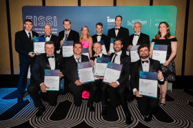
Each year representatives from the Association of Consulting Surveyors NSW and the Institution of Surveyors NSW come together to organise the NSW Excellence in Surveying and Spatial Information (EISSI) Awards.
The awards recognise the achievements of organisations and individuals from across the state who are engaged in the surveying and spatial information profession; celebrate excellence before an audience of industry peers; encourage activities that create a stronger, larger and more relevant industry; and embrace the achievements of the industry and its related industries and professions.

The not-to-be-missed Geospatial Council of Australia (GCA) South Australia Cadastral Workshop, to be held in Adelaide on 16 March, will bring together professionals in the field of land surveying and provide an opportunity for them to expand their knowledge of the complexities of cadastral surveying.
This workshop offers a unique opportunity for professionals in the field of land surveying to gather and expand their knowledge in the complexities of cadastral surveying. Participants will hear expert-led discussions into topics ranging from advanced surveying techniques to legal frameworks governing land boundaries, and gain invaluable insights to enhance their expertise and address the challenges of modern cadastral surveying practices.
- Members: $90 (incl. GST)
- Non-members: $135 (incl. GST)
- Registered survey graduates and students: $45 (incl. GST)


