SSSI in conjunction with the Hunter Environmental Institute will present this webinar with three pre-eminent speakers:
Amy Steiger (Cardno)
Title: RPAS and thermal cameras for wildlife detection post-bushfire and coastal monitoring
Details: Amy has promoted the use of Remotely Piloted Aircraft Systems (RPAS) gaining experience with remote data capture to cover a range of coastal, environmental and land development applications.
RPAS thermal inspection capability was deployed this summer in wildlife detection post-bushfires.
Amy has also done volumetric surveys of beaches and flown isolated coastal cliff faces in NSW to capture high-resolution photography and derived photogrammetric models to identify geotechnical hazards and contribute to coastal monitoring.
Charity Mundava (WaterNSW)
Title: Remote Sensing in Water Management
Details: Charity will discuss the use of GIS and remote sensing to support water catchment management, feasibility and environmental studies for critical water infrastructure across the state and to support ongoing research into and management of river catchments. Charity will touch on the significance and spatial support for this in the recent NSW bushfires coordinating reservoir availability (in drought) and access for helicopter water drops and supporting bushfire fighting efforts.
Associate Professor In-Young Yeo (University of Newcastle)
Title: Remote sensing and GIS applications for water resources management
Details: Dr Yeo will explain how remote sensing can be used as a technique for assessing soil moisture using multi-source data fusion approaches, vegetation monitoring and water requirement with remote sensing and water balance approach.
She will explain the impacts of conservation management practices in agricultural catchments assessed using catchment model and remote sensing/GIS drawing on examples from Australian and American case studies
CPD Points
BOSSI CPD is 1 SP for this webinar.
Cost
As per details as follows
Contact
rom.nsw@sssi.org.au

The AEGC petroleum, mineral and water resource industry conference, incorporating the ASEG-PESA International Geophysical Conference and Exhibition, will be jointly hosted by the Australian Institute of Geoscientists (AIG), Australian Society of Exploration Geophysicists (ASEG) and Petroleum Exploration Society of Australia (PESA).
Under the conference theme of Geoscience for a Sustainable World, the AEGC will attract a large number of international and national delegates and organisations from across the spectrum of Australasian geosciences, representing industry, government and academia. It is expected there will be dedicated streams for Australian basins, resourcing a sustainable energy challenge, data, innovation and technology, high-quality resources for future generations and developing the future workforce.

Hosted by 12d – the companies behind 12d Model and 12d Synergy – the highly anticipated 12d Tech Forum returns on 19 – 21 October 2021. The three-day online industry summit will connect over 2,000 surveying, engineering, and construction professionals to learn, innovate, and be inspired.
The 12d Tech Forum provides surveying and geospatial professionals with an excellent training opportunity to keep up to date with the latest innovations and advancements in the industry.
50+ Hours of Inspiring Industry Talks
The 12d Tech Forum will host over 50 hours of industry insights, case studies from cutting-edge Australian and New Zealand surveying projects, and actionable training content. Delivered by some of the greatest minds and speakers in the industry. Talks are tailored for surveyors, engineers, and directors, not just 12d operators.
Free Access to All Keynote Presentations
We’ve secured a huge line-up of 40+ industry speakers, including talks from Land Surveys, Fulton Hogan, GHD, SMEC, Piritahi, and many more.
A few keynote titles include:
- Pilbara Desert Collaboration: Land Surveys’ data management strategy collaborating across the Pilbara desert
- GDA2020 at Mackay City Council: Practical insights into successfully implementing GDA2020 through 12d Model
- Piritahi Case Study: 10,000 lot land development project to crush the Auckland housing crisis
- TfNSW Steering Group & Uniform Coding: Aligning managed utilities through a consistent framework for delivery
Best yet, all sessions will be recorded and available to watch on-demand for 12 months after the event.
Surveying and Geospatial Topics Include…
- BIM & Digital Engineering
- Land & Construction Surveying
- GDA2020, ADAC, A-SPEC
- Point Clouds
- Drone Surveying & Photogrammetry
- Mobile Mapping & GIS
- Digital Twins & Asset Management
- Data Management & Collaboration
Check Out the Preliminary Event Agenda
To see a comprehensive list of keynotes and topics that will be covered at the 12d Tech Forum 2021, check out our Preliminary Event Agenda here.
12d Training Breakout Streams
For more tailored training content focused on upskilling your use of 12d software, purchase a Training Pass (A$149 +GST). Here you will have access to an additional five technical streams covering topics on Design, Survey, Water, Data Management, and Training.
Accrue CPD Points
Every hour you watch of the 12d Tech Forum can earn you 1 CPD point for many industry institutions, such as SSI, Australian Consulting Surveyors, Engineers Australia, and many more.
Virtual Networking Sessions
Meet like-minded individuals and build lasting relationships with our virtual networking sessions. The online forum will be attended by thousands of surveying, mapping, and geospatial professionals from across Australia, New Zealand, and abroad.
Register for FREE Today
Join over 2,000 professionals and gain access to 50+ hours with 150+ in-depth talks, delivered by over 60 speakers. Register for your free Industry Pass today!
To learn more and register, visit 12dtechforum.com/

The Australasian Hydrographic Society’s HydroSpatial2021 Conference will focus on how hydrography will develop in the future, noting the development of ‘digital twinning’ and the emerging name variants for hydrography such as ‘hydrospatial’ or ‘hydrogeomatics’.
The conference theme, Hydrography of the Future, morphs two modern yet wide-ranging aspects of the hydrographic surveying profession, and should draw papers from relevant scientific, technological, operational and environmental communities. The aim is to provide delegates with valuable insights, creative ideas and inspiration on how to harness current and future technologies, systems and processes so that they can deal with present challenges and prepare for a more sustainable future.

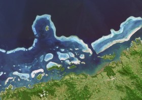
Hydrographers and all those with an interest in hydrography and related disciplines, are invited to attend a World Hydrography Day 2023 Seminar in Suva, Fiji, on 22 and 23 June.
The seminar will be held jointly by the Australasian Hydrographic Society and the Fiji Hydrographic Service. The venue will be the Moana Anglican Services and Teaching Centre at St John the Baptist Theological College.
The organisers are calling for potential sponsors and presenters to get in touch.
The theme for World Hydrography Day 2023 is ‘Hydrography: Contributing to the United Nations Ocean Decade’.
The seminar comes after a two-year pause due to the COVID pandemic and associated travel restrictions. It will provide an opportunity for professionals to network and share hydrospatial knowledge through presentations and discussion.
It is also intended that the presentations will highlight the empowerment of women within the hydrography field.
Registration is free but places are limited. Registrations must be secured by close of business, Tuesday, 20 June 2023.

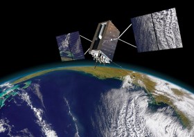
The IGNSS Association’s biennial international GNSS conference will return to UNSW Sydney from 7 to 9 February, 2024, where it will celebrate the first half-century of GNSS and look ahead to the next 50 years.
IGNSS 2024 will bring together experts, policy makers and emerging leaders from across the globe to examine the latest advances, present cutting edge research and discuss policy, market development and infrastructure.
The conference will also showcase Australia and New Zealand’s Southern Positioning Augmentation Network (SouthPAN), along with developments by other countries across the Asia-Pacific.
Topics to be covered at the conference will include:
- Autonomy on land, air, sea and in space
- Aviation and avionics
- Cooperative Intelligent Transport Systems
- Machine guidance applications in agriculture, construction and mining
- Maritime applications
- Uncrewed aerial systems
- Space applications of PNT in Earth orbit and for lunar and Martian exploration
- Positioning infrastructure
- GNSS vulnerability, resilience and risk
- Interference detection and mitigation
- Policies and standards
- SBAS and other augmentations
- Datums and geodesy
- National and international GNSS developments
- Emerging application areas for GNSS
- Key industries and their reliance on GNSS
- The multi-GNSS era
- Cyber security in PNT applications and infrastructure
- Alternative PNT
- State of the art in PNT algorithms and software development
- GNSS aiding and sensor fusion
- Positioning in GNSS denied environments
- Development of GNSS receiver hardware and firmware
- Precise position using smartphones
The organisers are encouraging early career researchers and industry representatives to present their work. The abstract submission process will open soon — keep an eye on the IGNSS website for announcements.
Image courtesy Lockheed-Martin


