Speaker:
Rebecca Price is the Principal Policy Officer, Land Management Policy | Energy, Environment and Climate Change at DELWP.
Rebecca will be presenting on the update of the Marine and Coastal Policy that was recently released. Join in the questions and answers after the presentation.
If you are involved in sea level implications from beach erosion, storm surges, the tidal interface, land tenure etc, don’t miss this webinar!
Second speaker to be announced.
Cost
Member FREE | Non-member $45
Contact

Registrations are now open for the Australian Institute of Mine Surveyors (AIMS) Kalgoorlie Regional Seminar, which will be held at the Kalgoorlie Bowling Club on Friday, 29 October.
The day will start at 2:30pm with an optional lawn bowls and beers social occasion, followed at 4:00pm by AIMS sessions and a sponsor interaction session. Drinks and nibbles will be supplied. Sponsors include AAM, Arvista, Caroni, Deswik, GeoCue Australia, HL Geospatial and Maptek.
There are various levels of registration fees depending upon member category. Full details can be found at the link above.

The Ocean Optics Conference attracts a diverse audience of active practitioners in the field, including oceanographers, marine ecologists, limnologists, optical engineers, marine resource managers and policy professionals from around the world.
Conference presentations will include the science of optics across all aquatic environments, research, and applications, including (but not limited to) biogeochemistry, environmental management and applications, instruments, techniques and observational systems, remote sensing, phytoplankton ecology, radiative transfer and optical theory, global change, and benthic processes.
Attendees will attend plenary presentations during the day and interact with colleagues during scientific poster session receptions held in the exhibit/poster hall in the early evening. In addition to invited and contributed oral and poster presentations, the conference will provide the opportunity for community-wide discussions.
NASA Earth Observatory image by Joshua Stevens, using Landsat data from the U.S. Geological Survey.

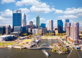
The WA geospatial community will come together on 16 February 2022 to learn, network, share experiences and catch up with colleagues old and new.
The WA Asia-Pacific Spatial Excellence Awards dinner will also be held in conjunction with the conference, celebrating the outstanding work being undertaken across the region during 2022.
Image credit: ©stock.adobe.com/au/anekoho

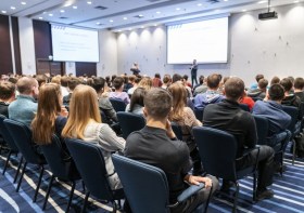
The Tasmanian Spatial Information Council (TASSIC) will hold a Geospatial Workforce Development Forum on 9 November 2023, to help shape the future of the geospatial sector in Tasmania.
The Forum will bring together key stakeholders from education, employers, government and suppliers to address critical challenges and opportunities facing the sector.
The Forum will include presentations from representatives of industry, government and the education sector, as follows:
- Paul Digney (Jacobs)
- Rob Rowell (Insight GIS)
- Ben Morris (Local Government Association of Tasmania)
- Michael Krome (Australian Spatial Analytics)
- Arco Lucieer (University of Tasmania)
- Sam Ebert (TAFE NSW)
- Troy Robbins (TasTAFE)
The event will conclude with a moderated discussion session led by Danika Bakalich (Geospatial Council of Australia).
The Forum will be a hybrid event with both in-person and online attendance options available, and it will employ the Menti-Meter program to facilitate discussions, ensuring that each delegate’s voice is heard and their input valued.
Image credit: ©stock.adobe.com/au/borisblik


