We are pleased to announce our Qld Conference Highlights Webinar Series, showcasing some of the most popular presentations from our 2019 Qld Surveying & Spatial Day, Central Group and Northern Group Conferences.
First up is Dale Atkinson, presenting Native Title and the role of Cadastral Surveyor.
There have been over 120 Native Title Determinations registered in Queensland alone. Complicated legal concepts, lengthy federal court judgements and cultural sensitivities have made this a very avoidable issue for the cadastral surveyor. This talk attempts to provide a basic understanding and argues that there is a vital role for cadastral surveyors to play in this process.
Dale is a cadastral surveyor that runs a small rural based practice in North Queensland. He has a keen interest in rural surveying and maintains a good relationship with many retired rural surveyors. Dale is currently the Chair of the Qld Land Surveying Commission Committee.
Don’t forget to check out our other webinars here.
Registration
By registering below, you receive access to the watch the webinar live OR if you can’t watch it live, you receive the link to the recording 24 hours after the event date. You can then watch the recording at your leisure.
BOSSI CPD
BOSSI CPD points have been assessed as below. The event code for BOSSI is: tbc
- 1.00 BOSSI Cadastral points for live viewing
- 1.00 BOSSI Cadastral points for viewing the recorded webinar if accompanied by a questionnaire with 80% pass mark (contact Katie for a copy)
- 0.5 BOSSI Cadastral CPD points for viewing of the recorded webinar with no questionnaire
Contact
Katie Le Miere
rom.qld@sssi.org.au

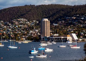
The 2022 Tasmania Surveying & Spatial Conference will be held on Friday, 2 September at Wrest Point in Hobart, and promises to be a fantastic opportunity to learn and network with SSSI members and the broader surveying and spatial community.
This year’s event will include a gala dinner, held in partnership with the University of Tasmania, to celebrate that institution’s 50 years in the field of surveying and spatial teaching.
In addition, the event will include the presentation of the 2022 Tasmanian Asia-Pacific Spatial Excellence Awards.
Image credit: ©stock.adobe.com/au/Norman

The 2023 Tasmanian Geospatial Conference & Awards Reception will be held at the Crowne Plaza in Hobart on 1 September 2023, where delegates will hear the latest news from across the local geospatial industry, including presentations on cadastral surveying, GIS, education and more.
Immediately following the conference will be the Geospatial Excellence Awards Reception, where all attendees will have the chance to enjoy drinks and canapes whilst networking and celebrating the local winners.
The full conference program is now available.
Image credit: ©stock.adobe.com/au/Norman

The Institute of Navigation’s (ION) annual Precise Time and Time Interval Systems and Applications (PTTI) meeting will take place in Long Beach, California, January 22-25, 2024, and will be co-located with the ION International Technical Meeting.
The PTTI technical program is designed to:
- Disseminate and coordinate PTTI information at the user level
- Review present and future PTTI requirements
- Inform government and industry engineers, technicians, and managers of precise time and frequency technology and its problems, and
- Provide an opportunity for an active exchange of new technology associated with PTTI.
A commercial exhibition and pre-conference tutorials will be held in conjunction with the conference.

The 4th International Symposium on Applied Geoinformatics (ISAG2024), which will take place at the Wroclaw University of Science and Technology, Wroclaw, Poland, on 9 and 10 May 2024. ISAG2024 is jointly organised by the Department of Geomatics Engineering, Yildiz Technical University, Istanbul, Türkiye, Wroclaw University of Science and Technology, Wroclaw, Poland and Technical University of Crete, Chania, Crete, Greece.
The aim of the 4th ISAG is to bring scientists, engineers and industry researchers together to exchange and share their experiences and research results and discuss the practical challenges encountered and the solutions adopted in geoinformatics.
Topics to be covered include recent advances in AI, satellite imagery, advanced remote sensing, photogrammetry, image processing, global navigation satellite systems, height systems, terrestrial laser scanning, GIS, smart cities and land management.


