We are pleased to announce our Qld Conference Highlights Webinar Series, showcasing some of the most popular presentations from our 2019 Qld Surveying & Spatial Day, Central Group and Northern Group Conferences.
First up is Dale Atkinson, presenting Native Title and the role of Cadastral Surveyor.
There have been over 120 Native Title Determinations registered in Queensland alone. Complicated legal concepts, lengthy federal court judgements and cultural sensitivities have made this a very avoidable issue for the cadastral surveyor. This talk attempts to provide a basic understanding and argues that there is a vital role for cadastral surveyors to play in this process.
Dale is a cadastral surveyor that runs a small rural based practice in North Queensland. He has a keen interest in rural surveying and maintains a good relationship with many retired rural surveyors. Dale is currently the Chair of the Qld Land Surveying Commission Committee.
Don’t forget to check out our other webinars here.
Registration
By registering below, you receive access to the watch the webinar live OR if you can’t watch it live, you receive the link to the recording 24 hours after the event date. You can then watch the recording at your leisure.
BOSSI CPD
BOSSI CPD points have been assessed as below. The event code for BOSSI is: tbc
- 1.00 BOSSI Cadastral points for live viewing
- 1.00 BOSSI Cadastral points for viewing the recorded webinar if accompanied by a questionnaire with 80% pass mark (contact Katie for a copy)
- 0.5 BOSSI Cadastral CPD points for viewing of the recorded webinar with no questionnaire
Contact
Katie Le Miere
rom.qld@sssi.org.au

The 42nd Canadian Symposium on Remote Sensing will be a virtual event that will bring together academics, practitioners, vendors and policymakers from the remote sensing community in an informative and productive four-day event under the theme of Understanding Our World: Remote Sensing For A Sustainable Future. It fill have special sessions, general sessions, keynotes, panel discussions and workshops featuring speakers from around the world. Attendees will enjoy both technical sessions and networking opportunities online.

Unable to hold its scheduled 2021 NSW Regional Conference earlier in 2022, SSSI is now inviting the spatial community to join it for a special online seminar featuring some of the speakers from the original program, along with the announcement of the NSW winners of the 2021 Asia-Pacific Spatial Excellence Awards.
This seminar will focus on the importance, efficiency and innovation spatial data can provide in crisis management situations and will feature presentations on:
- Finding your Friendship Island amongst a sea of COVID restrictions — presented by Stella Blake-Kelly, Founder/Director, Cartisan
- Geospatial Intelligence: Providing real-time insights supporting NSW State Emergency Service’s emergency management response — presented by Melissa Daley, Manager, Geospatial Intelligence Systems, NSW State Emergency Service
- COVID-19 Near Me: Trials and tribulations — presented by Kenneth Tsang, Director, jxeeno

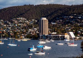
The 2022 Tasmania Surveying & Spatial Conference will be held on Friday, 2 September at Wrest Point in Hobart, and promises to be a fantastic opportunity to learn and network with SSSI members and the broader surveying and spatial community.
This year’s event will include a gala dinner, held in partnership with the University of Tasmania, to celebrate that institution’s 50 years in the field of surveying and spatial teaching.
In addition, the event will include the presentation of the 2022 Tasmanian Asia-Pacific Spatial Excellence Awards.
Image credit: ©stock.adobe.com/au/Norman

The 2022 SSSI Queensland Regional Conference will be held on Friday, 14 October at the Brisbane Convention & Exhibition Centre. It promises to once again be a fantastic opportunity to learn and connect with SSSI members and the broader surveying and spatial community.
The Queensland Asia-Pacific Spatial Excellence Awards dinner will also be held in conjunction with the conference, celebrating the outstanding work being undertaken across the region.
Image credit: ©stock.adobe.com/au/rudi1976

The Tasmanian Spatial Information Council (TASSIC) will hold a Geospatial Workforce Development Forum on 9 November 2023, to help shape the future of the geospatial sector in Tasmania.
The Forum will bring together key stakeholders from education, employers, government and suppliers to address critical challenges and opportunities facing the sector.
The Forum will include presentations from representatives of industry, government and the education sector, as follows:
- Paul Digney (Jacobs)
- Rob Rowell (Insight GIS)
- Ben Morris (Local Government Association of Tasmania)
- Michael Krome (Australian Spatial Analytics)
- Arco Lucieer (University of Tasmania)
- Sam Ebert (TAFE NSW)
- Troy Robbins (TasTAFE)
The event will conclude with a moderated discussion session led by Danika Bakalich (Geospatial Council of Australia).
The Forum will be a hybrid event with both in-person and online attendance options available, and it will employ the Menti-Meter program to facilitate discussions, ensuring that each delegate’s voice is heard and their input valued.
Image credit: ©stock.adobe.com/au/borisblik

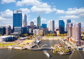
The Geospatial Council of Australia’s Western Australia Digital Twin Summit will be held on 15 November 2023.
The event will focus on Spatial Digital Twins, and attendees will hear the latest developments in this rapidly developing space from government, academia and private industry presenters.
The WA Asia-Pacific Spatial Excellence Awards dinner will also be held in conjunction with the conference, celebrating the outstanding work being undertaken across the region.
Image credit: ©stock.adobe.com/au/anekoho

The annual Geo Connect Asia Show & Conferences offers a two day, in-person meeting place for ASEAN’s vibrant geospatial community. Bringing geospatial solutions to the heart of decision-making the event combines with technologies from the digital construction, drone and remote sensing markets.
Geo Connect Asia looks to host its ASEAN neighbours and build on a vibrant community as new technologies add new application tools to enable the Industry 4.0 Revolution. The emergence of AI, blockchain, IoT, robotics and UAVs create a new dynamic and platforms for a region well equipped to take on the challenges ahead.

The 4th International Symposium on Applied Geoinformatics (ISAG2024), which will take place at the Wroclaw University of Science and Technology, Wroclaw, Poland, on 9 and 10 May 2024. ISAG2024 is jointly organised by the Department of Geomatics Engineering, Yildiz Technical University, Istanbul, Türkiye, Wroclaw University of Science and Technology, Wroclaw, Poland and Technical University of Crete, Chania, Crete, Greece.
The aim of the 4th ISAG is to bring scientists, engineers and industry researchers together to exchange and share their experiences and research results and discuss the practical challenges encountered and the solutions adopted in geoinformatics.
Topics to be covered include recent advances in AI, satellite imagery, advanced remote sensing, photogrammetry, image processing, global navigation satellite systems, height systems, terrestrial laser scanning, GIS, smart cities and land management.

The ISPRS Technical Commission II ‘Photogrammetry’ focuses, at various scales, on geometric, radiometric and multi-temporal aspects of the image- and range-based 3D surveying, mapping and modelling in the age of AI and mixed reality.
The organisers of the June 2024 Symposium welcome researchers, practitioners and companies involved in photogrammetry and computer vision to present and discuss their results with a broader audience. The Symposium will feature four days of plenary and keynote talks, along with parallel sessions of oral and poster presentations from academia and industry.
The symposium’s theme is ‘The Role of Photogrammetry for a Sustainable World,’ emphasising machine learning and mixed reality. The event is being organised in collaboration with ASPRS (American Society of Photogrammetry and Remote Sensing) and SGPF (Swiss Society of Photogrammetry and Remote Sensing).
Image credit: ©stock.adobe.com/au/Lifes_Sunday


