
The 2022 SSSI Queensland Regional Conference will be held on Friday, 14 October at the Brisbane Convention & Exhibition Centre. It promises to once again be a fantastic opportunity to learn and connect with SSSI members and the broader surveying and spatial community.
The Queensland Asia-Pacific Spatial Excellence Awards dinner will also be held in conjunction with the conference, celebrating the outstanding work being undertaken across the region.
Image credit: ©stock.adobe.com/au/rudi1976

The 2022 SSSI Victorian Surveying & Spatial Summit and APSEA-V Dinner will take place on Thursday, 27 October 2022. It will be an opportunity for all Victorian surveying and spatial professionals to come together to learn, share and connect.
The event will feature an array of speakers, along with plenty of networking opportunities and the chance to see the latest products and services from local suppliers.
Image credit: ©stock.adobe.com/au/Wirestock

The 2022 SSSI NSW Regional Conference will be held on Thursday 10 November and Friday 11 November 2022 at the Novotel Sydney Central. The theme will be ‘Connections’.
This regular event is an opportunity to learn from and connect with other SSSI members and the broader geospatial community.
The first day will comprise the main conference, with speakers presenting on various topics, followed by the NSW & ACT Asia-Pacific Spatial Excellence Awards dinner in the evening.
The second day will be a NSW Spatial Digital Twin workshop, an interactive session that will get ‘under the bonnet,’ looking at data sharing, use cases and more.
The Call for Abstracts will close at midday on Monday, 26 September 2022. Abstract proposals can be submitted online at https://lnkd.in/ek4xS6Bu.
The organisers are seeking papers and presentations on a variety of topics, such as:
- technical innovation, spatial aps, cloud computing, survey innovation, RPAS
- data analytics, crowd sourcing, machine learning, artificial intelligence, automation, data partnerships
- surveying -—land, cadastral, hydrographic, aerial survey, engineering
- 3D, digital engineering, LiDAR, reality meshes, BIM
- mobility, emergency management, spatial digital twins, environment, community, smart cities, utilities, coastal management, climate change
- convergence of space and spatial
Registrations are now open online for the conference, dinner and workshop at https://lnkd.in/eVSxGWeB.
The event’s Principal and Major sponsors are the NSW Department of Customer Services–Spatial Services and TAFE NSW.

The World of Drones and Robotics Congress New Zealand (WoDaRC NZ) is shaping up as an unmissable event for anyone involved in robotics, drones, AI, AgTech and data-led innovation. WoDaRC is business-led, technology based and will create opportunities for collaboration and growth across the technology ecosystem.
Topics to be covered include:
- Regional capability and strategy
- Humanitarian engineering and disaster response
- Environmental science and agricultural technology
- The new frontiers: oceans, mountains, and space
- Movies, media, community, and social empowerment
- Education

Planning is underway for the S+SNZ 2023 Annual Conference which will be held at Otago University in Dunedin from 30 August through to 1 September 2023.
The S+SNZ conference is the biggest continuing professional development event of the year for NZ surveying and spatial professionals. It invites sharing of knowledge amongst peers, bringing together networking opportunities for all delegates and is an essential event for professional development and connectivity within the sector.
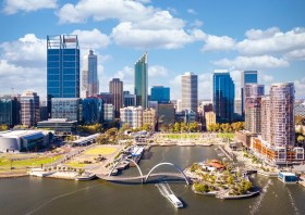
The Geospatial Council of Australia’s Western Australia Digital Twin Summit will be held on 15 November 2023.
The event will focus on Spatial Digital Twins, and attendees will hear the latest developments in this rapidly developing space from government, academia and private industry presenters.
The WA Asia-Pacific Spatial Excellence Awards dinner will also be held in conjunction with the conference, celebrating the outstanding work being undertaken across the region.
Image credit: ©stock.adobe.com/au/anekoho

Hosted by Eric Andelin CP, Senior Workflow Specialist with guest speaker Michael O’Sullivan, VP Sales, SimActive Inc.
It is often challenging for new entrants into the aerial imagery and mapping service profession to determine cost savings when it comes to their processing software solution. Smaller sensors, altitude restrictions, line of sight requirements and overall flight duration create unique challenges for drone operators. Medium and large format sensors acquire much larger areas, but require a much larger investment, or the ability to subcontract out the acquisition. Mapping expenses tend to increase as projects become larger. And using the wrong image processing software can exacerbate this, leading to narrowing project profits. This webinar will show how a higher-end software such as SimActive’s Correlator3D™ can reduce overall project costs. REGISTER HERE.
Specifically, attendees will learn about the following:
- Common challenges and impact on costs
- Cost variations as projects increase in size
- Workflows in Correlator3D to minimize man-hours
- Accelerating timelines with distributed processing
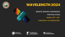
The Wavelength meeting was launched in 2013 for PhD students and early career researchers, addressing the demand for representation of new professionals as well as students from RSPSoc — the UK society for remote sensing and photogrammetry science.
Every year, Wavelength gathers participants from student and early career levels, as well as senior members and individuals within academia and business. The conference offers a setting to present student and EC work and meet new, like-minded contacts.
The 2024 conference will be run in a hybrid format, to accommodate those who can and those who cannot travel to Worcester.
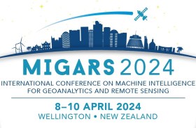
The International Association of the IEEE-Geoscience and Remote Sensing Society (GRSS), the IEEE-Computational Intelligence Society (CIS) and the local organising committee invite geospatial and computing professionals to attend the International Conference on Machine Intelligence for GeoAnalytics and Remote Sensing (MIGARS) to be held in Wellington, Aotearoa New Zealand in April 2024.
MIGARS aims to explore the interface of machine intelligence approaches with geosciences, spatial analytics, and remote sensing. With the tremendous developments in remote sensing technology, data acquisitions and sensing platforms, digital data have grown leaps and bounds to stream and are too big by volume, variety, and veracity. The challenge is handling, processing, and automating geo-data from various sources, such as multi-platform remote sensors and IoT devices, informing decision-making and monitoring our planet.
The conference will focus on connecting researchers from various disciplines, including computation/artificial intelligence, engineering, remote sensing, hydrology, agriculture and geosciences, and look for the potential use of intelligent computational approaches for geo-data-based applications and for serving society at large.

The New Zealand: Digital Twin 2024 Summit will explore the roadmap of digital twin systems and their impact on each stage of a project, and explore the core values, challenges and opportunities unique to the priorities of New Zealand and how digital twins can deliver them.
The event will feature real stories of success and failure, research insights, and focus not just on what has already happened but also on the potential of digital twins and where key opportunities for timely innovation appear to be.
Delegates will hear from technical experts, industry leaders and researchers in an experience designed to support the development of a dynamic and scalable digital twin ecosystem in New Zealand.


