
The 42nd Canadian Symposium on Remote Sensing will be a virtual event that will bring together academics, practitioners, vendors and policymakers from the remote sensing community in an informative and productive four-day event under the theme of Understanding Our World: Remote Sensing For A Sustainable Future. It fill have special sessions, general sessions, keynotes, panel discussions and workshops featuring speakers from around the world. Attendees will enjoy both technical sessions and networking opportunities online.
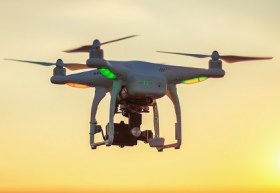
The World of Drones & Robotics Congress 2021 (WoDaRC) will be held at the Brisbane Convention and Exhibition Centre on 15 and 16 November 2021. Like last year, it will be presented in a hybrid format, providing in-person physical participation for those able to attend in Brisbane and a high-quality digital experience for those who cannot.
Due to additional companies seeking display space, WoDaRC has moved to a larger space (the Boulevard Auditorium) within the Brisbane Convention and Exhibition Centre. The Auditorium will also cater to larger numbers and provide increased social distancing for all those attending sessions.
Physical and virtual registration options are available. Al registration options, physical and digital, include access to all congress sessions for six months post-event on an on-demand basis via the WoDaRC viewer portal.
Image credit: ©stock.adobe.com/au/ValentinValkov

The Australian Association for Unmanned Systems’ ‘RPAS in Australian Skies 2022’ conference aims to continue discussion on the safe integration of RPAS into Australian airspace. It is supported by key government and industry participants and has established itself as a landmark event in the Australian RPAS calendar.
The 2022 themes will cover:
- Policy and Regulatory updates from the Department of Infrastructure, Transport, Regional Development and Communications, CASA, AirServices Australia and the Australian Defence Force relating to the use of emerging aviation technology in Australia.
- UAS Traffic Management (UTM), low level airspace, integrated airspace systems challenges and opportunities.
- Industry challenges and perspectives
- Continuing development of a professional and safe industry.
- ATSB RPAS data and trends
- Emerging technology and innovative solutions enabling integration or RPAS into Australian airspace.
- Future infrastructure requirements to enable drone delivery and advanced air mobility (AAM).
- Emerging RPAS and AAM applications – benefits, viability and social acceptance.
The conference will be a hybrid event incorporating face to face (live) and online (virtual) choices for participants. It will also include the AAUS Gala Dinner featuring the AAUS Industry Awards.

The International Society for Photogrammetry and Remote Sensing (ISPRS) will hold its 2022 congress in Nice, France, in June 2022. The event will be hosted by the French Society for Photogrammetry and Remote Sensing.
A wide-ranging program has been put together, and it includes a host of leading speakers, such as Australia’s Professor Sisi Zlatanova from the University of South Wales. More than 1500 papers will be presented in the various scientific tracks and sessions over the week. In addition to these presentations, participants will also have the chance to interact and network face-to-face with the authors in poster sessions.
In order to help the registered participants to choose the sessions and the presentations to build their own program during the week, pre-recorded video presentations of the papers will made accessible before the beginning of the event through the digital platform of this event.
The Congress will have a strong technology track, with a large exhibition space that will gather the major players of the geospatial business. A geospatial prospective forum will also address hot topics of our community in order to draw recommendations.
The deadline for both full papers and abstracts is January 10, 2022.
Advancing Earth Observation Forum 2022 will be a face-to-face, fully interactive forum. It will host user, industry, government, research and technical focused plenaries and interactive panels, poster and workshop sessions to interest and engage end-users, industry, researchers, government, analysts, start-up companies, educators and students.

Commercial UAV Expo, September 6-8 in Las Vegas is the premier event for the commercial drone industry focusing on the integration/operation of commercial UAS.
The event will feature exhibits and demonstrations by UAS solutions providers; keynotes, panel discussions, and presentations with interactive Q&A and chat; AI-powered networking; and more.
Industries covered include Construction; Drone Delivery; Energy & Utilities; Forestry & Agriculture; Infrastructure & Transportation; Mining & Aggregates; Public Safety & Emergency Services; Security; and Surveying & Mapping. It is presented by Commercial UAV News and organised by Diversified Communications.
Use code SAVE100 for a US$100 discount and/or FREE expo admission.

The Ocean Optics Conference attracts a diverse audience of active practitioners in the field, including oceanographers, marine ecologists, limnologists, optical engineers, marine resource managers and policy professionals from around the world.
Conference presentations will include the science of optics across all aquatic environments, research, and applications, including (but not limited to) biogeochemistry, environmental management and applications, instruments, techniques and observational systems, remote sensing, phytoplankton ecology, radiative transfer and optical theory, global change, and benthic processes.
Attendees will attend plenary presentations during the day and interact with colleagues during scientific poster session receptions held in the exhibit/poster hall in the early evening. In addition to invited and contributed oral and poster presentations, the conference will provide the opportunity for community-wide discussions.
NASA Earth Observatory image by Joshua Stevens, using Landsat data from the U.S. Geological Survey.

RPAS in Australia Skies is back for 2023. The conference is the Australian Association for Uncrewed Systems’ (AAUS) main event for the year and has established itself as a landmark event for the Australian drone industry, drawing interest from key government personnel, representatives from the regulatory and safety bodies, defence force, RPAS and UTM representatives, end users and academia.
The hybrid event will take place over two days and will include a combination of presentations and interactive panel discussions.
The conference will cover:
- RPAS related policy and regulatory updates from Australian and international government agencies.
- UAS Traffic Management, low-level airspace and integrated airspace systems
- Industry challenges and perspectives
- Continuing development of a professional and safe industry.
- Emerging technologies and innovative solutions enabling RPAS integration in Australian airspace.
- Emerging applications — benefits, viability and social acceptance
- Case studies of drone use and challenges in emergency services, infrastructure inspection, delivery, mining, and agriculture.
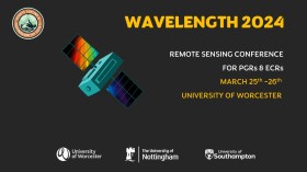
The Wavelength meeting was launched in 2013 for PhD students and early career researchers, addressing the demand for representation of new professionals as well as students from RSPSoc — the UK society for remote sensing and photogrammetry science.
Every year, Wavelength gathers participants from student and early career levels, as well as senior members and individuals within academia and business. The conference offers a setting to present student and EC work and meet new, like-minded contacts.
The 2024 conference will be run in a hybrid format, to accommodate those who can and those who cannot travel to Worcester.
The International Association of the IEEE-Geoscience and Remote Sensing Society (GRSS), the IEEE-Computational Intelligence Society (CIS) and the local organising committee invite geospatial and computing professionals to attend the International Conference on Machine Intelligence for GeoAnalytics and Remote Sensing (MIGARS) to be held in Wellington, Aotearoa New Zealand in April 2024.
MIGARS aims to explore the interface of machine intelligence approaches with geosciences, spatial analytics, and remote sensing. With the tremendous developments in remote sensing technology, data acquisitions and sensing platforms, digital data have grown leaps and bounds to stream and are too big by volume, variety, and veracity. The challenge is handling, processing, and automating geo-data from various sources, such as multi-platform remote sensors and IoT devices, informing decision-making and monitoring our planet.
The conference will focus on connecting researchers from various disciplines, including computation/artificial intelligence, engineering, remote sensing, hydrology, agriculture and geosciences, and look for the potential use of intelligent computational approaches for geo-data-based applications and for serving society at large.


