Presented by Bentley Institute, the Year in Infrastructure Conference is a global gathering of leading executives in the world of infrastructure design, construction, and operations focused on best practices and technologies for going digital.
The conference is globally recognized as the leading forum for addressing the current priorities and opportunities that impact the infrastructure industry. Attendees hear from industry thought leaders, engage in forums and discussions, and learn about technologies and best practices that will shape the future of infrastructure delivery and operations.
Keynotes
The Year in Infrastructure Conference mainstage is where industry leaders gain insight into how advancements in infrastructure, supported by Bentley technologies, are changing the world and accelerating possibilities. Mainstage presentations given by Greg Bentley and Keith Bentley share Bentley’s strategic vision and provide guidance for embracing going digital. Other presenters include Strategic Partner executives as well as respected global infrastructure leaders.
NEW for 2019! ACCELERATE
Join us at the brand-new ACCELERATE, and experience first-hand all the latest enhancements and key capabilities of CONNECT Edition. Meet Bentley’s product experts. Learn how to drive efficiency through multidiscipline workflows. Find out about infrastructure digital twins.

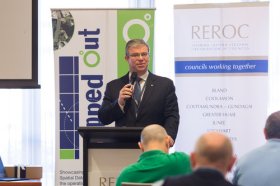
The latest in spatial data applications will be showcased at this year’s Mapped Out Conference to be held at the Rules Club in Wagga Wagga on Wednesday 2 & Thursday 3 March 2022.
Mapped Out will highlight the diversity of applications for spatial data, geographic information systems and their supporting technologies. Guest speakers with local and national experience will be showcasing the use of spatial data to enhance the operation and delivery of government services.
The Conference is a great opportunity for people working in regional NSW in both local government and the private sector to keep abreast of the latest technology and geographical information systems that can be utilised in their day to day work.
UPDATE, 27 January 2022: Montgomery Asia, the organiser of Geo Connect Asia, has announced new dates for the Show and Conference, which had been scheduled for 23 and 24 March 2022. The event will now be held across 1 and 2 June 2022 at the Marina Bay Sands Expo & Convention Centre, Singapore.
The date change will allow time for local event restrictions and international travel rules to gradually relax and facilitate expanded business and networking opportunities across core Asian markets.
With the rise of Industry 4.0, Geo Connect Asia looks to host their ASEAN neighbours and build on a vibrant geospatial community. The emergence of AI, blockchain, IoT, robotics and UAVs create a new dynamic and platforms for a region well equipped to take on the challenges ahead. Geo Connect Asia is your only gateway to meeting some of the world’s biggest players in geospatial technology and location intelligence solutions, right at the heart of Singapore.
The Geo Connect Asia Conference provides a strategic and collaborative platform for industry professionals, government agencies and start-ups to come together to build and develop knowledge and solutions for Asia’s geospatial & location intelligence markets. It also comprises panel sessions to provide interactive responses to real and current challenges.
Learn from respected key opinion leaders
Geospatial professionals and thought leaders from around the world represent topically relevant areas of the industry in a collaborative and lively platform.
Key Industries
![]()
![]()
![]()
![]()
![]()
![]()
![]()
![]()
![]()
If you are interested in knowing about conference sponsorship opportunities and/or live or virtual meeting spaces at Geo Connect Asia 2022, please contact Rupert.Owen@montgomeryasia.com.

The Tasmanian Spatial Information Council (TASSIC) will hold a Geospatial Workforce Development Forum on 9 November 2023, to help shape the future of the geospatial sector in Tasmania.
The Forum will bring together key stakeholders from education, employers, government and suppliers to address critical challenges and opportunities facing the sector.
The Forum will include presentations from representatives of industry, government and the education sector, as follows:
- Paul Digney (Jacobs)
- Rob Rowell (Insight GIS)
- Ben Morris (Local Government Association of Tasmania)
- Michael Krome (Australian Spatial Analytics)
- Arco Lucieer (University of Tasmania)
- Sam Ebert (TAFE NSW)
- Troy Robbins (TasTAFE)
The event will conclude with a moderated discussion session led by Danika Bakalich (Geospatial Council of Australia).
The Forum will be a hybrid event with both in-person and online attendance options available, and it will employ the Menti-Meter program to facilitate discussions, ensuring that each delegate’s voice is heard and their input valued.
Image credit: ©stock.adobe.com/au/borisblik

Hosted by the Riverina Eastern Regional Organisation of Councils and the Riverina Spatial Information Group, Mapped Out 2023 will bring together public- and private-sector professionals to learn about the latest geospatial developments.
Mapped Out will highlight the diversity of applications for spatial data, geographic information systems and their supporting technologies. Guest speakers with local and national experience will be showcasing the use of spatial data to enhance the operation and delivery of government services.
The Conference is a great opportunity for people working in regional NSW in both local government and the private sector to keep abreast of the latest technology and geographical information systems that can be utilised in their day-to-day work.

The 2024 edition of the International Conference on Geographical Information Systems Theory, Applications and Management (GISTAM 2024) aims to create a meeting point of researchers and practitioners that address new challenges in geo-spatial data sensing, observation, representation, processing, visualization, sharing and managing, in all aspects concerning both ICT as well as management information systems and knowledge-based systems.
The conference welcomes original papers of either practical or theoretical nature, presenting research or applications, of specialised or interdisciplinary nature, addressing any aspect of geographic information systems and technologies, such as:
- Data acquisition and processing
- Remote sensing
- Interaction with spatial-temporal information
- Spatial data mining
- Managing spatial data
- Modelling, representation and visualisation
- GIS and climate change
- Domain applications


