 Led by Australia’s medical colleges and professional societies and facilitated by NPS MedicineWise, Choosing Wisely Australia is challenging the way we think about health care.
The 2018 Choosing Wisely Australia National Meeting will bring together members, key stakeholders and influencers of the Choosing Wisely initiative, now in its third year. It is an opportunity for health professionals, consumers, researchers, funders and policy makers to come together to discuss, engage and network on topics related to reducing unnecessary care.
At the 2018 National Meeting you will:
- Engage with the Choosing Wisely Australia community and foster the exchange of ideas
- Hear about practical and implementable examples of projects on Choosing Wisely and their impact to date
- Learn about the impact of Choosing Wisely Australia
More details and registration:
http://www.choosingwisely.org.au/members/2018-choosing-wisely-australia-national-meeting

SDB Day 2019
The International Forum on Satellite-Derived Bathymetry 2019
Esteemed speakers and guests from hydrographic offices, marine industry, service providers and research institutes around the world will gather for Australia’s first SDB Day in May 2019.
Satellite Derived Bathymetry (SDB) is a method for providing high-resolution water depth data in shallow water environments. These waters are notoriously difficult and expensive to access. The method combines satellite imagery with advanced algorithms to provide affordable and accurate data, and all within a relatively quick turnaround time.
The forum addresses the urgent need for both users and producers of SDB to jointly discuss capabilities, standards, data integration and handling uncertainties in its application.

The 42nd Canadian Symposium on Remote Sensing will be a virtual event that will bring together academics, practitioners, vendors and policymakers from the remote sensing community in an informative and productive four-day event under the theme of Understanding Our World: Remote Sensing For A Sustainable Future. It fill have special sessions, general sessions, keynotes, panel discussions and workshops featuring speakers from around the world. Attendees will enjoy both technical sessions and networking opportunities online.

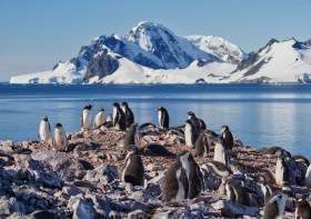
Since the establishment of Scott Base on Ross Island by the late Sir Edmund Hillary in 1957, surveyors have been appointed to assist scientists with survey related tasks on the ice.
This presentation by a panel of Antarctic surveyors promises to be educational, entertaining and informative, as they talk about their experiences on projects on the frozen continent over the last 35-plus years.
Image credit: ©stock.adobe.com/au/hrathke


