Featuring Don Murray, Co-Founder and President at Safe Software. With over 30 years experience and a Masters Degree in Computer Science from Simon Fraser University, Don leads the direction of Safe and focuses his specialty on server and cloud-based solutions. He regularly travels around the world sharing his passion for making data integration accessible to everyone who needs it.
With only a limited number of seats available, don’t miss this opportunity to find out where it’s come from and what the future holds!
“Supported by SSSI and SIBA/GITA”

SSSI in conjunction with the Hunter Environmental Institute will present this webinar with three pre-eminent speakers:
Amy Steiger (Cardno)
Title: RPAS and thermal cameras for wildlife detection post-bushfire and coastal monitoring
Details: Amy has promoted the use of Remotely Piloted Aircraft Systems (RPAS) gaining experience with remote data capture to cover a range of coastal, environmental and land development applications.
RPAS thermal inspection capability was deployed this summer in wildlife detection post-bushfires.
Amy has also done volumetric surveys of beaches and flown isolated coastal cliff faces in NSW to capture high-resolution photography and derived photogrammetric models to identify geotechnical hazards and contribute to coastal monitoring.
Charity Mundava (WaterNSW)
Title: Remote Sensing in Water Management
Details: Charity will discuss the use of GIS and remote sensing to support water catchment management, feasibility and environmental studies for critical water infrastructure across the state and to support ongoing research into and management of river catchments. Charity will touch on the significance and spatial support for this in the recent NSW bushfires coordinating reservoir availability (in drought) and access for helicopter water drops and supporting bushfire fighting efforts.
Associate Professor In-Young Yeo (University of Newcastle)
Title: Remote sensing and GIS applications for water resources management
Details: Dr Yeo will explain how remote sensing can be used as a technique for assessing soil moisture using multi-source data fusion approaches, vegetation monitoring and water requirement with remote sensing and water balance approach.
She will explain the impacts of conservation management practices in agricultural catchments assessed using catchment model and remote sensing/GIS drawing on examples from Australian and American case studies
CPD Points
BOSSI CPD is 1 SP for this webinar.
Cost
As per details as follows
Contact
rom.nsw@sssi.org.au

At 1Spatial we use validation, integration, automation and our rules-based approach to build strong data infrastructures, leading to better outcomes and making your data smarter.
Have you thought about how you will transform your data to GDA2020?
During this session, we will help you understand the requirements needed for GDA2020 and the best way to migrate your data to this new datum!
Join our team for a free webinar on Friday 27th November and hear how we can help you migrate your data to GDA2020.
Agenda
- Recognising your data and understanding the effect this will have on your data
- Authoritative data sets that already exist
- GA & ICSM slides defining the height datum + case studies of support issues
- Transformations with FME
- Ensuring your organisation has a plan for the transformation
- How we can help you implement the move
In the meantime, if you have any technical questions, or you’d just like a quotation on one of our products, some training or a dedicated consultancy session from one of our specialised consultants, just send us some details to sales.australia@1spatial.com and we’ll be sure to get back to you.
Whether you’re new to FME or an experienced user, our free webinars are packed with tips, tricks and knowledge to take your FME expertise to the next level!

FME 2021 has landed and there’s a lot to take in, so much so, that what might seem like an insignificant new feature at first can have some serious benefits to your data integration routines.
In this session, we’ll hear from our 5 highly qualified consultants on what their 5 hot features are in FME and why you might want to take a closer look.
Agenda
- Enterprise Integration – Using the connectors Safe continues to introduce each year to better integrate FME Server with other systems.
- The FME Parameter Manager – How to improve the user experience of FME parameters in 2021 with the FME Parameter Manager.
- Self Service –Are you tired of doing repetitive tasks? We’ll cover off how you can use FME technology to provide self-service functions to people within your organisation. Self-service data access, data submissions and requests can be streamlined using FME.
- Creating PDF Reports – Do you need to create PDF reports as part of your ETL process? These tips can help you create pretty PDF reports via FME.
- Getting Started Quickly with FME Cloud – Access the power of FME Server instantly without the burden of managing hardware and security.
This webinar is part of our free FME education programme where we focus on one specific topic and dive deep under the covers to highlight a particular data challenge or solution. All of our historic webinars are published on our on-demand webinar page, just in case you missed a session, you can review it there… but if you join us on the live session you’ll have the opportunity to ask our expert presenter some questions around the topic.
In the meantime, if you have any technical questions, or you’d just like a quotation for FME, some training or a dedicated consultancy session from one of our FME Certified Professionals, just send us some details to Sales.australia@1spatial.com and we’ll be sure to get back to you.
Put your pedal to the FMEdal and join us for the FME World Tour 2022!

Is your data driving you crazy? Overtake the competition with FME 2022! Register now to join us in a city near you. Whether you’re a newbie, just discovering the power of FME or an expert and hungry for new functionality, these fun events should be in your calendar!
Take a look at some of the most popular reasons to attend a World Tour event near you:
- Hear customer success stories and gain valuable insight on data integration strategies
- Get up to speed with FME 2022 new capabilities
- Our FME Pit Crew “Certified professionals” will be on the ground to answer any questions you may have.
- Plus lots of great prizes to be won!

Unable to hold its scheduled 2021 NSW Regional Conference earlier in 2022, SSSI is now inviting the spatial community to join it for a special online seminar featuring some of the speakers from the original program, along with the announcement of the NSW winners of the 2021 Asia-Pacific Spatial Excellence Awards.
This seminar will focus on the importance, efficiency and innovation spatial data can provide in crisis management situations and will feature presentations on:
- Finding your Friendship Island amongst a sea of COVID restrictions — presented by Stella Blake-Kelly, Founder/Director, Cartisan
- Geospatial Intelligence: Providing real-time insights supporting NSW State Emergency Service’s emergency management response — presented by Melissa Daley, Manager, Geospatial Intelligence Systems, NSW State Emergency Service
- COVID-19 Near Me: Trials and tribulations — presented by Kenneth Tsang, Director, jxeeno

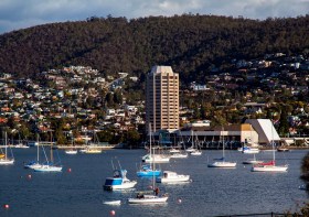
The 2022 Tasmania Surveying & Spatial Conference will be held on Friday, 2 September at Wrest Point in Hobart, and promises to be a fantastic opportunity to learn and network with SSSI members and the broader surveying and spatial community.
This year’s event will include a gala dinner, held in partnership with the University of Tasmania, to celebrate that institution’s 50 years in the field of surveying and spatial teaching.
In addition, the event will include the presentation of the 2022 Tasmanian Asia-Pacific Spatial Excellence Awards.
Image credit: ©stock.adobe.com/au/Norman

The 2022 SSSI Queensland Regional Conference will be held on Friday, 14 October at the Brisbane Convention & Exhibition Centre. It promises to once again be a fantastic opportunity to learn and connect with SSSI members and the broader surveying and spatial community.
The Queensland Asia-Pacific Spatial Excellence Awards dinner will also be held in conjunction with the conference, celebrating the outstanding work being undertaken across the region.
Image credit: ©stock.adobe.com/au/rudi1976

The Local Government Spatial Reference Group (LGSRG) will be holding a webinar on Monday, 4 September, to introduce a series of hands-on workshops it will be holding across Victoria during September 2023.
The webinar will cover the topic of Best Practice Geospatial Intelligence for Climate Impact, and will address important topics on climate impact, community safety and how geospatial intelligence can contribute to better outcomes for local governments.
The LGSRG was formed in 2003 to address the need for a sector wide group representing the strategic interests of the Victorian Local Government sector with respect to spatial information. The LGSRG has been active throughout the COVID pandemic to keep the local government geospatial community connected and engaged via the annual Spatial Capability Workshop series which have grown year on year, and is now diversifying with a quarterly Spatial Hour webinar to share stories of success within the local government geospatial sector.
Image credit: ©stock.adobe.com/au/yutthana

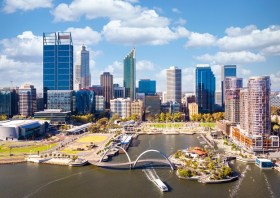
The Geospatial Council of Australia’s Western Australia Digital Twin Summit will be held on 15 November 2023.
The event will focus on Spatial Digital Twins, and attendees will hear the latest developments in this rapidly developing space from government, academia and private industry presenters.
The WA Asia-Pacific Spatial Excellence Awards dinner will also be held in conjunction with the conference, celebrating the outstanding work being undertaken across the region.
Image credit: ©stock.adobe.com/au/anekoho


