Are you a young surveyor and always wondered what the digital frontier of the profession looked like? Are you mid career but developed foundation skills but have not yet ventured into the digital data part of the discipline? Are you a seasoned professional who loves to see what amazing things you can do with the tools and technologies of the 21st century?
If you answered yes to any of those questions then this is a webinar you won’t want to miss!
Michael Finlay is a Geospatial Engineer who specialises in 3D laser scanning and point cloud technologies. He is an early career professional who has been working at Jacobs for 8 years and is passionate about all things 3D laser scanning, especially mobile laser scanning (MLS). Michael is a trail blazer in developing the digital data team and discipline at Jacobs as not only a real value add, efficiency but product and service enricher for the surveying team. He gets involved with the planning, scanning, processing, adjusting, classifying, extracting, automation, analysis, visualisation and supports the interfaces of surveying and digital engineering and GIS environments for stakeholders from a broad variety of disciplines.
Check out Michael’s profile to see some of the amazing projects he has been involved in and how he champions this modern digital space for surveying and geospatial engineers.
Registration
By registering below, you receive access to the watch the webinar live OR if you can’t watch it live, you receive the link to the recording 24 hours after the event date. You can then watch the recording at your leisure.
CPD
This event is worth one SSSI CPD Point. BOSSI points to be confirmed.
Note, only the individual registered for the event is entitled to receive the associated CPD points.
Contact
Katie Le Miere, National Events Manager
katie.lemiere@sssi.org.au

THE HELICOPTER AND UNMANNED FLIGHT EXPOSITION
FOR AUSTRALIA, NEW ZEALAND AND THE REGION
With a comprehensive three-day FREE to attend industry conference program, ROTORTECH is the region’s premier helicopter and unmanned flight systems showcase and forum, featuring more than 100 participating companies and key speakers from industry and government.
Join Australia’s helicopter and unmanned aerial flight communities including the Australian Helicopter Industry Association (AHIA), Australian Association for Unmanned Systems (AAUS) and the Aviation Maintenance Repair and Overhaul Business Association (AMROBA) at the industry’s own signature event.
Join the FREE conference program and engage with:
- Keynote address from the Hon. Michael McCormack MP, Deputy Prime Minister of Australia, Federal Minister for Infrastructure, Transport and Regional Development
- Aerial firefighting: lessons learned and the way ahead
- Heli-Mustering: beefing up the helicopter industry
- Rotary wing tourism: the bird’s eye view
- Financial forum: question the experts
- Remotely Piloted Aircraft Systems (RPAS) in fire and emergency management, agriculture, infrastructure inspection and aerial survey
- Helicopter technical workshops from Airbus, Bell, Boeing and Robinson
- The future rotary wing regulatory landscape
Walk the exhibition floor:
- More than 100 participating companies
- Helicopter static displays
- Unmanned Aerial System demonstrations
Network and socialise:
- Networking events on the exhibition floor
ROTORTECH 2018 was an unprecedented success, attracting 95 exhibitors, including three days of conferences with 30 speakers across some 22 sessions on Queensland’s Sunshine Coast.
Dramatic growth in demand for the event has prompted a move to the Royal International Convention Centre, Brisbane as a larger, more easily accessible venue with world class facilities, helicopter access and external flying demonstrations and networking.

This event defines and showcases the global commercial UAV industry, with a special focus on solutions in the Americas region and a glimpse into the world of urban air mobility. It showed consistent growth for 5 straight years, with 3,100+ live attendees in 2019 – up 32% – and a record 200 exhibiting companies.
It moves to much larger space right on the Las Vegas Strip for 2021 and adds a collocated Urban Air Mobility Summit produced by RAI Amsterdam. Strictly commercial by choice, it draws the power buyers and global influencers and sets the pace for the industry, with innovative formats, cutting-edge content, and unmatched excitement on the expo floor.
It is a must-attend event and will convene delegates and exhibitors from 6 continents. www.expouav.com Commercial UAV Expo Americas is produced by Diversified Communications’ technology portfolio which also includes Commercial UAV Expo Europe; Commercial UAV News; Geo Week comprised of the International Lidar Mapping Forum, SPAR 3D Expo & Conference, AEC Next Technology Expo & Conference; Geo Week ENewsletter, SPAR 3D ENewsletter, AEC ENewsletter.
For more information about exhibiting at Commercial UAV Expo, visit www.expouav.com/exhibition/ or contact Katherine Dow, Sales Manager, at kdow@divcom.com or +1.207-842-5497. For attending information, visit www.expouav.com or email info@expouav.com.

Update: This event has been rescheduled from its original date of 24 February.
The SSSI 2021 Victorian Surveying & Spatial Summit will be an opportunity for all Victorian surveying and spatial professionals to come together to learn, share and connect. The theme will be ‘Digital Transformation: Our Future’.
The one-day event will take place at the Novotel on Collins, Melbourne, and will be followed in the evening by the presentation of the Victorian Asia-Pacific Spatial Excellence Awards — the Awards celebrate the outstanding work being undertaken by individuals and organisations in the region.
Discounts are available for SSSI members and students. You can choose to register just for the Summit or select full registration which includes a ticket to APSEA-V event as well. Tickets for APSEA-V only (individual or full table of 8) are also available.
There will also be a pre-summit breakfast on the topic of Diversity and Inclusion, and organisers encourage potential participants to consider purchasing a ticket when registering for the Summit.

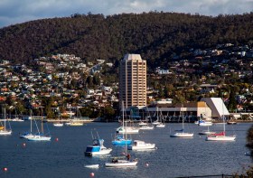
The 2022 Tasmania Surveying & Spatial Conference will be held on Friday, 2 September at Wrest Point in Hobart, and promises to be a fantastic opportunity to learn and network with SSSI members and the broader surveying and spatial community.
This year’s event will include a gala dinner, held in partnership with the University of Tasmania, to celebrate that institution’s 50 years in the field of surveying and spatial teaching.
In addition, the event will include the presentation of the 2022 Tasmanian Asia-Pacific Spatial Excellence Awards.
Image credit: ©stock.adobe.com/au/Norman

The 2022 SSSI Queensland Regional Conference will be held on Friday, 14 October at the Brisbane Convention & Exhibition Centre. It promises to once again be a fantastic opportunity to learn and connect with SSSI members and the broader surveying and spatial community.
The Queensland Asia-Pacific Spatial Excellence Awards dinner will also be held in conjunction with the conference, celebrating the outstanding work being undertaken across the region.
Image credit: ©stock.adobe.com/au/rudi1976

The 2022 SSSI Victorian Surveying & Spatial Summit and APSEA-V Dinner will take place on Thursday, 27 October 2022. It will be an opportunity for all Victorian surveying and spatial professionals to come together to learn, share and connect.
The event will feature an array of speakers, along with plenty of networking opportunities and the chance to see the latest products and services from local suppliers.
Image credit: ©stock.adobe.com/au/Wirestock

The 2022 SSSI NSW Regional Conference will be held on Thursday 10 November and Friday 11 November 2022 at the Novotel Sydney Central. The theme will be ‘Connections’.
This regular event is an opportunity to learn from and connect with other SSSI members and the broader geospatial community.
The first day will comprise the main conference, with speakers presenting on various topics, followed by the NSW & ACT Asia-Pacific Spatial Excellence Awards dinner in the evening.
The second day will be a NSW Spatial Digital Twin workshop, an interactive session that will get ‘under the bonnet,’ looking at data sharing, use cases and more.
The Call for Abstracts will close at midday on Monday, 26 September 2022. Abstract proposals can be submitted online at https://lnkd.in/ek4xS6Bu.
The organisers are seeking papers and presentations on a variety of topics, such as:
- technical innovation, spatial aps, cloud computing, survey innovation, RPAS
- data analytics, crowd sourcing, machine learning, artificial intelligence, automation, data partnerships
- surveying -—land, cadastral, hydrographic, aerial survey, engineering
- 3D, digital engineering, LiDAR, reality meshes, BIM
- mobility, emergency management, spatial digital twins, environment, community, smart cities, utilities, coastal management, climate change
- convergence of space and spatial
Registrations are now open online for the conference, dinner and workshop at https://lnkd.in/eVSxGWeB.
The event’s Principal and Major sponsors are the NSW Department of Customer Services–Spatial Services and TAFE NSW.

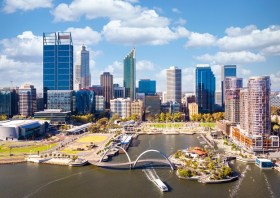
The Geospatial Council of Australia’s Western Australia Digital Twin Summit will be held on 15 November 2023.
The event will focus on Spatial Digital Twins, and attendees will hear the latest developments in this rapidly developing space from government, academia and private industry presenters.
The WA Asia-Pacific Spatial Excellence Awards dinner will also be held in conjunction with the conference, celebrating the outstanding work being undertaken across the region.
Image credit: ©stock.adobe.com/au/anekoho

Hosted by Eric Andelin CP, Senior Workflow Specialist with guest speaker Michael O’Sullivan, VP Sales, SimActive Inc.
It is often challenging for new entrants into the aerial imagery and mapping service profession to determine cost savings when it comes to their processing software solution. Smaller sensors, altitude restrictions, line of sight requirements and overall flight duration create unique challenges for drone operators. Medium and large format sensors acquire much larger areas, but require a much larger investment, or the ability to subcontract out the acquisition. Mapping expenses tend to increase as projects become larger. And using the wrong image processing software can exacerbate this, leading to narrowing project profits. This webinar will show how a higher-end software such as SimActive’s Correlator3D™ can reduce overall project costs. REGISTER HERE.
Specifically, attendees will learn about the following:
- Common challenges and impact on costs
- Cost variations as projects increase in size
- Workflows in Correlator3D to minimize man-hours
- Accelerating timelines with distributed processing


