Learn how to ‘geo-enlighten your organisation’ at Directions LIVE 2016.
This year’s roadshow will highlight how you can extend the benefits of geospatial technology throughout your entire business – to streamline workflows and maximise your return on investment.
Discover how to further leverage the ArcGIS platform’s spatial analysis capabilities and see how this technology gives your organisation the competitive edge.
At Directions LIVE 2016, you will learn the benefits of working with 3D and 4D data, how to select the perfect app to tackle any challenge, and how ArcGIS Pro complements ArcMap functionality.
We will also be showcasing the innovative ways local organisations are improving operational efficiency with GIS technology.
Directions LIVE is free for Esri users – with light lunch provided.
Register today to join our team of ArcGIS experts and your local GIS user community, and learn how to unlock the full potential of the platform – the market’s only complete GIS solution.

Discover what’s new and what’s next in HDS technology with immersive sessions and a day dedicated to learning, led by Leica Geosystems experts.
The HDS User Conference is designed to deliver a new experience for all attendees from Australia and New Zealand.
Together with our partners C.R. Kennedy and Global Survey the HDS User Conference will bring together Leica Geosystem HDS users in a community environment where they’ll access training sessions, learn about our latest innovations, listen to best practices from industry and experience live demos of the latest HDS technology and solutions.
The HDS User Conference features insightful keynote addresses, customer success stories and HDS dedicated group training sessions. Discover and test-drive new, innovative hardware and software solutions that will improve the performance, speed, workflows and efficiency across your organisation.
SEE AGENDA
Reasons to attend:
- Experience the latest solutions that will help you compete and win in today’s dynamic environment
- Learn about reality capture hardware and software solutions and how to be more efficient and productive
- Leica Geosystems will unveil several new innovations and attendees will get a first-hand look at the latest technology advancements
- Experience hands-on demonstrations and training to improve your workflows
- Learn from and network with peers across industries
What’s included in your registration:
- Two days filled with informative sessions and networking opportunities plus a dedicated day to learning
- Evening welcome cocktail reception
- Post-conference access to training material and presentations
- Morning tea, lunch and afternoon tea catering
- Delegate bags
NOTE: We ask that you select your preferred training session time when registering. Simply choose from the four session times available, per workshop.
This helps us manage classroom numbers to ensure we provide you with quality training sessions and you will have the opportunity to attend each topic throughout day two of the conference.
Day two- August 15
Workshop sessions and timings
Maximising 3DReshaper
9am – 10:30am I 11am- 12:30pm I 1:30pm-3:00pm I 3:30pm-5:00pm
Advanced data management and registration workflow
9am – 10:30am I 11am- 12:30pm I 1:30pm-3:00pm I 3:30pm-5:00pm
Creating diverse deliverables: optimising the latest Leica HDS software updates to transform point cloud data into value- added deliverables
9am – 10:30am I 11am- 12:30pm I 1:30pm-3:00pm I 3:30pm-5:00pm
BIM workflow
9am – 10:30am I 11am- 12:30pm I 1:30pm-3:00pm I 3:30pm-5:00pm
Visit the event page for more information
If you have any questions about the HDS User Conference, training sessions, or assistance regarding registration, please contact:
Tamara Stakic
Marketing Manager
info.anz.geo@leica-geosystems.com
T: +61 3 9914 2262

The AEGC petroleum, mineral and water resource industry conference, incorporating the ASEG-PESA International Geophysical Conference and Exhibition, will be jointly hosted by the Australian Institute of Geoscientists (AIG), Australian Society of Exploration Geophysicists (ASEG) and Petroleum Exploration Society of Australia (PESA).
Under the conference theme of Geoscience for a Sustainable World, the AEGC will attract a large number of international and national delegates and organisations from across the spectrum of Australasian geosciences, representing industry, government and academia. It is expected there will be dedicated streams for Australian basins, resourcing a sustainable energy challenge, data, innovation and technology, high-quality resources for future generations and developing the future workforce.

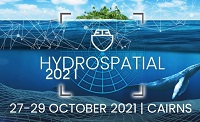
The Australasian Hydrographic Society’s HydroSpatial2021 Conference will focus on how hydrography will develop in the future, noting the development of ‘digital twinning’ and the emerging name variants for hydrography such as ‘hydrospatial’ or ‘hydrogeomatics’.
The conference theme, Hydrography of the Future, morphs two modern yet wide-ranging aspects of the hydrographic surveying profession, and should draw papers from relevant scientific, technological, operational and environmental communities. The aim is to provide delegates with valuable insights, creative ideas and inspiration on how to harness current and future technologies, systems and processes so that they can deal with present challenges and prepare for a more sustainable future.

Survey and Spatial NZ’s 2022 conference will be held from 1 to 3 August at the Novotel Lakeside, Rotorua. The conference is the biggest continuing professional development event of the year for NZ surveying and spatial professionals. It invites sharing of knowledge amongst peers, bringing together networking opportunities for all delegates and is an essential event for professional development and connectivity within the sector.
The choice of Rotorua as the location is apt, given the conference theme of ‘Turning up the Heat’. The organisers aim to stimulate discussion regarding challenges in regional areas, which include climate change and developments outside of Auckland.

Geo Week is an event for increased integration between the built environment, advanced airborne/terrestrial technologies, and commercial 3D technologies. It was created as a response to the changing needs of built world and geospatial professionals, and to acknowledge the convergence of technology taking place currently.
New technological innovations, the need for remote workflows, and hardware breakthroughs are redefining expectations across teams, organisations, and entire industries will canvassed at the event.
Attendees will hear about the latest updates, case studies, ideas and predictions from a variety of experts: innovators, end-users, regulators, and more. What trends and technologies do they see coming? What new challenges and opportunities lie ahead? How can you and your organisation prepare, anticipate, and benefit in a rapidly evolving environment?


