SDB Day 2019
The International Forum on Satellite-Derived Bathymetry 2019
Esteemed speakers and guests from hydrographic offices, marine industry, service providers and research institutes around the world will gather for Australia’s first SDB Day in May 2019.
Satellite Derived Bathymetry (SDB) is a method for providing high-resolution water depth data in shallow water environments. These waters are notoriously difficult and expensive to access. The method combines satellite imagery with advanced algorithms to provide affordable and accurate data, and all within a relatively quick turnaround time.
The forum addresses the urgent need for both users and producers of SDB to jointly discuss capabilities, standards, data integration and handling uncertainties in its application.

About this Event
Everybody talks about UAV LiDAR – the engineer in planning, the forester involved in wood mass calculation, the construction companies taking part in large projects to model it before, during and after its implementation or the utility companies for their corridor mapping and infrastructures management.
Reasons enough for us to continue the Yellowscan Demo tour in Australia, under the motto « Measuring the world with UAV LiDAR ». The scope is to show this high tech tool in a real working environment and how easy it is to generate topographic data with UAV LiDAR.
During our tour you will learn about the latest solutions and use cases from YellowScan and its partners with lectures, workshops and open discussions.
We look forward to meeting you !
YellowScan will be demonstrating two systems:
– YellowScan Surveyor Ultra, the high density & long-range LiDAR solution for UAV. Thanks to its high density (600 000 shots per second), this turn-key fully autonomous system is ideally suited for high speed & long-range projects. Its light weight (1.7 kg battery included) makes it also easy to mount on any drone.
Ideal Use cases: Mining, Archeology, Powerlines.
Applanix APX-15 & Velodyne VLP-32 inside.
– YellowScan Vx-20, the high precision & long-range LiDAR solution for UAV. This system is ideally suited for long range survey needs advanced accuracy (2,5 cm) and precision (1 cm).
Ideal Use Cases: Civil engineering, Forestry
Applanix APX-20 & Riegl miniVUX inside.
LiDAR systems are renowned for under vegetation 3D modeling, and fast data processing.
Contact :
Contact us for any question at laure.fournier@yellowscan-lidar.com

Update: This event has been rescheduled from its original date of 24 February.
The SSSI 2021 Victorian Surveying & Spatial Summit will be an opportunity for all Victorian surveying and spatial professionals to come together to learn, share and connect. The theme will be ‘Digital Transformation: Our Future’.
The one-day event will take place at the Novotel on Collins, Melbourne, and will be followed in the evening by the presentation of the Victorian Asia-Pacific Spatial Excellence Awards — the Awards celebrate the outstanding work being undertaken by individuals and organisations in the region.
Discounts are available for SSSI members and students. You can choose to register just for the Summit or select full registration which includes a ticket to APSEA-V event as well. Tickets for APSEA-V only (individual or full table of 8) are also available.
There will also be a pre-summit breakfast on the topic of Diversity and Inclusion, and organisers encourage potential participants to consider purchasing a ticket when registering for the Summit.

The National Surveying Congress will be an opportunity for leaders in the surveying profession to discuss the opportunities and challenges facing the profession. The 2022 Congress theme is ‘Automatic Mutual Relaxation’.
As the profession comes to understand the impact of Automatic Mutual Recognition for surveyors across the country, the event will provide an opportunity for surveyors from across Australia to gather and discuss the issues facing the profession and the opportunities for the future. The highlight of the program each year is the Cadastral Leaders Panel which sees all the Surveyors-General on stage speaking about changes and opportunities in their states and territories as well as an update from ICSM and ANZLIC. There will also be an online option.
The National Surveying Consultancy Excellence Awards and Gala Dinner will be held on the second day of the event, 23 June 2022.

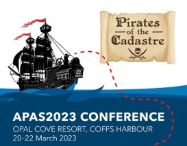
The Association of Public Authority Surveyors, NSW (APAS) annual conference for 2023 will be held at Opal Cove Resort in Coffs Harbour, from 20 to 22 March 2023.
The theme for the event will the ‘Pirates of the Cadastre’. The program is being developed, with a call for abstracts currently in place (as of June 2022).
Important dates and deadlines to note, are:
- Abstract submission deadline: Friday, 23 September 2022
- Draft paper deadline: Friday, 18 November 2022
- Final paper deadline: Friday, 20 January 2023


