Join us for the first session in our ‘Locate Connect’ online learning series! Hear from Scott Dewar, Director, Chris Hewett, Assistant Secretary GEOINT Capability and Development & Phil Shears, Director DEF799 Phase 2.
In this session from 1300 – 1400, the Australian Geospatial-Intelligence Organisation (AGO) will be launching the Defence Geospatial-Intelligence (GEOINT) Strategy, a document that addresses how the Defence GEOINT Community will transform to meet the future needs of the Australian Defence Force. The AGO Executive will also provide an update on their GEOINT projects and announce upcoming opportunities for industry and discuss how the COVID-19 pandemic has impacted the organisation.
Then from 1430 – 1545, AGO, along with Frontier SI will describe how The Analytics Lab Program (AGO Labs) fits into the bigger picture of AGO capability and summarise the outcomes of their 2019 activities. AGO Labs, coordinated through FrontierSI, is investigating a number of ways to better engage and work with industry. Specifically, the AGO is keen to attract a wider pool of companies and technologies to draw on for automated geospatial intelligence. The primary focus of this program is to address AGO capability challenges through a small number of short-term industry projects, with a focus on machine learning and analytics for producing automated imagery analysis, including automated object classification. AGO will announce a new 2020 program of challenges hoping to find innovative solutions through their partnership with FrontierSI.

The National Surveying Congress will be an opportunity for leaders in the surveying profession to discuss the opportunities and challenges facing the profession. The 2022 Congress theme is ‘Automatic Mutual Relaxation’.
As the profession comes to understand the impact of Automatic Mutual Recognition for surveyors across the country, the event will provide an opportunity for surveyors from across Australia to gather and discuss the issues facing the profession and the opportunities for the future. The highlight of the program each year is the Cadastral Leaders Panel which sees all the Surveyors-General on stage speaking about changes and opportunities in their states and territories as well as an update from ICSM and ANZLIC. There will also be an online option.
The National Surveying Consultancy Excellence Awards and Gala Dinner will be held on the second day of the event, 23 June 2022.

The Ocean Optics Conference attracts a diverse audience of active practitioners in the field, including oceanographers, marine ecologists, limnologists, optical engineers, marine resource managers and policy professionals from around the world.
Conference presentations will include the science of optics across all aquatic environments, research, and applications, including (but not limited to) biogeochemistry, environmental management and applications, instruments, techniques and observational systems, remote sensing, phytoplankton ecology, radiative transfer and optical theory, global change, and benthic processes.
Attendees will attend plenary presentations during the day and interact with colleagues during scientific poster session receptions held in the exhibit/poster hall in the early evening. In addition to invited and contributed oral and poster presentations, the conference will provide the opportunity for community-wide discussions.
NASA Earth Observatory image by Joshua Stevens, using Landsat data from the U.S. Geological Survey.

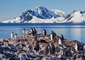
Since the establishment of Scott Base on Ross Island by the late Sir Edmund Hillary in 1957, surveyors have been appointed to assist scientists with survey related tasks on the ice.
This presentation by a panel of Antarctic surveyors promises to be educational, entertaining and informative, as they talk about their experiences on projects on the frozen continent over the last 35-plus years.
Image credit: ©stock.adobe.com/au/hrathke

Featuring a spotlight on crowd-sourced bathymetry, the Map the Gaps Symposium 2023 will bring people together to learn, share and contribute to ocean discovery.
Held on behalf of GEBCO, this event draws global experts in ocean technology, science and policy to discuss deep and coastal ocean exploration, offshore surveying technology, policy, diversity, equity and inclusion, the Nippon Foundation-GEBCO Seabed 2030 project and GEBCO alumni activities.
Participation is open to all, including industry professionals, explorers, authors, students, researchers, government representatives and emerging technologists. Participants can attend in person or online.

The 2024 edition of the International Conference on Geographical Information Systems Theory, Applications and Management (GISTAM 2024) aims to create a meeting point of researchers and practitioners that address new challenges in geo-spatial data sensing, observation, representation, processing, visualization, sharing and managing, in all aspects concerning both ICT as well as management information systems and knowledge-based systems.
The conference welcomes original papers of either practical or theoretical nature, presenting research or applications, of specialised or interdisciplinary nature, addressing any aspect of geographic information systems and technologies, such as:
- Data acquisition and processing
- Remote sensing
- Interaction with spatial-temporal information
- Spatial data mining
- Managing spatial data
- Modelling, representation and visualisation
- GIS and climate change
- Domain applications


