Engadget has a post talking of a “space harpoon” created by Astrium that will be used to spear space junk and drag it into the atmosphere, causing it to burn up. With more and more space junk orbiting the planet, the risk of it damaging space infrastructure is only increasing.
The BBC have a story about new software in development that can map and individually highlight those buildings with high greenhouse gas emissions, helping in carbon accounting, as well as identifying areas most in need of emissions reduction.
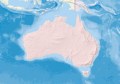
Spatial Information in the 12st Century has a post entitled “The Rise and Fall of Bushfire Connect”, which closed up shop last week after two years of crowd-sourced bushfire data.
Asian Surveying and Mapping talk of China’s local positioning system, which aims to bring 0.1 metre outdoor accuracy, and 3m indoor accuracy for all of China’s major cities by 2015.
LiDAR News has a video outlining a cheap method that uses a Gopro camera to add texture to point clouds.
AnyGeo has a post about a community mapping effort that is mapping Antarctica at its true size and shape (using stereographic projection), based on NASA aerial imagery, the SCAR Antarctic Digital Database, and open source tools.
Space Boomerang has a post discussing the renaming (and inferred shift of focus) of the Australian Space Policy to the “Satellite Utilisation Policy.”