

Welcome to Spatial Source’s International Women’s Day 2026 interview series.
We’re celebrating International Women’s Day 2026 by showcasing some of the outstanding individuals who are helping to shape Australia’s geospatial sector.
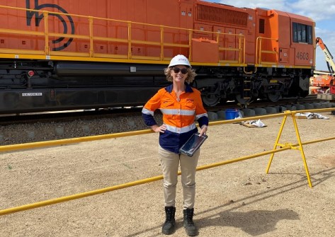
In this interview we speak with Cherie Malone, a GIS specialist who founded her own consultancy business and has worked on government and industry projects, from the resources sector to environmental protection.
How did you get into this field and what attracted you to it?
I commenced a science degree at James Cook University in 1997 as a mature-age student with two children under five. My original plan was to become a microbiologist, but I quickly realised that peering down a microscope all day was not my strength!
Everything changed when I attended an environmental science lecture by Dr Marji Puotinen, a brilliant GIS lecturer, who introduced me to the concept of GIS and my mind went into overdrive. I had no idea this career even existed, but I was hooked.
That lecture opened my eyes to a profession that combined science, technology, creativity and real-world impact. I was immediately drawn to the ability to visualise complex environmental issues spatially and support better decision-making through mapping and data. I knew at that moment that I wanted to be a GIS nerd, and I honestly haven’t looked back.
Please tell us about your current role and responsibilities.
I am the founder of CocoTell, a Townsville-based geospatial consultancy specialising in the preparation, presentation and analysis of spatial data within contemporary ESRI environments. My work spans government and industry projects, including marine and environmental datasets, cartographic products and strategic spatial solutions.
Beyond technical delivery, my role involves mentoring team members, engaging with stakeholders, and ensuring that complex spatial information is translated into clear, meaningful outputs.
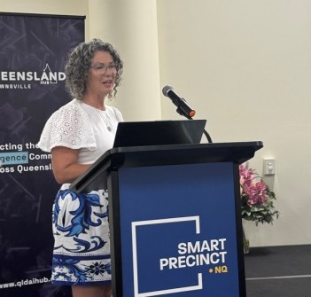
I am also Chair of the FunGIS Group in North Queensland, where I support community engagement and professional development within the geospatial sector.
What do you enjoy most about your job?
What I enjoy most is inspiring others — particularly women — to consider a career in geospatial. GIS is an incredibly rewarding and intellectually challenging profession that enables you to solve problems, influence policy, and make tangible contributions to environmental and community outcomes.
I love taking a client’s abstract problem and transforming it into a beautiful, functional spatial product that genuinely helps decision-making. Seeing others grow in confidence and technical capability within this field is equally fulfilling.
Are there any personal qualities or attributes that are helpful to have in this field?
Troubleshooting and perseverance are essential in GIS. Spatial problems are rarely straightforward, and the ability to calmly work through technical and conceptual challenges is critical.
However, technical skill alone is not enough. Strong communication skills and emotional intelligence are equally important. You need to understand what people are really asking for, often before they can articulate it clearly themselves. Knowing which questions to ask, and at what stage, is what elevates someone from being technically competent to being a leader in the field.
What makes you most proud about your role and achievements?
Starting my own business is something I am deeply proud of. For many years, I struggled with low confidence, and it was the encouragement of strong mentors throughout my career that helped me take that leap of faith.
Along the way, I have been fortunate to contribute to significant projects, including Queensland Globe, assisting with the removal of offensive place names from the Queensland Place Names Register, and supporting the 2019 Townsville flood recovery efforts.
A personal career highlight was meeting Jack and Laura Dangermond, founders of ESRI. Their vision for GIS as a force for positive change reaffirmed my commitment to doing my best work in this profession.
As a woman, have you had any struggles during your career? Conversely, have you had support?
Early in my career, working in what was often a male-dominated environment presented challenges. There were times when I had to work harder to be heard or taken seriously. However, I have also experienced strong mentorship and support from both men and women who recognised my capability and invested in my growth.
As the industry evolves and more women step into leadership roles, I see increasing confidence among women to speak up, lead projects and shape the direction of our profession. That cultural shift is encouraging and important.
We need more women in the geospatial sector. Do you have any ideas?
Visibility and mentorship are key. We need more women in leadership positions who are visible, accessible and willing to champion others. That is one reason I chair FunGIS. Community groups create platforms where women can see others like themselves leading, presenting and contributing at a high level. When women see someone who looks like them succeeding, it becomes easier to believe that, “If she can do it, I can too”.
We must continue to create supportive networks and actively invite women into technical and leadership spaces.
What would you say to women who are considering a career in geospatial?
Do it, even if you do not feel ready. Confidence grows with experience. GIS is a rewarding profession that blends science, technology and creativity, and it allows you to influence real-world outcomes.
You do not need to know everything at the start. Troubleshooting, perseverance and asking the right questions will take you far. Find good mentors, back yourself and remember there is space for you in this industry, not just to participate, but to lead.
Is there anything else you would like to add?
At one point in my career, I decided to move from a predominantly environmental government role into the resources sector, and then into consulting. For some, that may have seemed like moving to the ‘dark side,’ but my motivation was clear: GIS gives us a powerful seat at the decision-making table. Used responsibly, it can improve transparency, environmental stewardship and accountability.
I remain committed to ensuring spatial data is used as a tool for informed and ethical decision-making.


