

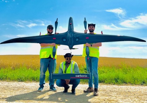
A Volanti drone from Australian firm Carbonix has taken to the skies over Michigan under the control of US drone data management provider Aerial Vantage, as part of a large rural remote sensing project.
The Michigan Department of Agriculture and Rural Development (MDARD) aerial remote sensing project aims to boost farming technologies, promote sustainability, improve water and nutrient management and enhance crop yield forecasting.
Data from the flights, which take place every fortnight, will be plugged into Aerial Vantage’s software platform, Accelerate, which uses AI and machine learning to combine drone imagery with satellite imagery and other data to analyse crop yields.
The beyond visual line of sight (BVLOS) capabilities of the Volanti drone increase the cost effectiveness of the data acquisition.
“Michigan is one of the largest states in the US with large areas to be covered, allowing BVLOS capabilities to be utilised to their full potential. This will drive significant operating efficiencies and cost reductions when it comes to large-scale agricultural scanning projects such as these for the MDARD,” said Carbonix CEO, Philip van der Burg.
“Being able to participate in these real-world missions signifies the opportunities that lie ahead as drone capabilities advance and continue to revolutionise industries, redefine aerial operations and empower businesses worldwide.”
Aerial Vantage CEO, Michael Dalley, said that “Our partnership with Carbonix is not only about pushing the boundaries of long-range unmanned flight, but also about creating real-world solutions for various industries.”
“Through our collaboration with the Michigan Department of Agriculture and Rural Development, we are at the forefront of enhancing farming technologies, promoting sustainability, and improving crop yield forecasting.”


