Tasmania’s surveying and geospatial community came together in Launceston last week to explore how spatial information is helping map out the state’s future.
Held under the theme ‘See the Land Differently: Surveying and Geospatial in a Changing World,’ the conference brought together representatives from government, industry and academia to examine the evolving role of surveying and geospatial information in supporting decision-making across Tasmania.
The conference featured a diverse program of presentations highlighting innovation across the surveying, spatial and geospatial sectors. Attendees heard insights into emerging technologies, contemporary industry challenges and the growing importance of spatial information in supporting informed decision-making.
Spatial projects on show
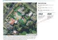
Investment in geospatial technology and infrastructure was a key focus of the event, including the modernisation of LISTmap through the All Hazards Spatial Infrastructure Project.
The new platform will provide improved mobile access, 3D visualisation, stronger data management and modern cloud-based services, making critical spatial information more accessible and supporting natural hazard planning and response.
Other government initiatives highlighted included:
- the development of electronic survey data lodgement to improve efficiency and reduce administrative requirements;
- a three-year program to replace decades of analogue aerial imagery; and
- continued investment in imagery and LiDAR data that supports bushfire preparedness, flood modelling, infrastructure planning and environmental management.
Alongside this, presentations from academia and industry showcased advances in drone research, the growing application of AI in geospatial processing, and even explored the science behind satisfying mowing patterns.
Award for heritage efforts
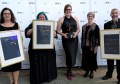
As Spatial Source reported last week, the conference also hosted the Excellence in Surveying and Spatial Information (EISSI) Awards, celebrating outstanding achievements across the industry.
An Aboriginal Heritage Tasmania project undertaken by Jacobs received the Community and Sustainable Environment Award for their ongoing cultural heritage recording project, which uses LiDAR, photogrammetry and UAVs to digitally record and protect significant Aboriginal cultural heritage sites.
Since commencing in 2020, the project has created highly accurate datasets and immersive visual products that support the conservation, management and sharing of important cultural heritage places. The award recognises the innovative work being undertaken to preserve Tasmania’s Aboriginal cultural heritage for future generations.
Breadth of innovation in Tasmania
Speaking after the event, Surveyor-General Matthew Reid said the conference showcased the breadth of innovation occurring across the surveying, spatial and geospatial sectors.
“The conference provided an opportunity for professionals from across Tasmania to come together, share ideas and explore how surveying and geospatial information can help address future challenges,” he said.
“The quality of presentations generated valuable discussion and highlighted the important role our professions continue to play in a rapidly changing world.”
Strong attendance throughout the day reflected the continued strength of Tasmania’s surveying and spatial community, providing valuable opportunities for professionals to reconnect, share knowledge and strengthen industry relationships.