Next week’s TERN webinar will outline how time series LiDAR can be used to build clearer evidence of vegetation change.
Australia’s Terrestrial Ecosystem Research Network (TERN) will host a webinar on Wednesday, 7 October, to outline how terrestrial and airborne LiDAR are becoming practical tools for adding the time dimension to Australian ecosystem monitoring.
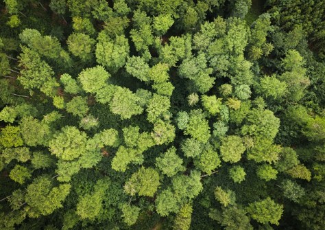
Monitoring of vegetation structure is one of the best ways to gauge how ecosystems are faring, e.g. carbon stored, available habitats, fire or drought recovery, and climate change resilience.
Yet single snapshot surveys are insufficient for getting the full picture. That’s where repeated, time series monitoring comes in, but not just on a wide scale — it can now be performed from individual trees all the way up to larger plots.
The Ecosystems Observations webinar will show how measurements on the ground and broader aerial coverage are complementary, and why repeated measurements can enable differentiation between recovery from decline, and storage from loss.
The online event will feature presentations from three experts in the field:
- Professor Kim Calders (Ghent University), a leading researcher in the field of forest ecology with expertise in 3D measurements for the monitoring of vegetation dynamics. He has a particular interest in terrestrial laser scanning and has co-ordinated numerous terrestrial LiDAR field campaigns in Europe, Africa, South America and Australia.
- Dr William Woodgate (The University of Queensland), a specialist in remote sensing technologies for environmental monitoring, and formerly a Principal Investigator of the TERN-OzFlux Tumbarumba site for 10 years, helping to set a global benchmark for validating environmental satellite products.
- Dr Shaun Levick, a Senior Principal Research Scientist within CSIRO’s Environment Research Unit, where he leads the Landscape Observation team. His work includes the use of multi-scale LiDAR to calibrate satellite products and reduce uncertainty in regional and national scale trends.
Professor Calders will introduce LiDAR measurement of vegetation structure, why those measurements matter for biomass, biodiversity and related challenges, and the benefits of repeat surveys. He will contrast terrestrial and UAV laser scanning and how to choose between them, using Australian examples.
Dr Woodgate will focus on the TERN-related terrestrial LiDAR work, setting TERN’s SuperSites in their global context and describe how terrestrial LiDAR is used to reconstruct 3D trees, estimate leaf area and detect subtle changes.
Dr Levick will discuss national and international initiatives; why linking to programs such as GEO-Trees and satellite calibration/validation is beneficial; outline progress toward consistent national information on vegetation height and structure; and speak about how denser observations can help constrain models used for carbon accounting.
When: 7 October, 4:00pm to 5:00pm AEST
Where: Online webinar
Register: Online