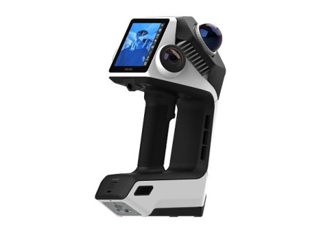
NavVis has introduced the CLX, a handheld LiDAR scanner for reality capture of as-built data.
NavVis says its new CLX dual-LiDAR handheld scanner is designed with as-built documentation projects in mind, as well as general surveying and reality capture where high-precision scanners may be unnecessary or inefficient for standard documentation-grade work.
According to NavVis, the CLX is particularly suited to area referencing, site assessment, and quantity surveying, as well as LOD200 Scan-to-CAD/BIM and 2D drafting.
“For the first time, we are combining the everyday usability, speed, and scalability required for high-volume documentation with the quality and reliability that companies expect from high-end devices,” said Georg Schroth, CTO and co-founder of NavVis.
“This innovation addresses the trade-off between accessibility and efficiency and professional-grade results, giving teams a faster path to reliable data at a lower cost of ownership and operations.”
The CLX features:
- Two LiDAR sensors to provide complementary fields of view, supporting more comprehensive capture across environments as well as stable SLAM tracking;
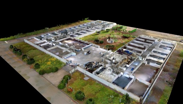
- Live 2D and 3D coverage feedback via teal-time visualisation on the integrated screen; and
- An included pole for elevated or difficult-to-reach areas, or an optional harness for hands-free operation.
Integration with IVION Processing and IVION provides a continuous path from capture to processing to usable data,
The CLX is available through Aptella, NavVis’ distribution partner across Australia, New Zealand and Southeast Asia.
“NavVis CLX fills a real gap for our customers,” said Geoffrey Preece, Business Team Manager, Reality Capture at Aptella.
“It’s an excellent, complementary solution to the NavVis range, ideal for teams that need fast, frequent scanning without compromising on accuracy.
“For businesses managing a high volume of routine documentation, that combination of speed and reliable data quality is exactly what they’ve been asking for.”