

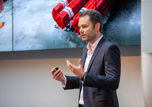
Georg Schroth, CTO of NavVis
NavVis aims to bridge the gap between the physical and digital worlds in the surveying and BIM sectors.
PARTNER FEATURE
Based in Germany and with offices in the US and China, reality capture company NavVis is considered a rising star in the European tech start-up sector, with recent funding rounds raising total investment in the firm to €85 million. Rapidly expanding, NavVis has now entered the Australasian market by partnering with Position Partners.
To find out more about the company, we spoke with Georg Schroth, NavVis’ CTO, who helped co-found the company based on his experience in positioning systems gained during a stay at the Stanford Global Positioning Laboratory and the Stanford Information Systems Laboratory.
Tell us about your company and your presence in Australasia.
In 2020, we launched NavVis VLX. It was an extraordinary success and practically the first time a mobile mapping device could compete with a terrestrial laser scanner in terms of data quality. And with the exponential growth that followed, came the challenges of mass production for servicing new markets.
We firmly believe that the best way to address such markets is with trusted local partners in the correct time zone. For Australia and New Zealand, we have identified Position Partners as the ideal match for us. We aim to offer end-users the best of both worlds — a feeling of proximity to the manufacturer, but also an immediate connection to Position Partners. We recently went on tour with them, stopping by Melbourne, Brisbane and Sydney, and felt really welcomed by the Australian market.
How much change have you seen in recent years?
In the past, BIM was only seen as a requirement imposed on construction companies. However, people have started to realise the value of advanced and detailed planning to avoid change orders. Governments have also become aware of this, which is why more countries are mandating BIM for large or state-run construction projects. The need to create a BIM model of the existing situation has made scan-to-BIM practically a must.
Until recently, mobile scanning was unsuitable because the accuracy of classic hand-held scanners did not meet the requirements of a BIM model at a medium level of detail. NavVis VLX changed the game starting in 2020, and the large-scale realisation of this became evident when hundreds of our customers started successfully applying the technology and providing scanned data for BIM modelling much faster, with fewer people and less time on site.
Do clients want LiDAR only, or both LiDAR and photogrammetry?
I think it depends on the application. For photogrammetry, you need to see the same physical object or detail from at least three to four different perspectives. With outdoor drone scans, for example, it’s possible to view the same objects from different angles and have a good ratio between the area to be scanned and the number of photos. For an office environment with many white walls, there are no correspondences between image or texture features, which makes it very difficult using photogrammetry. Hence, in most indoor environments, a hybrid approach, if not primarily LiDAR-based, is preferable.
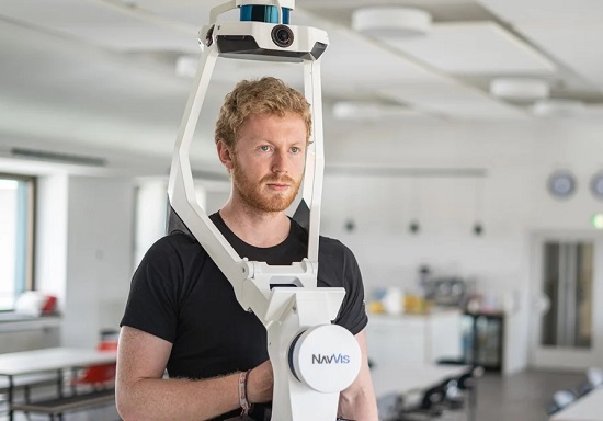
The NavVis VLX
How has SLAM changed things?
NavVis VLX is the only scanner on the market with a level of accuracy comparable to that of a terrestrial laser scanner. While a high-precision terrestrial laser scanner is still advisable for very fine details, on the overall accuracy of a project, such as measuring the distance between two walls, the results are almost equal. This is the first time that not only approximate 2D plans (usually made with the help of a distometer) but also projects traditionally carried out with terrestrial laser scanners can be realised with a mobile mapping device.
Which tech trends are you keeping an eye on?
The shift in focus from measurements to semantic data. We see a wealth of possibilities for doing things like counting assets — chairs, tables, maybe cars, and pellets — simply by walking past them with a device like NavVis VLX. This way, based on images and LiDAR data, you can count, understand, segment objects, and draw conclusions in terms of KPIs.
What’s next for NavVis?
We are scaling our business and operations and growing our team, and with partners such as Position Partners we are seeing tremendous adoption worldwide. We will also increasingly invest in modern cloud-based infrastructure and automation to radically simplify workflows, reducing the time between scanning and value creation. Imagine being able to upload data directly into the cloud and, by the time you get home, have your dataset processed and ready to share for downstream modelling work. This is just the beginning.


