Why the future of our profession depends not only on better technology, but on stronger leadership, collaboration and research translation.
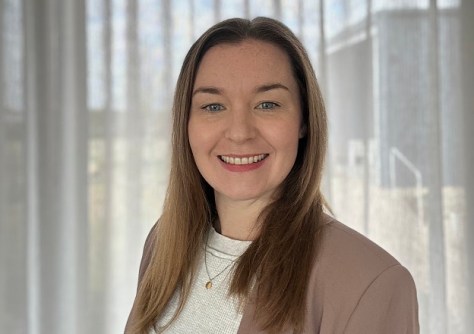
By Katie Potts
In the aftermath of a disaster, one of the first questions communities ask is not “Where did the hazard occur?” but “How do we recover?”.
The answer often depends on something far less visible than damaged buildings or flooded roads. It depends on the quality of a country’s land administration and geospatial information systems. Without reliable land records, authoritative geospatial data and trusted governance frameworks, recovery becomes slower, more complex and less equitable.
That lesson fundamentally changed how I think about the geospatial profession.
Throughout my career as a geomatic engineer and researcher, I have become increasingly interested not only in developing geospatial capability, but in helping governments, international organisations and industry use geospatial information to tackle challenges including disaster resilience, climate action and sustainable development.
Working with the Centre for Spatial Data Infrastructures and Land Administration (CSDILA) at the University of Melbourne, alongside Professor Abbas Rajabifard and an exceptional multidisciplinary team, has reinforced one central idea — our greatest contribution is not simply producing better maps or more sophisticated technology, it is in helping decision-makers use geospatial information to make better decisions.
From research to real-world impact
One of the most rewarding aspects of my career has been working at the interface between research and implementation.
Collaborating with the World Bank, supporting initiatives led by the United Nations Committee of Experts on Global Geospatial Information Management (UN-GGIM), partnering with governments, and contributing to international capacity-building programs has shown me that research achieves its greatest value when it informs policy and practice.
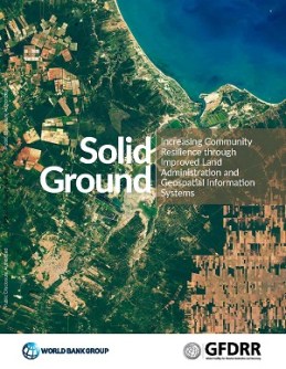
Among the projects that have most influenced my thinking was our report with the World Bank, Solid Ground: Increasing Community Resilience through Improved Land Administration and Geospatial Information Systems. That publication demonstrated how reliable land administration and authoritative geospatial information underpin every phase of disaster management — from preparedness and mitigation through to recovery and reconstruction.
One message stood out clearly: resilient communities are built long before disasters occur. Secure land rights, trusted geospatial information and integrated land administration systems enable governments to understand risk, coordinate emergency response, protect property rights and support faster recovery.
More recently, contributing to work on Access to Land for Climate Action has reinforced another important lesson. As countries accelerate renewable energy, nature-based solutions and climate adaptation initiatives, equitable access to land is becoming one of the defining challenges of the global energy transition.
These projects demonstrate that geospatial information is far more than a technical resource. It provides the evidence base for policy, supports informed investment and helps ensure development is resilient, equitable and sustainable.
Beyond technology
The geospatial profession has never had access to more powerful technologies. Artificial intelligence, digital twins, Earth observation, LiDAR and advanced spatial analytics are transforming how we understand our world. Yet the biggest barriers to impact are rarely technological. More often they relate to governance, collaboration and communication.
Some of the most rewarding projects I have been involved in have focused on connecting researchers with governments, industry and international organisations so that geospatial innovation moves beyond academic publications and becomes embedded in policy and decision-making.
Technical excellence creates possibility. Collaboration creates impact.
The next frontier: Geospatial leadership
These experiences have convinced me that the next evolution of our profession is not simply technological — it is organisational. As geospatial information becomes recognised as essential infrastructure for addressing climate change, disaster resilience, urbanisation and sustainable development, technical expertise alone is no longer enough.
Our profession also needs leadership. Geospatial leadership is about creating shared vision, building trust between organisations, communicating across disciplines and ensuring that geospatial information becomes embedded in decision-making.
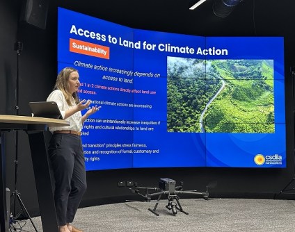
This belief has inspired our work at CSDILA to develop new approaches to geospatial leadership through executive education, international training programs and our forthcoming book, Geospatial Leadership: Training Leaders for Impact. Our goal is to help prepare professionals who can not only develop innovative technologies, but also influence policy, build partnerships and translate geospatial knowledge into meaningful societal outcomes.
Leadership is ultimately about connecting people — to ideas, to evidence and to one another.
Looking ahead
Reflecting on my own career, I realise that the most valuable lessons have not come from any single technology or project.
They have come from working alongside researchers, governments and international organisations that share a common goal: using geospatial information to improve outcomes for people and communities.
Our profession has an extraordinary opportunity. Geospatial information is increasingly recognised as critical infrastructure for decision-making, underpinning everything from disaster risk reduction and climate action to land administration, infrastructure planning and the achievement of the Sustainable Development Goals.
The technologies will continue to evolve. Artificial intelligence will become more capable. Digital twins will become more sophisticated. But I believe the future success of our profession will not be measured by the technologies we develop alone. It will be measured by the decisions they enable, the communities they strengthen and the lives they improve.
Geospatial information helps us understand our world. Through collaboration, research translation and leadership, we have an opportunity — and a responsibility — to help shape its future.
Dr Katie Potts is a Research Fellow with the Centre for Spatial Data Infrastructures and Land Administration (CSDILA) at the University of Melbourne. With a background in geomatic engineering and land administration, she works across international research collaborations, sustainability, research translation and geospatial leadership to maximise the societal impact of geospatial innovation.