A campaign is underway to secure a historic partnership with NASA, with Australian researchers potentially having the chance to use the world-leading AVIRIS-3 airborne imaging instrument.
NASA’s Jet Propulsion Laboratory, which operates the instrument, has indicated strong interest in working with Australian researchers to collect data over key land and water sites over the October-November 2026 timeframe.
The campaign is being spearheaded by University of New England (UNE) Professor of Remote Sensing and Earth Observation, Bradley Evans, and Professor Alex Held, CSIRO Chief Research Scientist, Space and Astronomy.
What is AVIRIS-3?
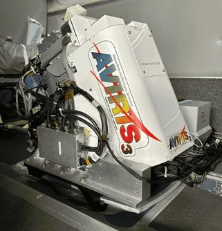
AVIRIS-3, the third-generation Airborne Visible/Infrared Imaging Spectrometer, is an Earth observation imaging sensor that can be carried aboard several different kinds of aircraft, including NASA’s ER-2 — a modified U-2 Cold War intelligence-gathering aircraft.
AVIRIS-3 technical specifications:
- Spectral range: 380 nm to 2,510 nm (visible to shortwave infrared)
- Sampling: 7.4 nm
- Field of view: 39°
- Spatial resolution: 0.5 to 13 metres (depending on aircraft altitude)
Key applications for Australian research
AVIRIS-3 is ideally suited to investigations in field such as:
- Ecosystem mapping for assessing vegetation health, species composition and land cover changes;
- Mineral exploration, by identifying surface mineralogy;
- Assessing water quality, turbidity and algal blooms; and
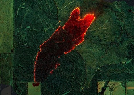
- Disaster management, through real-time mapping of bushfires, oil spills and floods.
“This is a unique opportunity to capture data that can demonstrate invaluable applications, including predicting habitats for some of our listed endangered native species,” said Professor Evans.
“It would also benefit industries such as agriculture, as it provides us with knowledge that could significantly increase farm productivity.”
“We ask collaborators who are interested to fill out our EOI by June 30.”
Benefits for Australian science
“This collaboration with NASA would provide a strong foundation of high-quality imaging spectroscopy data for use in remote sensing research and in preparation for future Earth observation (EO) satellites,” said Professor Held.
As part of the EOI process, local scientists are being asked to nominate potential study locations and research proposals to make the best use of the opportunity.
As an example of one potential use for the proposed observing campaign, Professor Held said that consultations have been held with Steven Ahoy, UNE Cultural Heritage Advisor, and the indigenous Anaiwan people, to image as many of key Anaiwan cultural heritage sites as possible.
Importantly, all data collected by the AVIRIS sensor would be made free and open for use by the Australian scientific community, in accordance with NASA’s ‘Open Science’ data policies.