

Welcome to Spatial Source’s International Women’s Day 2026 interview series.
We’re celebrating International Women’s Day 2026 by showcasing some of the outstanding individuals who are helping to shape Australia’s geospatial sector.
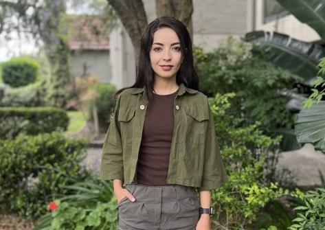
In this interview we speak with Shokoufeh Farhadi, who graduated with a Master’s Degree in Remote Sensing from the University of Tabriz in Iran and is currently an international Master’s by Research student at the Digital Twin and Land Tenure Engineering Lab at the University of New South Wales’ (UNSW) School of Civil and Environmental Engineering.
How did you get into this field and what attracted you to it?
My journey into this field began during high school through mathematics, where I developed a strong interest in geometry and spatial reasoning. Growing up in a family that valued education — with a parent working as a schoolteacher — I was encouraged from an early age to read widely, ask questions, and actively search for answers. This environment played a key role in shaping my curiosity and confidence in analytical thinking.
As I explored possible study pathways, I was drawn to disciplines that combined mathematics, three-dimensional thinking and Earth systems, even though these fields were often viewed as traditionally male-dominated in my local context. Choosing to study Surveying Engineering at the University of Tabriz enabled me to build a strong technical foundation in geodesy, remote sensing, photogrammetry and GIS.
I later continued directly into a Master’s Degree in Remote Sensing, focusing on 3D point cloud modelling, while gaining hands-on experience in field surveying and GIS-based projects. What ultimately attracted me to the geospatial field was its unique integration of theory, technology, and real-world spatial problem-solving — and the opportunity to contribute meaningfully to how we understand, model, and manage land and space.
Please tell us about your current role and responsibilities.
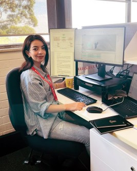
I am an international Master’s by Research student at UNSW in Sydney, working closely with my supervisor on a 3D cadastral research project. My research focuses on the validation of 3D cadastral data, and this work is supported by the Intergovernmental Committee on Surveying and Mapping as part of an Australian Research Council (ARC) funded project.
My work involves spatial modelling, understanding three-dimensional land ownership structures, and applying GIS-based methods to analyse and visualise complex geospatial information. My responsibilities include developing and refining 3D cadastral models, exploring innovative analytical approaches, and working with advanced spatial datasets to support land administration and planning research. This role combines academic research with practical problem-solving, contributing to real-world applications in cadastral systems and spatial data management.
What do you enjoy most about your work?
What I enjoy most about my work is the process of transforming complex geospatial concepts into practical, real-world solutions. Whether it involves analysing satellite data, contributing to infrastructure design such as fibre-optic networks, or now working on 3D cadastral modelling, I find it deeply rewarding to see how spatial data directly informs decisions and shapes the built environment.
I am also strongly motivated by continuous learning. Many of my technical skills have been developed through self-directed study, and each new project presents an opportunity to expand my knowledge and approach problems from new perspectives. This constant evolution — both intellectually and technically — is what keeps me engaged and enthusiastic about working in the geospatial field.
Are there any personal qualities or attributes that are helpful to have in this field?
Curiosity, persistence and self-directed learning have been essential throughout my career. In a GIS project role, I was given significant responsibility, which pushed me to quickly develop advanced technical skills and find independent solutions. This strengthened my initiative and confidence in handling complex geospatial challenges.
Adaptability and preparedness are also critical. I have learned to always have alternative plans, as geospatial and surveying work depends on clear answers and sequential decisions. Delays at one stage can directly affect the accuracy of the next.
More broadly, I believe every experience offers lessons that may prove valuable over time. Combined with strong analytical skills, attention to detail, and adaptability across field, industry, and research settings, this mindset supports effective and resilient practice in the geospatial field.
What makes you most proud about your role and achievements?
I am proud of building a progressive and diverse career path — from teaching mathematics and physics during my studies, to leading components of GIS projects, transitioning into telecommunications infrastructure, and advancing into research. Each step has allowed me to develop both technical expertise and problem-solving skills across different professional contexts.
Making the conscious decision to migrate for higher education and contribute to a 3D cadastre project stands out as one of my most meaningful achievements. It has given me the opportunity to work on a project that combines innovation, spatial data analysis and real-world impact. Looking back, I take pride not only in the roles I have held, but also in the resilience, curiosity and commitment that have carried me through each stage of this journey.
As a woman, have you had any struggles during your career? Conversely, have you had support?
Early in my career, my first professional role in my field placed me in a completely male-dominated environment, where I was often the only woman in the entire company. At first, this was challenging, and sometimes my contributions were overlooked, requiring me to work harder to demonstrate my abilities. Field surveys were particularly demanding, but these experiences pushed me to become more confident, precise, and resilient.
At the same time, I have been fortunate to receive support from mentors, supervisors and colleagues who trusted me with responsibilities and encouraged my growth. Their guidance and encouragement have been crucial in helping me navigate challenges and develop as a professional in the geospatial field. These experiences together reinforced both my technical skills and my belief in the value of perseverance and collaboration in male-dominated industries.
We need more women in the geospatial sector. Do you have any ideas?
I believe introducing geospatial careers early can make a real difference. Hands-on school projects, sharing real professional experiences, and mentorship programs can inspire young women to explore this field. Seeing the practical impact of geospatial work — and meeting women already succeeding in it — makes the career more tangible and motivating.
Inclusive workplaces and equal development opportunities are equally important. Women need clear pathways for growth and leadership in geospatial science. The current gender imbalance reflects limited awareness and exposure, not a lack of ability.
Finally, support from family, mentors and colleagues is vital. Encouragement, guidance and visible role models help women not only enter the field but thrive and lead within it.
What would you say to women who are considering a career in geospatial?
I would tell women considering a career in geospatial: go for it! If you enjoy solving problems, continuous learning, and applying technology to real-world challenges, this is a fantastic field. It combines fieldwork, research and analysis, with opportunities to contribute to projects worldwide.
Be confident, take on responsibility and embrace challenges — each project helps you grow and make a real impact. With curiosity, persistence, and supportive mentors and colleagues, you can build a rewarding career. The geospatial community may be small, but it is welcoming and eager to see you succeed.


