Loft has announced a deal with Australia’s SmartSaT CRC for on-orbit deployment of fire-spotting software.
According to the US-headquartered satellite manufacturer, the project will “serve as a high-tech demonstration of near real-time, software-based wildfire detection from low Earth orbit”.
Under the partnership, Loft will host SmartSat’s software on its satellites for the purpose of validating its functionality and performance.
The aim is to test a proof-of-concept for low-latency early detection of small smoke signatures.
It will do this by using hyperspectral signatures to distinguish between smoke and clouds and fog.
The hope is that it will accelerate the detection of fires when they are still small and have not had time to spread.
On-orbit testing service
“This partnership with SmartSat CRC is an important step in proving how software-defined missions can advance vital Earth observation goals,” said Mack Koepke, Senior VP of Business Development at Loft.
“By testing this application on our satellite platform, we are establishing the technical foundation required to provide low-latency insights to emergency organizations on a global scale.”
Loft’s business model comprises two streams. The first is the ability to provide standardised small-satellite platforms upon which clients can launch their payloads. Loft says it maintains an inventory of satellite buses ready for launch, to cut down on mission development time.

The other half of the equation is the ability to host software applications on satellites that are already in orbit, providing flexibility for those wishing to ‘try before they fly’.
No fire (warning) without smoke
The detection from orbit of fires on the ground has been in the news lately, with the ABC reporting that a smoke-spotting service relied upon by Australian users, is in danger of failing.
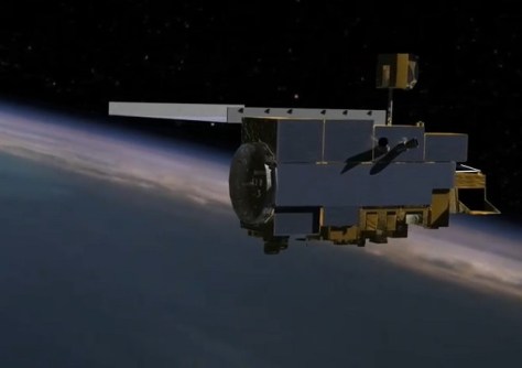
The Northern Australian Fire Information (NAFI) service relies upon data from NASA’s long-serving Terra satellite for provision of fire-spotting data.
But according to NAFI’s service manager, Peter Jacklyn, Terra is on its last legs.
“It’s dying,” he told the ABC. “It’s 25 years old [and] it’s a minor miracle it’s still operating.”
The ABC report goes on to give an example of grazier in Queensland who fought a fire for six to eight hours, but that the fire did not register on the NAFI website due to the data disruption from Terra… in particular, its ASTER TIR instrument.
End of the Terra era
Terra is indeed suffering from reliability problems, but that’s not surprising considering it was launched in 1999.
A statement posted online by NASA on 12 February, said that “The thermal infrared capabilities of an imager on NASA’s Terra satellite have been shut off and will no longer collect data, more than 25 years after the instrument captured its first image of Earth from space.”
“This is the latest effort to prioritize power on Terra for its remaining instruments. Terra, which had a design life of six years when launched, has long outperformed its mission life.”
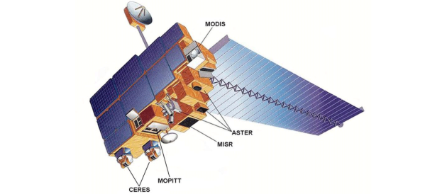
The NASA statement goes on to say that “The ASTER Thermal Infrared (TIR) subsystem was turned off Jan. 16, due to power limitations on the spacecraft. The ASTER TIR thermal control system was powered off on Feb. 6, to provide necessary power to continue to operate the remaining Terra instruments.”
“Turning off the TIR thermal control system means that the ASTER TIR subsystem will no longer be recoverable even if power margins improve.
“However, with the power margin provided by turning off the TIR thermal control system, the ASTER Visible and Near Infrared operations were able to resume on Feb. 9.”