

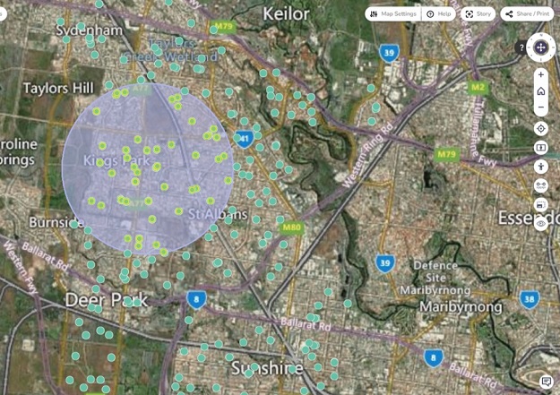
The spatial query tool enables users to draw a shape to select and display features on a 2D map. Courtesy DTV.
There are now two more tools available within the Digital Twin Victoria (DTV) platform — a line-of-sight tool and a spatial query tool.
The tools give users the ability to visualise, analyse and assess more than 4,000 Victorian datasets.
The line-of-sight tool enables users to draw a line between two locations and identify if any obstructions lie along it.
This capability will prove useful for the planning and development of residential properties, viewshed protection, telecommunications planning as well as urban and rural council planning.
The spatial query tool enables users to draw a shape on the map and use it to select a subset of 2D data from spatial layers. Information can then be exported from the selected layers as a downloadable report.
The new tools will be available for integration into TerraJS-based applications, and join a range of other tools and capabilities already available within the platform, such as:
- Searching and selecting 3D data
- A pedestrian mode for exploring at street level
- A slider for comparing datasets
- A timeline to support the tracking of data across time
- The ability to produce, annotate and share ‘stories’ with colleagues.
The DTV platform, which became publicly accessible in August 2022, is part of the Victorian Government’s $37.4 million investment in digital twin technology and spatial innovation.


