

Image courtesy Hannan Metals
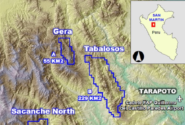
Canadian miner Hannan Metals has begun a large-scale 2,782 line-kilometre LiDAR survey over 64,500 hectares of the San Martin JOGMEC JV sediment-hosted copper-silver project in Peru, in which the company has an interest.
Hannan says the survey is one of the first in Peru to use LiDAR for geological mapping, fieldwork targeting and drilling and logistics planning.
Aerial survey company Horizons South America (HSA) has been engaged to undertake the survey.
The survey aims to:
- Enable mapping of geology and structure and, in conjunction with geological and geochemical field observations, define geological controls on copper-silver mineralisation;
- Provide a detailed topographic ground model to facilitate efficient fieldwork to map key outcrops and access in the thick jungle terrain
- Provide targeted ground access, and
- Support environmental monitoring and precise drill collar location planning.
“Up to now, LiDAR has been used primarily for mapping vegetation canopy and for topographic controls,” said Hannah CEO, Michael Hudson.
“Sensor technology and ability to process and interpret the vast cloud point datasets means that the technology can now be applied to mineral exploration in these highly vegetated and challenging terrains for the first time.
“This is truly a game changer for exploration in these areas and Hannan, along with HSA, is pleased to be leading the application of this technology in Peru.”
Hudson praised the ability of LiDAR to enable “the dense jungle to be virtually stripped from the ground, allowing unprecedented ground detail to be observed for the first time”.
“Our exploration teams will be able to map the geology and structure, by machine learning, in extreme detail and allow highly targeted field work to enhance the efficiency of our exploration efforts over San Martin,” he added.
“In addition, Hannan will use the data for drill design and planning access, and should our copper-silver exploration continue to provide successful outcomes, allow siting and design of future development facilities.
“Overall LiDAR is a highly cost-effective dataset that can be utilised efficiently through the entire project lifecycle.”
Stay up to date by getting stories like this delivered to your inbox.
Sign up to receive our free weekly Spatial Source newsletter.


