The Utility Survey Standard is an essential element in New Zealand’s evolving infrastructure management regime.
By Karl Wilton, Assistant Surveyor-General, and Estelle Cook, Senior Customer Regulatory Specialist, Toitū Te Whenua Land Information New Zealand (LINZ)
Infrastructure is rarely out of the news in New Zealand. Burst water mains, wastewater overflows, power outages, storm damage and stalled developments are frequent, and costs keep climbing. Communities feel the impact through service failures and disruption during repairs and renewals.
Regulators, central and local government agencies and the public want clearer answers about what failed, what risks were understood, and whether investment decisions targeted the right places. They also expect impacts on communities, public health and the environment to be reduced wherever possible.
Across the infrastructure spectrum, the expectation is no longer just that infrastructure exists and broadly functions, but that it is actively managed and resilient.
Asset owners are expected to show robust asset knowledge, credible long-term planning, climate-informed decision-making and clear accountability, especially where public health, safety and environmental protection are concerned.
Many of the challenges now confronting the sector have a common and often overlooked aspect: confidence in where infrastructure assets actually are in the ground.
The Office of the Surveyor-General at LINZ has released the Utility Survey Standard 2025 to meet many of these challenges.
From fragmentation to coordination: Why location matters
First, a look at the historic context and background to the challenges in this area.
Historically, utility asset location information has often been collected for immediate project or operational needs, rather than as part of a coordinated long-term system.
Different requirements across utility owners have created wide variation in data content, quality, accuracy and format, even for the same asset types in the same areas. In many cases, the level of spatial confidence is unclear or undocumented, and information is underpinned by positional uncertainty. Historic records can be incomplete or hard to access, and new records are not always better.
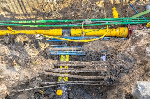
The result is a fragmented and inconsistent picture of where assets actually are in the ground. This fragmentation is not just technical; it has system-wide consequences. If asset information is inconsistent or hard to trust, it cannot be easily shared or used well. The impacts become greater as networks age, cities become denser and climate risks increase.
When asset locations are uncertain or inaccurate:
- condition assessments become less reliable;
- climate and hazard exposure modelling can be inaccurate or misleading;
- capital investment decisions carry higher uncertainty;
- construction and maintenance work becomes slower, riskier and more expensive; and
- accidental damage and safety risks are heightened.
In short, uncertainty about where assets are located amplifies almost every other infrastructure risk.
This challenge reflects decades of incremental data creation without a shared standard or common reference framework. Addressing it means moving from ad hoc local practices to a coordinated approach where asset location information can be trusted, shared and progressively improved.
It is against this backdrop that LINZ has released the Utility Survey Standard 2025.
What is the LINZ Utility Survey Standard?
The Utility Survey Standard provides a nationally consistent framework for the survey validated spatial capture of utility assets. It ensures that when asset location data is collected and recorded, it is done in a way that is accurate, repeatable, interoperable and fit for modern asset management, planning and regulatory expectations.
At its core, the Standard formalises several key principles.
1. Consistent national datums
The Standard requires utility assets to be referenced to recognised national horizontal and vertical datums. This ensures that datasets for different utility types align with each other and with other commonly used spatial datasets, including property and cadastral information, aerial photography, LiDAR derived elevation models, flood mapping and other hazard layers.
The result is that utility asset data is no longer spatially isolated but can be confidently integrated into GIS environments used for asset administration, planning, design, construction, resilience assessment and emergency management.
2. Defined accuracy classes
Rather than treating all asset locations as if they have the same level of reliability, the Standard introduces defined accuracy classes and quality expectations. This enables asset owners, contractors, and data users to understand not just where an asset is recorded, but how confident they can be in that location.
Accuracy requirements are structured to balance an appropriate level of spatial certainty against the cost of survey. The Standard sets minimum accuracy requirements, while enabling asset owners to specify higher accuracies where risk, consequence or asset criticality justify it.
The Standard introduces defined accuracy classes and quality expectations.
3. Consistent 3D data outputs
The Standard requires three dimensional coordinates as part of a consistent set of deliverables for utility surveys. Capturing assets in three dimensions in terms of the national datums and survey control network, ensures that their location remains known even as the surrounding environment changes.
This represents a shift from incomplete data tied to ephemeral features, to asset location data that is independent, accurate and enduring.
Why the Standard matters now
The Utility Survey Standard supports the direction the infrastructure sector is moving in. Government agencies and regulators are developing new requirements that emphasise stronger asset knowledge, better risk management, and clearer accountability. A nationally consistent survey standard provides a common foundation that can support these emerging expectations.
This is evident in the way the Standard is being embedded into wider regulatory and sector frameworks. It has been adopted into the National Code of Practice for Utility Operators’ Access to Transport Corridors and into Water New Zealand’s 3 Waters Asset Data Standard (v4.0).
The Standard has not been created to sit on the metaphorical shelf — it needs to be picked up and used by policy makers, asset owners, managers, engineers and surveyors.
Adopting the Standard will not solve all of the infrastructure challenges facing New Zealand, but it provides a critical piece of the foundation needed to address them — a shared and reliable understanding of where our infrastructure actually is.
The Utility Survey Standard is available for download at no cost from the LINZ website.
Related reading:
BYDA urges national underground data reform
Transforming underground utility location data