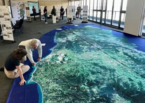
Giant, walk-on maps are helping northern NSW community members visualise their surroundings.
Known as a Big Map, the huge cloth maps are used by organisations such as local councils, the NSW Reconstruction Authority and Disaster Relief Australia to bring communities together to discuss and assess their local landscapes.
In the Clarence Valley on the NSW north coast, the Big Map has been used by cane farmers and other primary producers, community organisations and individuals.
By standing on the map, they’re able to obtain and eagle’s eye view of the terrain and rivers that surround them.
Big Map bringing the community together
By combining that aerial view with their own knowledge built up over generations, the community members are able to better understand the risks they face from natural disasters such as floods and fires.
“We must ensure that knowledge is documented and kept as a history bank but also have access to that for sharing,” said Ross Farlow from the NSW Canegrowers Association.
“There’s [sic] so many new people, new visitors, new homeowners, new business owners to the valley. They can be and maybe will be affected by floods,” he said.
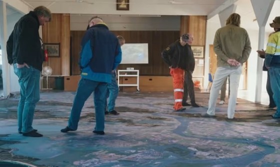
The Big Map concept is working out to be a great way of bringing the community together discuss concerns and network with one another.
“When I’m talking to a lot of cane farmers here today, it’s isolating work when you’re out on the farm,” said Samantha Osborne from the Rural Adversity Mental Health Program.
“And to be able to just take a little bit of time to come into town and see neighbours that you haven’t seen for ages… it’s just been amazing to see the connection, people smiling and getting together and having important conversations around preparedness.”
Preparing for disasters
A little further north in NSW Northern Rivers region, the Big Map is helping community members visualise the thinking behind the Northern Rivers Disaster Adaptation Plan.
At a series of drop-in sessions at seven locations, hosted by the NSW Reconstruction Authority, more than 170 community members were able to give their feedback and share their knowledge.
The Northern Rivers region is one of the most disaster-prone places in Australia, as demonstrated by the terrible flooding that struck the region around Lismore a few years ago. The area also takes in the towns of Ballina, Grafton, Tweed Heads and Byron Bay.
The region is also subject to bushfires and storms, with the intensity and frequency of such events expected to grow as climate change increasingly takes hold.
The 10m x 6m Big Map was a highlight of the drop-in sessions, giving locals a bird’s eye view of the area.