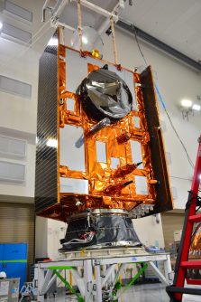
Sentinel-6B, the latest in a long line of Sentinel remote sensing spacecraft, has been launched into orbit aboard a SpaceX Falcon 9 rocket.
The launch took place on Monday, 17 November from the Vandenberg Space Force Base in California.
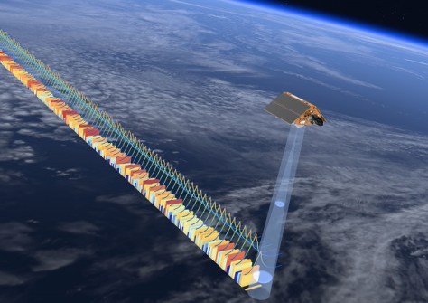
Sentinel-6B’s job is to measure and monitor sea level height, continuing the run of measurements begun in the early 1990s following the launch of the joint French-US Topex-Poseidon satellite, and the Jason satellites.
Spacecraft -6B joins its predecessor in orbit, Sentinel-6 Michael Freilich (named after a former director of NASA’s Earth Science Division), which was launched in November 2020.
The mission is a joint effort between the European Commission, ESA, NASA, Eumetsat and NOAA, with support from the French space agency CNES.
“Collaboration between partners is key to a mission such as Sentinel-6, and my thanks go to everyone involved in developing, launching and operating this exceptional satellite, which follows in the footsteps of the first Sentinel-6 Michael Freilich,” said Simonetta Cheli, ESA’s Director of Earth Observation Programmes.
Sentinel-6B is equipped with the Poseidon-4 dual-frequency (C- and Ku-band) radar altimeter, which provides improved performance compared to previous instruments.
It also carries a microwave radiometer which, together with the radar altimeter, will enable measurements of sea surface height, wave height and wind speed.
The spacecraft’s orbit will carry it to 66 degrees north and south of the equator — the same as predecessor satellites — which will give it coverage of 95% of Earth’s ice-free ocean surface every 10 days.