


NASA and CNES will jointly conduct a survey of Earth’s surface water and ocean surface height.
Search results for "nasa"

NASA prepares for launch of next Landsat
NASA's Landsat Data Continuity Mission (LDCM) is scheduled to launch February 11 from Vandenberg Air Force Base in California. A joint NASA and U.S. Geological Survey (USGS) mission, LDCM will add to the longest continuous data record of Earth's surface as viewed from space. LDCM is the eighth satellite in the Landsat series, […]

NASA smash two spacecraft into moon
After completing their successful mission of mapping the moon’s gravity to the micron, two NASA lunar orbiters were deliberately sent to crash into the surface of the moon, ending their robotic lives on a mountain near the north pole. Engineers commanded the twin spacecraft, Ebb and Flow, to fire their engines and burn their remaining […]

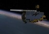
Astrium to develop two new satellites for NASA
Astrium has been commissioned to build two new research satellites for NASA’s Jet Propulsion Laboratory (JPL). For a minimum of five years from August 2017, the Gravity Recovery and Climate Experiment Follow-On (Grace FO) mission will continue the extremely accurate measurement data collection of the first twin Grace satellites, which have been in orbit since […]

NASA’s micro aerial vehicles are the new UAVs
The 20cm, 15 gram Prox Dynamics PD-100 Black Hornet may be the world’s smallest operational drone. Researchers led by Roland Brockers at the NASA Jet Propulsion Laboratory in Pasadena, California, have developed a micro aerial vehicle (MAV) that uses a camera pointed at the ground to navigate and pick landing spots. It can even identify […]
Australian cities join NASA global Space Apps event
The Victorian Space Science Education Centre (VSSEC) recently announced the launch of a multi-city Australian program as part of the NASA-convened International Space Apps Challenge to be held worldwide on 21-22 April 2012. VSSEC is the Australian convenor and host of the flagship event at its learning complex in Melbourne. The International Space […]

NASA releases free online global forests map
A NASA-led science team has created an accurate, high-resolution map of the height of Earth's forests. The map will help scientists better understand the role forests play in climate change and how their heights influence wildlife habitats within them, while also helping them quantify the carbon stored in Earth's vegetation. Scientists from NASA's […]

NASA improves free worldwide DEM
NASA and Japan have released a significantly improved version of the most complete digital topographic map of Earth, produced with detailed measurements from NASA's Terra spacecraft. The map, known as a global digital elevation model, was created from images collected by the Japanese Advanced Spaceborne Thermal Emission and Reflection Radiometer, or ASTER, instrument […]

Australian-NASA space science collaboration takes ‘one small step’
The importance of Australia's international space science collaboration was highlighted recently at a meeting between NASA Administrator Charles F. Bolden, Jr. and Innovation Minister Senator Kim Carr. International cooperation is key to the success of virtually all space endeavours, with space infrastructure and its applications playing an important part in the daily lives […]
Ups and downs for fire spotting from space
As NASA’s Terra satellite begins to reach end-of-life, new fire-spotting software will be tested in orbit.