


Enjoy our weekly compilation of geospatial news snippets from across Australia and around the world.
Search results for "Position Partners"
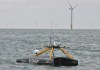
Seafloor mapping with remotely controlled USVs
Ireland-headquartered XOCEAN is expanding its operations around the world, including here in Australia.
Spatial Snippets for Wednesday, 30 October 2024
Enjoy our new weekly compilation of geospatial news snippets from across Australia and around the world.

INTERGEO 2024: Round-up of product launch news
Held this year in Stuttgart, the event attracted 579 exhibitors and more than 17,000 visitors from 121 countries.

NavVis releases MLX handheld laser scanner
The MLX delivers point cloud data captured by a 32-layer LiDAR sensor and 270° and 360° panoramic images.
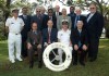
30 years of Australasian leadership in hydrography
The Australasian Hydrographic Surveyors Certification Panel was the first globally recognised scheme.

Australia, US collaborate on military GPS resilience
The widely used Defense Advanced GPS Receiver has been put to the test under simulated jamming conditions.

Christy Monaco appointed OGC’s new COO
The 30-year veteran of the US intelligence community will commence her new role in September.

Hidden risks in the global geodesy supply chain
Our societies depend upon geodesy, but the world’s geodetic ecosystem is facing significant vulnerabilities.

Advancing Australia’s seafloor mapping
CSIRO’s research vessel RV Investigator delivers a keystone capability for mapping Australia’s vast marine estate.

