RIEGL has released a slew of apps for its VZ-i scanners to remotely automate data acquisition and processing.
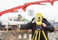
RIEGL has announced the latest step in its drive toward full automation — full remote operation capability of its VZ-i series terrestrial laser scanners.
Three new apps automate data application and processing, allowing remote operation and real time access to results without any intervention from the user, according to RIEGL.
Thomas Gaisecker, manager of the mining business division at RIEGL said that machine operators can optimise their work with real-time measurement results.
“Apps make this possible. The new RIEGL mining apps ensure that they get the data acquired by the scanner immediately as well as relevant, reliable and accurate deliverables to make prompt and appropriate decisions,” he said.
The Slope Angle, Design Compare and Monitoring apps can be used to operate the scanners remotely via LAN, Wi-Fi, and LTE network interfaces.
Stay up to date by getting stories like this delivered to your mailbox.
Sign up to receive our free weekly Spatial Source newsletter.