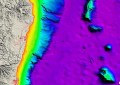
An image of Perth’s wetlands in 1827 from the exhibition.
© Edith Cowan University, 2014. Created in collaboration between Dimitri Fotev, 3D Model Coordinator, City Design, City of Perth and Jeff Murray, Cartographic Technician, ECU-Industry Collaboration Research Team.
A new exhibition at the Perth Town Hall is set to tell the tale of Perth’s swampy past.
Reimagining Perth’s Lost Wetlands is a joint project between Edith Cowan University (ECU), City of Perth, and Landgate, that aims to raise awareness of the cultural and environmental importance of Perth’s wetlands.
Some of the city’s most iconic buildings, including the Perth Railway Station, have been built over swamps that previously stretched from Lake Monger to Claise Brook.
The exhibition features three-dimensional digital modelling of Perth’s lost wetlands prior to 1827 in the Claise Brook catchment from Herdsman Lake to the Swan River.
School of Communications and Arts associate professor Rod Giblett said the three-dimensional models on display are based on Nyoongar history, archival maps, geological soil mapping, vegetation complex mapping, artistic impressions and botanists’ early settler accounts of flora.
“Like many other cities around the world, Perth was founded on wetlands. These environments have played a significant role in the city’s development and are important for a range of species,” Professor Giblett said.
“This exhibition provides a valuable setting to showcase the rich cultural history and environmental significance of these areas to the wider community.”
Reimagining Perth’s Lost Wetlands opens at 3.00pm on Sunday, 21 September at the Perth Town Hall, corner of Hay and Barrack Street, Perth.
The exhibition runs from Sunday 21, September until Thursday, 9 October 2014 and entry is free.