

Two Australian government programs have been recognised for using geospatial information technology to modernise operations and improve access to services.
The NSW customer service department’s Spatial Digital Twin project and the National Joint Common Operating Picture (NJCOP) disaster management project have both been awarded for Special Achievement in GIS (SAG) at Esri’s global conference.
The SAG Award is presented to organisations in recognition of “exceptional innovation” using geographic data management systems.
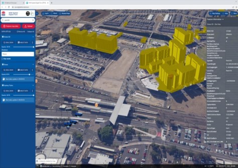
To date, 19 local government areas in Greater Sydney and regional NSW have had data produced for their area through the spatial digital twin project, which displays visual information in a near real-time 4D model, largely to assist planning and infrastructure delivery.
Bathurst was the first regional city to use the program, with four million square metres of CBD visualised.
The shared data management and delivery platform is open to both the public and private sectors, with the government hoping it will be a key element in establishing integrated geospatial infrastructure across the state.
NSW’s Surveyor-General and Executive Director of DCS Spatial Services, Narelle Underwood, said GIS technology allows for better collaboration between agencies, and facilitates community engagement.
“Thanks to its ability to connect different data types and systems, the NSW Spatial Digital Twin program is enabling more efficient planning, prioritisation and delivery of infrastructure, and ultimately improved community engagement,” she said.

Responding to disasters
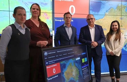
The NJCO is an initiative of Home Affairs’ National Emergency Management Agency (NEMA), and came in response to the 2020 Royal Commission into natural disaster arrangements.
The customisable platform displays information about floods, fires, cyclones, drought, earthquakes, tsunamis and even falling space junk, as well as demographic and infrastructure data, so that various levels of government can improve their responses to crises.
It includes feeds from the BoM, Geoscience Australia and federal, state and territory emergency agencies, as well as transport information such as road closures and the location of landmark buildings.
David Long, NEMA’s Assistant Coordinator-General of National Crisis Operations, says GIS technology can provide consolidated access for more than 50 federal, state and territory agencies.
“It provides a consolidated view that displays nationally significant event information such as flood, fire threat, earthquake, tidal surge and tsunami along with demographic data to help users identify potential impacts on the population and the environment,” he said.
“NJCOP has been pivotal in terms of collaboration and the ability for national agencies to provide timely advice and deploy resources both equitably and quickly.”
Esri Australia Managing Director, Brett Bundock, said the projects represent a change in the way government organisations use data to plan and deliver services.
“The technology has been an enabler of change, assisting decision makers to explore new lines of investigation, and giving them a more informed view of a variety of situations.”
Republished courtesy of Government News.


